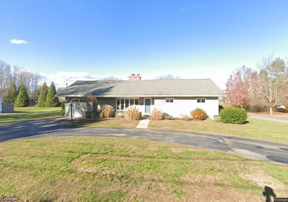
36 Mudnock Rd Salisbury, MA 01952
Estimated Value: $519,000 - $586,000
3
Beds
2
Baths
1,296
Sq Ft
$428/Sq Ft
Est. Value
About This Home
This home is located at 36 Mudnock Rd, Salisbury, MA 01952 and is currently estimated at $555,189, approximately $428 per square foot. 36 Mudnock Rd is a home located in Essex County with nearby schools including Triton Regional High School.
Ownership History
Date
Name
Owned For
Owner Type
Purchase Details
Closed on
Aug 19, 2015
Sold by
Niko Associates Ltd
Bought by
Cecile C Papoulias Ret
Current Estimated Value
Purchase Details
Closed on
Jul 7, 1995
Sold by
Mudnock 36 Rt and Larocque Hope M
Bought by
Bonny Charles E and Bonny Louann M
Home Financials for this Owner
Home Financials are based on the most recent Mortgage that was taken out on this home.
Original Mortgage
$117,300
Interest Rate
7.84%
Mortgage Type
Purchase Money Mortgage
Create a Home Valuation Report for This Property
The Home Valuation Report is an in-depth analysis detailing your home's value as well as a comparison with similar homes in the area
Home Values in the Area
Average Home Value in this Area
Purchase History
| Date | Buyer | Sale Price | Title Company |
|---|---|---|---|
| Cecile C Papoulias Ret | -- | -- | |
| Bonny Charles E | $115,000 | -- |
Source: Public Records
Mortgage History
| Date | Status | Borrower | Loan Amount |
|---|---|---|---|
| Previous Owner | Bonny Charles E | $117,300 | |
| Previous Owner | Bonny Charles E | $10,000 | |
| Previous Owner | Bonny Charles E | $55,000 | |
| Previous Owner | Bonny Charles E | $15,000 |
Source: Public Records
Tax History Compared to Growth
Tax History
| Year | Tax Paid | Tax Assessment Tax Assessment Total Assessment is a certain percentage of the fair market value that is determined by local assessors to be the total taxable value of land and additions on the property. | Land | Improvement |
|---|---|---|---|---|
| 2025 | $4,340 | $430,600 | $203,100 | $227,500 |
| 2024 | $4,154 | $397,500 | $192,400 | $205,100 |
| 2023 | $4,085 | $378,200 | $192,400 | $185,800 |
| 2022 | $3,975 | $356,800 | $171,000 | $185,800 |
| 2021 | $3,926 | $348,700 | $171,000 | $177,700 |
| 2020 | $3,793 | $331,000 | $179,600 | $151,400 |
| 2019 | $3,692 | $311,300 | $171,000 | $140,300 |
| 2018 | $3,512 | $298,100 | $160,300 | $137,800 |
| 2017 | $3,236 | $271,500 | $139,000 | $132,500 |
| 2016 | $3,143 | $269,300 | $132,500 | $136,800 |
| 2015 | $3,010 | $256,200 | $129,500 | $126,700 |
Source: Public Records
Map
Nearby Homes
- 16 Mudnock Rd
- 8 Meadowview Ln Unit B
- 48 Beach Rd Unit A
- 48 Beach Rd Unit C
- 3 Lighthouse Cir Unit A
- 27 True Rd Unit 2
- 86 Ferry Rd
- 7 Palis Dr
- 9 Partridge Ln Unit A
- 14 Partridge Ln Unit C
- 12 Baker Rd
- 157 Bridge Rd
- 105 Forest Rd
- 175 Bridge Rd
- 1 Jefferson St
- 34 Dock Ln
- 42 Kendell Ln
- 191 Elm St
- 266 Merrimac St Unit F
- 288 Merrimac St