Estimated Value: $775,000 - $1,119,000
2
Beds
2
Baths
1,536
Sq Ft
$597/Sq Ft
Est. Value
About This Home
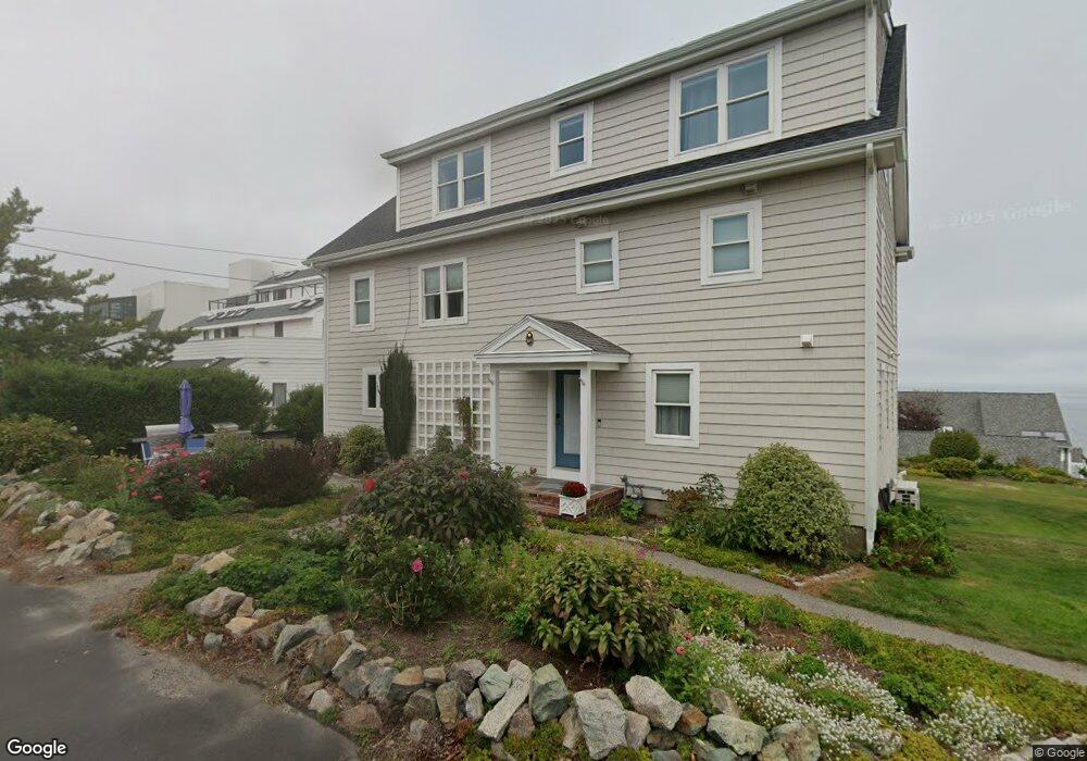
This home is located at 36 Oceanside Dr, Hull, MA 02045 and is currently estimated at $917,054, approximately $597 per square foot. 36 Oceanside Dr is a home located in Plymouth County with nearby schools including Lillian M. Jacobs Elementary School, Memorial Middle School, and Hull High School.
Ownership History
Date
Name
Owned For
Owner Type
Purchase Details
Closed on
Mar 14, 2024
Sold by
Scharf Lauren E
Bought by
Lauren E Scharf Ret and Scharf
Current Estimated Value
Purchase Details
Closed on
Mar 9, 2021
Sold by
Cass John E and Cass Christine M
Bought by
Scharf Lauren E
Purchase Details
Closed on
Oct 8, 2020
Sold by
Beckwith Tammy J
Bought by
Cass John E and Cass Christine M
Home Financials for this Owner
Home Financials are based on the most recent Mortgage that was taken out on this home.
Original Mortgage
$584,000
Interest Rate
2.9%
Mortgage Type
New Conventional
Purchase Details
Closed on
Jun 27, 2017
Sold by
White Rt and White
Bought by
Beckwith Tammy J
Home Financials for this Owner
Home Financials are based on the most recent Mortgage that was taken out on this home.
Original Mortgage
$500,800
Interest Rate
4.05%
Mortgage Type
New Conventional
Purchase Details
Closed on
Aug 28, 1998
Sold by
Elovitz Elaine
Bought by
White Rt and White
Purchase Details
Closed on
Jul 29, 1992
Sold by
Remmer Robert R
Bought by
Elovitz Elaine
Create a Home Valuation Report for This Property
The Home Valuation Report is an in-depth analysis detailing your home's value as well as a comparison with similar homes in the area
Purchase History
| Date | Buyer | Sale Price | Title Company |
|---|---|---|---|
| Lauren E Scharf Ret | -- | None Available | |
| Lauren E Scharf Ret | -- | None Available | |
| Scharf Lauren E | $772,900 | None Available | |
| Cass John E | $730,000 | None Available | |
| Beckwith Tammy J | $626,000 | -- | |
| White Rt | $245,000 | -- | |
| White Rt | $245,000 | -- | |
| Elovitz Elaine | $142,000 | -- | |
| Elovitz Elaine | $142,000 | -- |
Source: Public Records
Mortgage History
| Date | Status | Borrower | Loan Amount |
|---|---|---|---|
| Previous Owner | Cass John E | $584,000 | |
| Previous Owner | Beckwith Tammy J | $500,800 | |
| Previous Owner | Elovitz Elaine | $20,000 |
Source: Public Records
Tax History
| Year | Tax Paid | Tax Assessment Tax Assessment Total Assessment is a certain percentage of the fair market value that is determined by local assessors to be the total taxable value of land and additions on the property. | Land | Improvement |
|---|---|---|---|---|
| 2025 | $7,956 | $710,400 | $0 | $710,400 |
| 2024 | $7,964 | $683,600 | $0 | $683,600 |
| 2023 | $8,182 | $672,300 | $0 | $672,300 |
| 2022 | $7,831 | $624,500 | $0 | $624,500 |
| 2021 | $6,813 | $537,300 | $0 | $537,300 |
| 2020 | $7,013 | $547,000 | $0 | $547,000 |
| 2019 | $7,138 | $547,000 | $0 | $547,000 |
| 2018 | $6,895 | $513,800 | $0 | $513,800 |
| 2017 | $7,049 | $513,800 | $0 | $513,800 |
| 2016 | $6,743 | $500,200 | $0 | $500,200 |
| 2015 | $6,479 | $464,800 | $0 | $464,800 |
| 2014 | $5,526 | $398,400 | $0 | $398,400 |
Source: Public Records
Map
Nearby Homes
- 62 Oceanside Dr
- 1 Longbeach Ave Unit 202
- 6 State Park Rd Unit 2
- 121 Nantasket Ave Unit 503
- 99 Nantasket Ave
- 4 Atherton Rd
- 22 Berkley Rd Unit B
- 0 Seaview Ave
- 23 Wyola Rd
- 181 Atlantic Ave
- 155 George Washington Blvd Unit 210
- 2 Cliff Rd
- 137 Hampton Cir
- 166 Hull St
- 127 Hampton Cir
- 3 3rd St
- 15 Lincoln Ave
- 597 Jerusalem Rd
- 560 Jerusalem Rd
- 114 Hull St
- 63 Oceanside Dr
- 61 Oceanside Dr
- 59 Oceanside Dr
- 58 Oceanside Dr
- 57 Oceanside Dr
- 56 Oceanside Dr
- 55 Oceanside Dr
- 54 Oceanside Dr
- 53 Oceanside Dr
- 51 Oceanside Dr
- 50 Oceanside Dr
- 49 Oceanside Dr
- 48 Oceanside Dr
- 47 Oceanside Dr
- 46 Oceanside Dr
- 45 Oceanside Dr
- 44 Oceanside Dr
- 43 Oceanside Dr
- 40 Oceanside Dr
- 37 Oceanside Dr
Your Personal Tour Guide
Ask me questions while you tour the home.