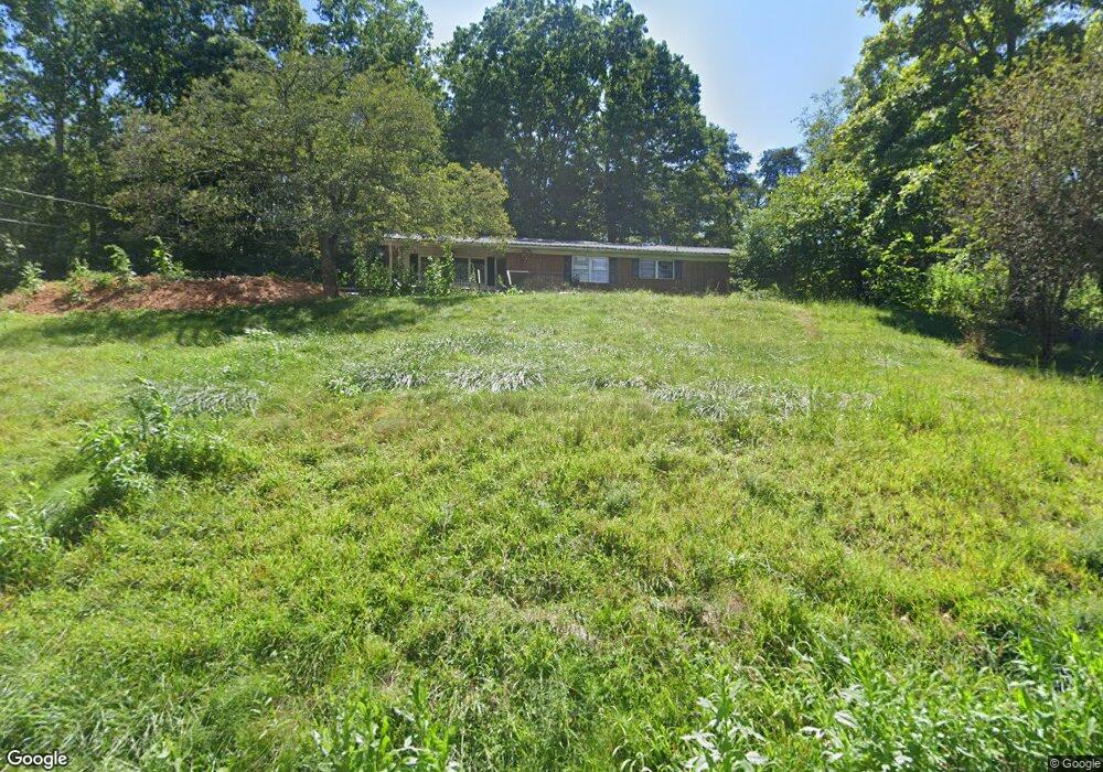
36 Odonald Rd Asheville, NC 28806
West Asheville NeighborhoodEstimated Value: $424,881 - $530,000
3
Beds
2
Baths
1,792
Sq Ft
$264/Sq Ft
Est. Value
About This Home
This home is located at 36 Odonald Rd, Asheville, NC 28806 and is currently estimated at $472,470, approximately $263 per square foot. 36 Odonald Rd is a home located in Buncombe County with nearby schools including Clyde A. Erwin High School, West Buncombe Elementary School, and Clyde A. Erwin Middle School.
Ownership History
Date
Name
Owned For
Owner Type
Purchase Details
Closed on
May 30, 2008
Sold by
Davis Debra Lee
Bought by
Mcabee Dustin and Mcabee Lisa B
Current Estimated Value
Home Financials for this Owner
Home Financials are based on the most recent Mortgage that was taken out on this home.
Original Mortgage
$227,500
Outstanding Balance
$108,035
Interest Rate
6%
Mortgage Type
Seller Take Back
Estimated Equity
$364,435
Purchase Details
Closed on
Aug 4, 2004
Sold by
Rigsby Susan Lynn and Rigsby Michael Clement
Bought by
Davis Debra Lee
Create a Home Valuation Report for This Property
The Home Valuation Report is an in-depth analysis detailing your home's value as well as a comparison with similar homes in the area
Home Values in the Area
Average Home Value in this Area
Purchase History
| Date | Buyer | Sale Price | Title Company |
|---|---|---|---|
| Mcabee Dustin | $227,500 | None Available | |
| Davis Debra Lee | $99,000 | -- |
Source: Public Records
Mortgage History
| Date | Status | Borrower | Loan Amount |
|---|---|---|---|
| Open | Mcabee Dustin | $227,500 |
Source: Public Records
Tax History Compared to Growth
Tax History
| Year | Tax Paid | Tax Assessment Tax Assessment Total Assessment is a certain percentage of the fair market value that is determined by local assessors to be the total taxable value of land and additions on the property. | Land | Improvement |
|---|---|---|---|---|
| 2025 | $1,889 | $289,400 | $20,400 | $269,000 |
| 2024 | $1,889 | $289,400 | $35,400 | $254,000 |
| 2023 | $1,889 | $289,400 | $35,400 | $254,000 |
| 2022 | $1,803 | $289,400 | $35,400 | $254,000 |
| 2021 | $1,603 | $289,400 | $0 | $0 |
| 2020 | $1,585 | $236,900 | $0 | $0 |
| 2019 | $1,585 | $236,900 | $0 | $0 |
| 2018 | $1,561 | $236,900 | $0 | $0 |
| 2017 | $1,561 | $192,800 | $0 | $0 |
| 2016 | $1,396 | $192,800 | $0 | $0 |
| 2015 | $1,396 | $192,800 | $0 | $0 |
| 2014 | $1,357 | $192,800 | $0 | $0 |
Source: Public Records
Map
Nearby Homes
- 117 Scott Meadows Dr
- 110 Scott Meadows Dr
- 78 Scott Meadows Dr
- 71 Scott Meadows Dr
- 129 Scott Meadows Dr
- 79 Scott Meadows Dr
- 254 Mount Carmel Rd
- 23 Westmont Dr
- 50 Tipperary Dr
- 35 Fieldcrest Cir
- 7 Windy Hollow Rd
- 88 Lees Creek Rd
- 21 Mount Carmel Dr
- 116 Dix Creek Chapel Rd
- 207 Christina Ct
- 33 English Ivy Rd
- 31 English Ivy Rd
- 41 Rotunda Cir
- 59 Knollview Dr
- 94 Rotunda Cir