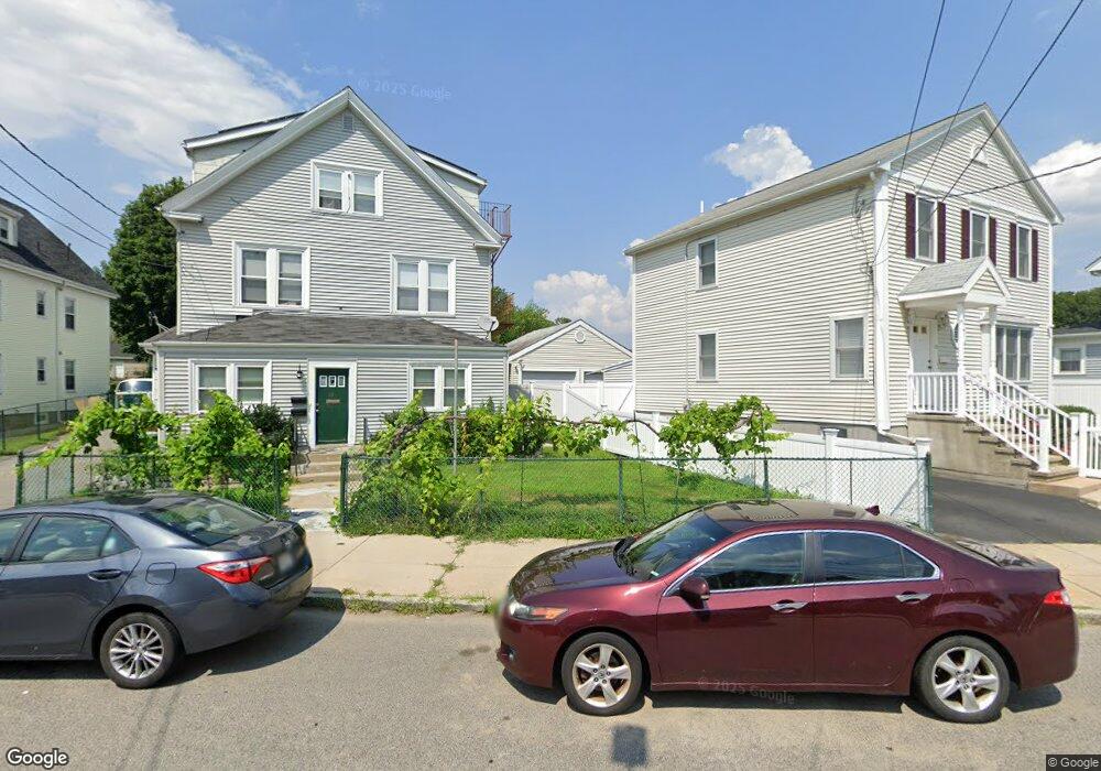
36 Ramsdell Ave Roslindale, MA 02131
Roslindale NeighborhoodEstimated Value: $832,000 - $902,000
4
Beds
3
Baths
2,521
Sq Ft
$343/Sq Ft
Est. Value
About This Home
This home is located at 36 Ramsdell Ave, Roslindale, MA 02131 and is currently estimated at $865,235, approximately $343 per square foot. 36 Ramsdell Ave is a home located in Suffolk County with nearby schools including Brooke Charter School Roslindale, Sacred Heart STEM School, and St. Clare High School.
Ownership History
Date
Name
Owned For
Owner Type
Purchase Details
Closed on
Jul 24, 2017
Sold by
Forgit Gene L and Farricy Tara
Bought by
Forgit Gene L
Current Estimated Value
Purchase Details
Closed on
Apr 2, 2012
Sold by
Forgit Gene L and Forgit Gene L
Bought by
Cox Gene L and Cox Tara
Home Financials for this Owner
Home Financials are based on the most recent Mortgage that was taken out on this home.
Original Mortgage
$200,000
Interest Rate
3.88%
Mortgage Type
New Conventional
Purchase Details
Closed on
Oct 22, 2004
Sold by
Forgit Gene and Forgit Joann
Bought by
Forgit Virginia E and Forgit Joann E
Create a Home Valuation Report for This Property
The Home Valuation Report is an in-depth analysis detailing your home's value as well as a comparison with similar homes in the area
Home Values in the Area
Average Home Value in this Area
Purchase History
| Date | Buyer | Sale Price | Title Company |
|---|---|---|---|
| Forgit Gene L | -- | -- | |
| Cox Gene L | -- | -- | |
| Forgit Virginia E | -- | -- |
Source: Public Records
Mortgage History
| Date | Status | Borrower | Loan Amount |
|---|---|---|---|
| Previous Owner | Cox Gene L | $200,000 |
Source: Public Records
Tax History
| Year | Tax Paid | Tax Assessment Tax Assessment Total Assessment is a certain percentage of the fair market value that is determined by local assessors to be the total taxable value of land and additions on the property. | Land | Improvement |
|---|---|---|---|---|
| 2025 | $8,357 | $721,700 | $224,000 | $497,700 |
| 2024 | $7,339 | $673,300 | $205,200 | $468,100 |
| 2023 | $6,889 | $641,400 | $195,500 | $445,900 |
| 2022 | $6,459 | $593,700 | $180,900 | $412,800 |
| 2021 | $5,976 | $560,100 | $170,700 | $389,400 |
| 2020 | $5,730 | $542,600 | $156,900 | $385,700 |
| 2019 | $5,503 | $522,100 | $139,500 | $382,600 |
| 2018 | $5,066 | $483,400 | $139,500 | $343,900 |
| 2017 | $4,659 | $439,900 | $139,500 | $300,400 |
| 2016 | $4,622 | $420,200 | $138,500 | $281,700 |
| 2015 | $3,958 | $326,800 | $126,000 | $200,800 |
| 2014 | $3,722 | $295,900 | $126,000 | $169,900 |
Source: Public Records
Map
Nearby Homes
- 6 Ramsdell Ave Unit 4
- 766 Hyde Park Ave
- 800 Hyde Park Ave Unit 3
- 624 Hyde Park Ave Unit D4
- 624 Hyde Park Ave Unit C3
- 175 Clare Ave Unit B3
- 886 Canterbury St
- 4 Rowe Ct
- 60 Stella Rd
- 419 Poplar St
- 8 Mount Calvary Rd Unit 4
- 76 Dale St
- 87 Victoria Heights Rd
- 65 Victoria Heights Rd Unit 65
- 16 Hilburn Place
- 49 Dale St
- 68 Rowe St Unit 3
- 68 Rowe St Unit 2
- 895 Hyde Park Ave Unit 2
- 103 Whitford St
- 36 Ramsdell Ave Unit 3
- 36 Ramsdell Ave Unit 2
- 40 Ramsdell Ave
- 32 Ramsdell Ave
- 59 Navarre St
- 44 Ramsdell Ave
- 55 Navarre St
- 31 Ramsdell Ave
- 28 Ramsdell Ave
- 27 Ramsdell Ave
- 35 Ramsdell Ave
- 25 Ramsdell Ave
- 51 Navarre St
- 51 Navarre St Unit B
- 24 Ramsdell Ave
- 24 Ramsdell Ave Unit 1
- 38 Clare Ave Unit 1
- 38 Clare Ave
- 37 Ramsdell Ave
- 62 Clare Ave
Your Personal Tour Guide
Ask me questions while you tour the home.