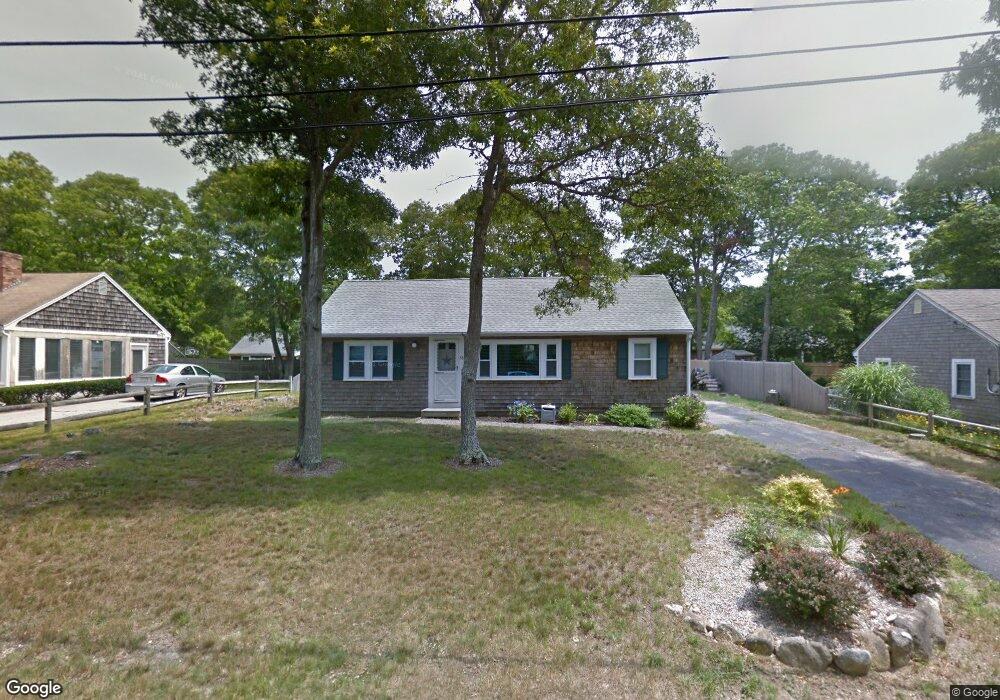
36 Security St Hyannis, MA 02601
Estimated Value: $382,000 - $531,000
3
Beds
1
Bath
898
Sq Ft
$527/Sq Ft
Est. Value
About This Home
This home is located at 36 Security St, Hyannis, MA 02601 and is currently estimated at $473,175, approximately $526 per square foot. 36 Security St is a home located in Barnstable County with nearby schools including Hyannis West Elementary School, Barnstable United Elementary School, and Barnstable Intermediate School.
Ownership History
Date
Name
Owned For
Owner Type
Purchase Details
Closed on
Jun 17, 2011
Sold by
Ricciotti Robert C and Tartaglia Ricciotti L
Bought by
Rgr Rt
Current Estimated Value
Purchase Details
Closed on
Apr 25, 1997
Sold by
Shea Richard J and Shea Dorothy M
Bought by
Stevens Florence P
Create a Home Valuation Report for This Property
The Home Valuation Report is an in-depth analysis detailing your home's value as well as a comparison with similar homes in the area
Home Values in the Area
Average Home Value in this Area
Purchase History
| Date | Buyer | Sale Price | Title Company |
|---|---|---|---|
| Rgr Rt | -- | -- | |
| Tartaglia Ricciotti L | $156,500 | -- | |
| Stevens Florence P | $75,000 | -- |
Source: Public Records
Tax History
| Year | Tax Paid | Tax Assessment Tax Assessment Total Assessment is a certain percentage of the fair market value that is determined by local assessors to be the total taxable value of land and additions on the property. | Land | Improvement |
|---|---|---|---|---|
| 2025 | $3,350 | $361,400 | $139,600 | $221,800 |
| 2024 | $3,252 | $359,300 | $139,600 | $219,700 |
| 2023 | $2,999 | $313,400 | $126,900 | $186,500 |
| 2022 | $2,921 | $252,500 | $94,000 | $158,500 |
| 2021 | $2,632 | $221,000 | $94,000 | $127,000 |
| 2020 | $2,679 | $217,300 | $94,000 | $123,300 |
| 2019 | $2,536 | $201,600 | $94,000 | $107,600 |
| 2018 | $2,282 | $185,500 | $98,900 | $86,600 |
| 2017 | $2,155 | $179,700 | $98,900 | $80,800 |
| 2016 | $2,171 | $185,100 | $104,300 | $80,800 |
| 2015 | $2,088 | $180,500 | $97,200 | $83,300 |
Source: Public Records
Map
Nearby Homes
- 20 Sunset Terrace
- 36 Grouse Ln
- 15 Glen Rd
- 83 Peacock Dr
- 135 W Main St Unit 7
- 14 Marston Ave
- 260 Tobey Way
- 50 Redwood Ln
- 33 Edgewood Rd
- 140 6th Ave
- 46 Washington Ave
- 292 Megan Rd
- 18 Mount Vernon Ave
- 179 Sudbury Ln
- 172 Irving Ave
- 125 Sea St
- 75 Olander Dr
- 75 Olander Dr
- 432 Sea St Unit 8D
- 432 Sea St Unit 8D
- 52 Security
- 28 Security St
- 44 Security St
- 95 Homeport Dr
- 101 Homeport Dr
- 87 Homeport Dr
- 20 Security St
- 52 Security St
- 52 Security St Unit Winter
- 39 Security St
- 31 Security St
- 79 Homeport Dr
- 45 Security St
- 109 Homeport Dr
- 23 Security St
- 60 Security St
- 55 Security St
- 71 Homeport Dr
- 15 Security St
- 12 Security St
Your Personal Tour Guide
Ask me questions while you tour the home.