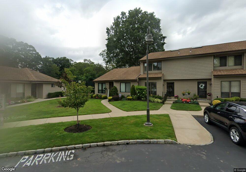
36 Stanford Ct Wantagh, NY 11793
Estimated Value: $649,000 - $662,000
2
Beds
2
Baths
1,093
Sq Ft
$600/Sq Ft
Est. Value
About This Home
This home is located at 36 Stanford Ct, Wantagh, NY 11793 and is currently estimated at $655,500, approximately $599 per square foot. 36 Stanford Ct is a home located in Nassau County with nearby schools including Lee Road Elementary School, Jonas E. Salk Middle School, and Gen. Douglas MacArthur Senior High School.
Ownership History
Date
Name
Owned For
Owner Type
Purchase Details
Closed on
Mar 23, 2021
Sold by
Brancato Richard A and Brancato Cheryl S
Bought by
Maher Maureen
Current Estimated Value
Purchase Details
Closed on
Mar 18, 2010
Sold by
Ambadjes Chris X and Revocable Living Trust Of Jean
Bought by
Brancato Richard A and Brancato Cheryl S
Purchase Details
Closed on
Mar 11, 1999
Sold by
Ambadjes Jeanette
Bought by
Ambadjes Jeanette and Jeanette Ambadjes Revocable Li
Purchase Details
Closed on
Oct 31, 1998
Create a Home Valuation Report for This Property
The Home Valuation Report is an in-depth analysis detailing your home's value as well as a comparison with similar homes in the area
Home Values in the Area
Average Home Value in this Area
Purchase History
| Date | Buyer | Sale Price | Title Company |
|---|---|---|---|
| Maher Maureen | $505,000 | None Available | |
| Brancato Richard A | $332,000 | -- | |
| Ambadjes Jeanette | -- | Fidelity National Title Ins | |
| -- | -- | -- |
Source: Public Records
Tax History Compared to Growth
Tax History
| Year | Tax Paid | Tax Assessment Tax Assessment Total Assessment is a certain percentage of the fair market value that is determined by local assessors to be the total taxable value of land and additions on the property. | Land | Improvement |
|---|---|---|---|---|
| 2025 | $12,242 | $391 | $208 | $183 |
| 2024 | $2,897 | $402 | $214 | $188 |
| 2023 | $11,982 | $402 | $214 | $188 |
| 2022 | $11,982 | $402 | $214 | $188 |
| 2021 | $16,492 | $397 | $211 | $186 |
| 2020 | $11,915 | $584 | $492 | $92 |
| 2019 | $2,747 | $584 | $492 | $92 |
| 2018 | $2,651 | $584 | $0 | $0 |
| 2017 | $8,178 | $621 | $453 | $168 |
| 2016 | $10,889 | $675 | $463 | $212 |
| 2015 | $2,751 | $675 | $463 | $212 |
| 2014 | $2,751 | $675 | $463 | $212 |
| 2013 | $2,744 | $718 | $492 | $226 |
Source: Public Records
Map
Nearby Homes
- 84 Stanford Ct
- 236 Duckpond Dr S
- 7 Stanford Ct
- 200 Willowood Dr
- 231 Willowood Dr
- 55 Duckpond Dr N
- 27 Wildflower Ln
- 1243 Peapond Rd
- 1100 Wantagh Ave
- 2794 Janet Ave
- 1200 Roger Rd
- 86 Weaving Ln
- 985 Douglas Ave
- 3405 Lufberry Ave
- 2889 Anderson St
- 3356 Carrollton Ave
- 1010 Brent Dr
- 19 Wayside Ln
- 22 Balsam Ct
- 3418 Silverton Ave
- 35 Stanford Ct
- 34B Stanford Ct
- 34 Stanford Ct Unit B
- 33 Stanford Ct Unit B
- 32 Stanford Ct
- 31 Stanford Ct
- 69 Stanford Ct
- 220 Duckpond Dr S
- 37 Stanford Ct Unit A
- 38 Stanford Ct
- 30 Stanford Ct
- 39 Stanford Ct
- 70 Stanford Ct
- 40 Stanford Ct
- 29 Stanford Ct Unit B
- 71 Stanford Ct
- 41 Stanford Ct
- 72 Stanford Ct
- 28 Stanford Ct
- 73 Stanford Ct