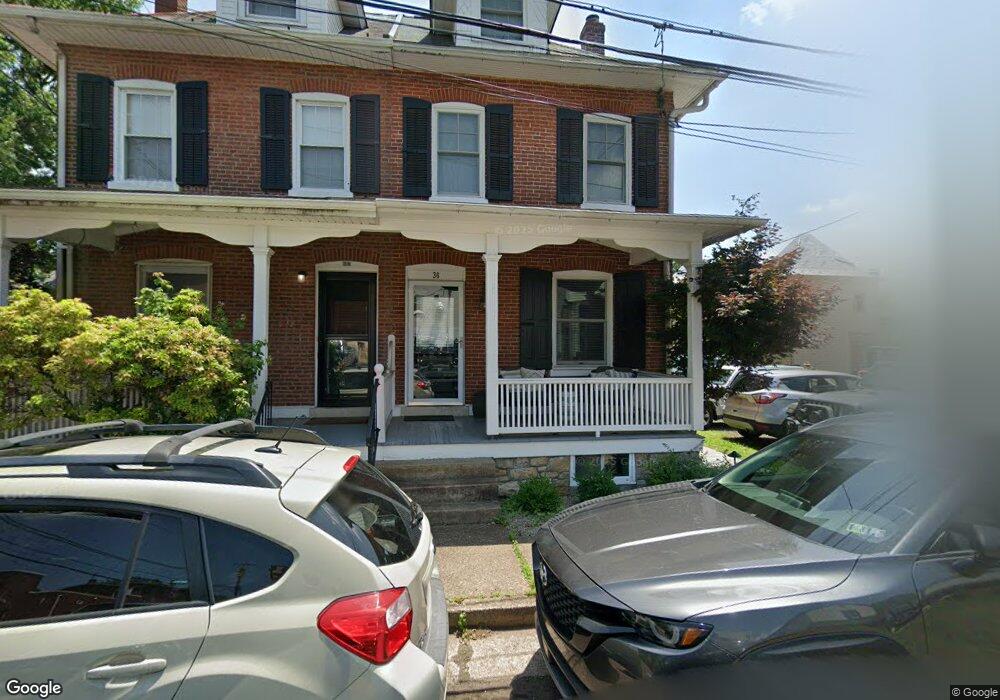
36 Taylor Ave Doylestown, PA 18901
Estimated Value: $553,871 - $640,000
2
Beds
1
Bath
1,450
Sq Ft
$412/Sq Ft
Est. Value
About This Home
This home is located at 36 Taylor Ave, Doylestown, PA 18901 and is currently estimated at $597,218, approximately $411 per square foot. 36 Taylor Ave is a home located in Bucks County with nearby schools including Linden El School, Lenape Middle School, and Central Bucks High School-West.
Ownership History
Date
Name
Owned For
Owner Type
Purchase Details
Closed on
Mar 16, 2009
Sold by
Wiggins W Stover
Bought by
Arculin Jennie E
Current Estimated Value
Home Financials for this Owner
Home Financials are based on the most recent Mortgage that was taken out on this home.
Original Mortgage
$314,204
Interest Rate
4.86%
Mortgage Type
FHA
Purchase Details
Closed on
Apr 12, 2002
Sold by
Hamilton Harold W
Bought by
Wiggins W Stover
Create a Home Valuation Report for This Property
The Home Valuation Report is an in-depth analysis detailing your home's value as well as a comparison with similar homes in the area
Home Values in the Area
Average Home Value in this Area
Purchase History
| Date | Buyer | Sale Price | Title Company |
|---|---|---|---|
| Arculin Jennie E | $320,000 | None Available | |
| Wiggins W Stover | $151,000 | -- |
Source: Public Records
Mortgage History
| Date | Status | Borrower | Loan Amount |
|---|---|---|---|
| Previous Owner | Arculin Jennie E | $314,204 |
Source: Public Records
Tax History Compared to Growth
Tax History
| Year | Tax Paid | Tax Assessment Tax Assessment Total Assessment is a certain percentage of the fair market value that is determined by local assessors to be the total taxable value of land and additions on the property. | Land | Improvement |
|---|---|---|---|---|
| 2025 | $3,416 | $18,960 | $1,040 | $17,920 |
| 2024 | $3,416 | $18,960 | $1,040 | $17,920 |
| 2023 | $3,254 | $18,960 | $1,040 | $17,920 |
| 2022 | $3,209 | $18,960 | $1,040 | $17,920 |
| 2021 | $3,174 | $18,960 | $1,040 | $17,920 |
| 2020 | $2,953 | $17,840 | $1,040 | $16,800 |
| 2019 | $2,921 | $17,840 | $1,040 | $16,800 |
| 2018 | $2,885 | $17,840 | $1,040 | $16,800 |
| 2017 | $2,855 | $17,840 | $1,040 | $16,800 |
| 2016 | $2,855 | $17,840 | $1,040 | $16,800 |
| 2015 | -- | $17,840 | $1,040 | $16,800 |
| 2014 | -- | $17,840 | $1,040 | $16,800 |
Source: Public Records
Map
Nearby Homes
- 69 E Oakland Ave
- 20 E Court St
- 110 E Ashland St
- 1 Barnes Ct
- 155 E Oakland Ave
- 37 N Clinton St
- 236 Green St
- 146 E Court St
- 146 N Church St
- 130 N Clinton St
- 195 Lafayette St
- 89 Homestead Dr
- 339 E Ashland St
- 403 S Main St Unit S201
- 121 Cottage St
- 3 Steeplechase Dr
- 418 North St
- 9 Mill Creek Dr
- 505 E State St
- 6 Edison Ln Unit 1
- 38 Taylor Ave
- 39 E Ashland St
- 57 E Ashland St
- 33 E Ashland St
- 24 Taylor Ave Unit 24B
- 61 E Ashland St
- 41 Taylor Ave Unit 2
- 41 Taylor Ave Unit 1
- 41 Taylor Ave Unit 3
- 41 Taylor Ave
- 25 Taylor Ave
- 23 Taylor Ave
- 63 E Ashland St
- 7 Taylor Ave
- 28 E Oakland Ave Unit B-4
- 28 E Oakland Ave
- 21 E Ashland St Unit 2
- 21 E Ashland St Unit B
- 21 E Ashland St
- 71 E Ashland St Unit 2ND FL