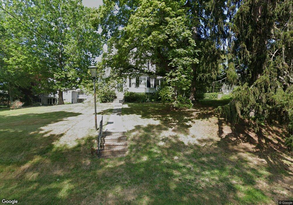
36 Toppans Ln Newburyport, MA 01950
Estimated Value: $1,314,000 - $1,750,000
5
Beds
3
Baths
2,690
Sq Ft
$567/Sq Ft
Est. Value
About This Home
This home is located at 36 Toppans Ln, Newburyport, MA 01950 and is currently estimated at $1,524,397, approximately $566 per square foot. 36 Toppans Ln is a home located in Essex County with nearby schools including Francis T. Bresnahan Elementary School, Edward G. Molin Elementary School, and Rupert A. Nock Middle School.
Ownership History
Date
Name
Owned For
Owner Type
Purchase Details
Closed on
Sep 25, 1987
Sold by
Oravec Bruce J
Bought by
Smith Thomas R
Current Estimated Value
Create a Home Valuation Report for This Property
The Home Valuation Report is an in-depth analysis detailing your home's value as well as a comparison with similar homes in the area
Home Values in the Area
Average Home Value in this Area
Purchase History
| Date | Buyer | Sale Price | Title Company |
|---|---|---|---|
| Smith Thomas R | $315,000 | -- |
Source: Public Records
Mortgage History
| Date | Status | Borrower | Loan Amount |
|---|---|---|---|
| Open | Smith Thomas R | $487,500 | |
| Closed | Smith Thomas R | $516,000 | |
| Closed | Smith Thomas R | $136,000 | |
| Closed | Smith Thomas R | $224,000 |
Source: Public Records
Tax History Compared to Growth
Tax History
| Year | Tax Paid | Tax Assessment Tax Assessment Total Assessment is a certain percentage of the fair market value that is determined by local assessors to be the total taxable value of land and additions on the property. | Land | Improvement |
|---|---|---|---|---|
| 2025 | $13,649 | $1,424,700 | $503,400 | $921,300 |
| 2024 | $13,354 | $1,339,400 | $459,900 | $879,500 |
| 2023 | $12,396 | $1,154,200 | $400,000 | $754,200 |
| 2022 | $11,633 | $968,600 | $336,900 | $631,700 |
| 2021 | $11,414 | $903,000 | $308,400 | $594,600 |
| 2020 | $11,595 | $903,000 | $308,400 | $594,600 |
| 2019 | $11,136 | $851,400 | $308,400 | $543,000 |
| 2018 | $10,605 | $799,800 | $294,900 | $504,900 |
| 2017 | $10,570 | $785,900 | $281,000 | $504,900 |
| 2016 | $10,376 | $774,900 | $256,700 | $518,200 |
| 2015 | $9,892 | $741,500 | $256,700 | $484,800 |
Source: Public Records
Map
Nearby Homes
- 110 Low St
- 138 Low St
- 14 Dexter Ln Unit B
- 14 Dexter Ln Unit A
- 27 Warren St Unit 1
- 13 Broad St
- 45 Boardman St Unit 1
- 287 1/2 High St
- 41 Washington St Unit B
- 44 Washington St Unit C
- 288 Merrimac St
- 158 Merrimac St Unit 3
- 266 Merrimac St Unit F
- 1 Hill St
- 1 Hill St Unit 1
- 2 Court St Unit 4
- 126 Merrimac St Unit 47
- 126 Merrimac St Unit 35
- 42 Myrtle Ave
- 17 Alberta Ave
- 38 Toppans Ln Unit 2
- 36 Toppans Ln Unit 2
- 36 Toppans Ln Unit 1
- 36R Toppans Ln Unit 2
- 36 Toppans Ln
- 38 Toppans Ln Unit A
- 38 Toppans Ln Unit 1
- 1 Deer Island St Unit 3
- 3 Rogers Ct
- 99999 Restaurant
- One Commercial Opportunity
- 5 Water St Rear Unit F Unit F
- 0 0 Unit 70650910
- 40 Toppans Ln
- 34 Toppans Ln
- 42 Toppans Ln
- 44 Toppans Ln
- 37 Toppans Ln
- 33 Toppans Ln
- 33 Toppans Ln