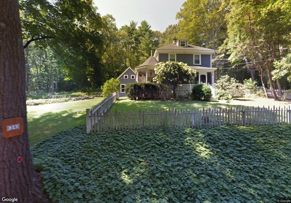
36 Union St Norfolk, MA 02056
Estimated Value: $743,958 - $810,000
3
Beds
2
Baths
2,229
Sq Ft
$352/Sq Ft
Est. Value
About This Home
This home is located at 36 Union St, Norfolk, MA 02056 and is currently estimated at $783,990, approximately $351 per square foot. 36 Union St is a home located in Norfolk County with nearby schools including H. Olive Day School, Freeman-Kennedy School, and Woodside Montessori Academy.
Ownership History
Date
Name
Owned For
Owner Type
Purchase Details
Closed on
Nov 15, 2002
Sold by
Lee Harry F and Lee Eileen F
Bought by
Carter John A and Carter Barbara W
Current Estimated Value
Home Financials for this Owner
Home Financials are based on the most recent Mortgage that was taken out on this home.
Original Mortgage
$250,000
Outstanding Balance
$104,791
Interest Rate
6.03%
Mortgage Type
Purchase Money Mortgage
Estimated Equity
$679,199
Purchase Details
Closed on
Oct 15, 1999
Sold by
Whiting John K and Whiting Nancy A
Bought by
Lee Harry F and Lee Eileen F
Home Financials for this Owner
Home Financials are based on the most recent Mortgage that was taken out on this home.
Original Mortgage
$236,000
Interest Rate
7.8%
Mortgage Type
Purchase Money Mortgage
Purchase Details
Closed on
Jul 19, 1988
Sold by
Gaynor Frank A
Bought by
Whiting John K
Create a Home Valuation Report for This Property
The Home Valuation Report is an in-depth analysis detailing your home's value as well as a comparison with similar homes in the area
Home Values in the Area
Average Home Value in this Area
Purchase History
| Date | Buyer | Sale Price | Title Company |
|---|---|---|---|
| Carter John A | $383,500 | -- | |
| Lee Harry F | $295,000 | -- | |
| Whiting John K | $182,240 | -- |
Source: Public Records
Mortgage History
| Date | Status | Borrower | Loan Amount |
|---|---|---|---|
| Open | Carter John A | $250,000 | |
| Previous Owner | Whiting John K | $236,000 | |
| Previous Owner | Whiting John K | $191,250 | |
| Previous Owner | Whiting John K | $60,000 | |
| Previous Owner | Whiting John K | $35,000 |
Source: Public Records
Tax History
| Year | Tax Paid | Tax Assessment Tax Assessment Total Assessment is a certain percentage of the fair market value that is determined by local assessors to be the total taxable value of land and additions on the property. | Land | Improvement |
|---|---|---|---|---|
| 2025 | $9,791 | $613,100 | $226,500 | $386,600 |
| 2024 | $8,517 | $547,000 | $226,500 | $320,500 |
| 2023 | $8,656 | $527,500 | $226,500 | $301,000 |
| 2022 | $8,170 | $448,900 | $212,100 | $236,800 |
| 2021 | $8,639 | $480,200 | $206,000 | $274,200 |
| 2020 | $7,778 | $417,300 | $187,300 | $230,000 |
| 2019 | $7,464 | $408,100 | $187,300 | $220,800 |
| 2018 | $7,185 | $385,900 | $187,300 | $198,600 |
| 2017 | $7,084 | $388,800 | $187,300 | $201,500 |
| 2016 | $7,030 | $388,800 | $187,300 | $201,500 |
| 2015 | $6,907 | $391,100 | $178,600 | $212,500 |
| 2014 | $6,866 | $393,900 | $178,600 | $215,300 |
Source: Public Records
Map
Nearby Homes
- 45 Meetinghouse Rd Unit 45
- 3 Elliot Mills Unit 2
- 6 Elliot Mills Unit 31
- 7 Keeney Pond Rd
- 16 Keeney Pond Rd
- 23 Fredrickson Rd
- 292 Main St
- 8 Ridgefield Rd
- 0 Toils End Rd
- 0 W Birch Rd
- 1187 West St
- 4 Haydn Ln
- 246 Forest Grove Ave
- 37 Thomas Mann Cir Unit 23
- 45 Thomas Mann Cir Unit 27
- 49 Thomas Mann Cir Unit 29
- 27 Thomas Mann Cir Unit 18
- 53 Thomas Mann Cir Unit 31
- 28 Thomas Mann Cir Unit Lot 38
- 26 Thomas Mann Cir Unit 37
- 32 Union St
- 31 Union St
- 25 Union St
- 35 Union St
- 46 Union St
- 38 Union St
- 30 Union St
- 23 Union St
- 37 Union St
- 103 Meetinghouse Rd
- 61 Meetinghouse Rd
- 61 Meetinghouse Rd Unit 21 Bldg.4
- 61 Meetinghouse Rd Unit 61
- 93 Meetinghouse Rd
- 87 Meetinghouse Rd
- 85 Meetinghouse Rd
- 21 Meetinghouse Rd
- 41 Meetinghouse Rd
- 41 Meetinghouse Rd Unit 13 Bldg.3
- 63 Meetinghouse Rd
Your Personal Tour Guide
Ask me questions while you tour the home.