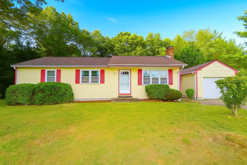
36 Winfield St East Freetown, MA 02717
Estimated payment $3,396/month
Highlights
- Golf Course Community
- Ranch Style House
- Bonus Room
- Community Stables
- Wood Flooring
- Mud Room
About This Home
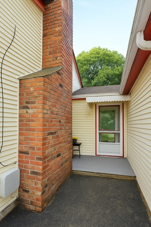
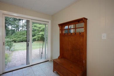
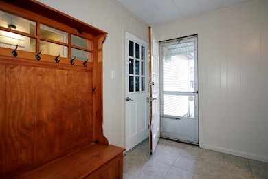
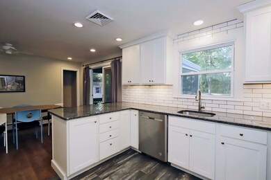
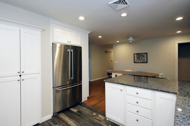
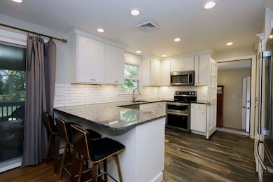
Welcome to 36 Winfield St in desirable Robinson Estates, where comfort, functionality & privacy come together. A welcoming entry leads to a spacious mudroom with abundant storage, while the open-concept kitchen boasts a striking granite peninsula with generous counter space & seating, flowing seamlessly into the dining & living areas. Step through the slider to a serene screened-in porch, the perfect spot to relax & enjoy the private & expansive backyard. Three well-sized bedrooms & a full bath with laundry complete the main level. The finished basement adds over 900 sq ft of versatile living space, including a bonus room with direct backyard access & a second full bath—ideal for guests, hobbies, or office space. A garage & expansive driveway offer ample parking, while the nearly three-quarter acre lot enhances the sense of space & privacy. Well-maintained & move-in ready, this home is a rare opportunity in Robinson Estates not to be missed!
Home Details
Home Type
- Single Family
Est. Annual Taxes
- $4,325
Year Built
- Built in 1972
Parking
- 1 Car Attached Garage
- Driveway
- Open Parking
- Off-Street Parking
Home Design
- Ranch Style House
- Frame Construction
- Shingle Roof
- Concrete Perimeter Foundation
Interior Spaces
- Ceiling Fan
- Recessed Lighting
- Sliding Doors
- Mud Room
- Living Room with Fireplace
- Bonus Room
- Basement Fills Entire Space Under The House
- Solid Surface Countertops
- Washer and Electric Dryer Hookup
Flooring
- Wood
- Wall to Wall Carpet
- Ceramic Tile
- Vinyl
Bedrooms and Bathrooms
- 3 Bedrooms
- 2 Full Bathrooms
Schools
- Freetown Elementary School
- Freetown-Lakeville Middle Scho
- Apponequet Regional High School
Utilities
- Central Air
- Heating System Uses Oil
- Baseboard Heating
- Private Water Source
- Private Sewer
Additional Features
- Enclosed Patio or Porch
- 0.62 Acre Lot
- Property is near schools
Listing and Financial Details
- Assessor Parcel Number M:107 P:78,2850311
Community Details
Overview
- No Home Owners Association
- Robinson Estates Subdivision
Recreation
- Golf Course Community
- Community Stables
- Jogging Path
Map
Home Values in the Area
Average Home Value in this Area
Tax History
| Year | Tax Paid | Tax Assessment Tax Assessment Total Assessment is a certain percentage of the fair market value that is determined by local assessors to be the total taxable value of land and additions on the property. | Land | Improvement |
|---|---|---|---|---|
| 2025 | $4,325 | $436,400 | $175,700 | $260,700 |
| 2024 | $4,295 | $411,800 | $165,800 | $246,000 |
| 2023 | $4,194 | $391,600 | $149,300 | $242,300 |
| 2022 | $3,995 | $331,300 | $126,500 | $204,800 |
| 2021 | $3,863 | $304,200 | $115,000 | $189,200 |
| 2020 | $3,791 | $291,200 | $110,600 | $180,600 |
| 2019 | $3,583 | $272,500 | $105,300 | $167,200 |
| 2018 | $3,421 | $257,000 | $105,300 | $151,700 |
| 2017 | $3,330 | $250,000 | $105,300 | $144,700 |
| 2016 | $3,180 | $242,900 | $102,300 | $140,600 |
| 2015 | $3,123 | $242,100 | $102,300 | $139,800 |
| 2014 | $2,931 | $232,400 | $100,200 | $132,200 |
Property History
| Date | Event | Price | List to Sale | Price per Sq Ft |
|---|---|---|---|---|
| 10/12/2025 10/12/25 | Pending | -- | -- | -- |
| 10/01/2025 10/01/25 | For Sale | $575,000 | -- | $255 / Sq Ft |
Purchase History
| Date | Type | Sale Price | Title Company |
|---|---|---|---|
| Quit Claim Deed | -- | None Available | |
| Deed | $130,000 | -- |
Mortgage History
| Date | Status | Loan Amount | Loan Type |
|---|---|---|---|
| Previous Owner | $94,000 | No Value Available | |
| Previous Owner | $87,000 | Purchase Money Mortgage |
Source: MLS Property Information Network (MLS PIN)
MLS Number: 73437739
APN: FREE-000107-000000-000078
Disclaimer: Certain information contained herein is derived from information provided by parties other than Homes.com. All information provided is deemed reliable, but is not guaranteed to be accurate and should be independently verified.
![]() The property listing data and information, or the Images, set forth herein were provided to MLS Property Information Network, Inc. from third party sources, including sellers, lessors and public records, and were compiled by MLS Property Information Network, Inc. The property listing data and information, and the Images, are for the personal, non-commercial use of consumers having a good faith interest in purchasing or leasing listed properties of the type displayed to them and may not be used for any purpose other than to identify prospective properties which such consumers may have a good faith interest in purchasing or leasing. MLS Property Information Network, Inc. and its subscribers disclaim any and all representations and warranties as to the accuracy of the property listing data and information, or as to the accuracy of any of the Images, set forth herein.
The property listing data and information, or the Images, set forth herein were provided to MLS Property Information Network, Inc. from third party sources, including sellers, lessors and public records, and were compiled by MLS Property Information Network, Inc. The property listing data and information, and the Images, are for the personal, non-commercial use of consumers having a good faith interest in purchasing or leasing listed properties of the type displayed to them and may not be used for any purpose other than to identify prospective properties which such consumers may have a good faith interest in purchasing or leasing. MLS Property Information Network, Inc. and its subscribers disclaim any and all representations and warranties as to the accuracy of the property listing data and information, or as to the accuracy of any of the Images, set forth herein.
