Estimated Value: $557,968 - $653,000
5
Beds
3
Baths
2,951
Sq Ft
$204/Sq Ft
Est. Value
About This Home
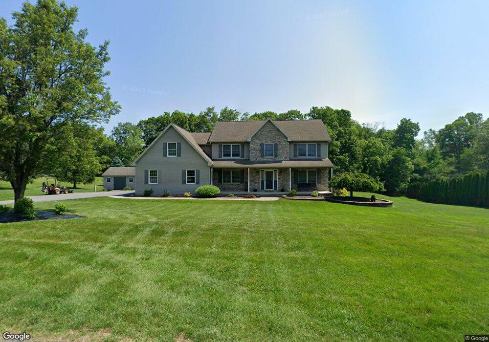
This home is located at 360 Abi Ln, Bath, PA 18014 and is currently estimated at $602,992, approximately $204 per square foot. 360 Abi Ln is a home located in Northampton County with nearby schools including Moore Elementary School, Northampton Area Middle School, and Northampton Area High School.
Ownership History
Date
Name
Owned For
Owner Type
Purchase Details
Closed on
Jul 26, 2016
Sold by
Reese Michael J and Reese Dawn R
Bought by
Reese Michael J
Current Estimated Value
Purchase Details
Closed on
Jun 17, 2015
Sold by
Reese Michael J and Reese Dawn R
Bought by
Reese Michael J
Purchase Details
Closed on
Feb 5, 2002
Bought by
Reese Michael J and Reese Dawn R
Create a Home Valuation Report for This Property
The Home Valuation Report is an in-depth analysis detailing your home's value as well as a comparison with similar homes in the area
Home Values in the Area
Average Home Value in this Area
Purchase History
| Date | Buyer | Sale Price | Title Company |
|---|---|---|---|
| Reese Michael J | -- | Penn Title Insurance Co | |
| Reese Michael J | -- | None Available | |
| Reese Michael J | -- | -- |
Source: Public Records
Tax History
| Year | Tax Paid | Tax Assessment Tax Assessment Total Assessment is a certain percentage of the fair market value that is determined by local assessors to be the total taxable value of land and additions on the property. | Land | Improvement |
|---|---|---|---|---|
| 2026 | $1,117 | $103,400 | $24,900 | $78,500 |
| 2025 | $1,117 | $103,400 | $24,900 | $78,500 |
| 2024 | $7,498 | $103,400 | $24,900 | $78,500 |
| 2023 | $7,498 | $103,400 | $24,900 | $78,500 |
| 2022 | $7,498 | $103,400 | $24,900 | $78,500 |
| 2021 | $7,516 | $103,400 | $24,900 | $78,500 |
| 2020 | $7,516 | $103,400 | $24,900 | $78,500 |
| 2019 | $7,200 | $103,400 | $24,900 | $78,500 |
| 2018 | $7,090 | $103,400 | $24,900 | $78,500 |
| 2017 | $6,932 | $103,400 | $24,900 | $78,500 |
| 2016 | -- | $103,400 | $24,900 | $78,500 |
| 2015 | -- | $103,400 | $24,900 | $78,500 |
| 2014 | -- | $103,400 | $24,900 | $78,500 |
Source: Public Records
Map
Nearby Homes
- 2799 Valley View Dr
- 3061 Pheasant Dr
- 608 Monocacy Dr
- 172 Moorestown Dr
- 203 Beechwood Ln
- 460 N Chestnut St
- 2451 Fairway Ln Unit 52
- 8220 Airport Rd Unit 4
- 271 Park Terrace Ct Unit Court
- 6149 Snyders Church Rd Unit Trl28
- 8161 Valley View Rd
- 104 S Chestnut St
- 622 Creek Rd
- 3449 Franklin Square
- 104 Washington St
- 156 E Northampton St
- 3242 Sterner Rd Unit 5
- 3240 Sterner Rd Unit 6
- 13 Longwood Cir
- 3420 Westminster Way
- 370 Abi Ln
- 350 Abi Ln
- 355 Abi Ln
- 365 Abi Ln
- 380 Abi Ln
- 340 Abi Ln
- 345 Abi Ln
- 375 Abi Ln
- 2860 Whitetail Deer Dr
- 2840 Whitetail Deer Dr
- 2870 Whitetail Deer Dr
- 390 Abi Ln
- 378 E Dannersville Rd
- 370 E Dannersville Rd
- 380 E Dannersville Rd
- 2820 Whitetail Deer Dr
- 364 E Dannersville Rd
- 390 E Dannersville Rd
- 400 E Dannersville Rd
- 2817 Whitetail Deer Dr
Your Personal Tour Guide
Ask me questions while you tour the home.