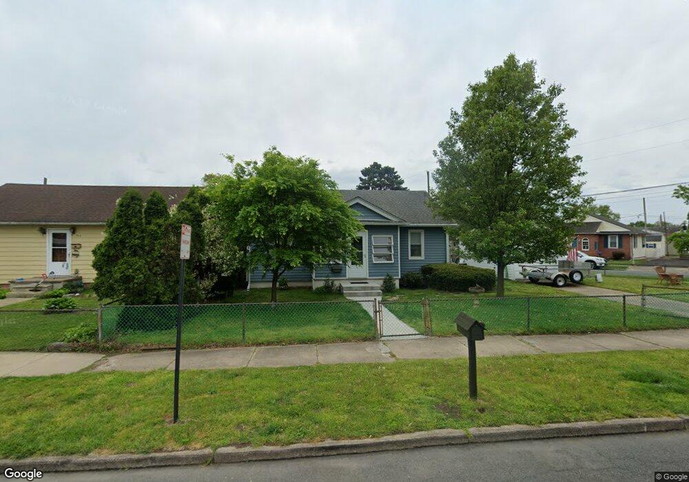
360 East Cir Bristol, PA 19007
Estimated Value: $206,000 - $323,699
3
Beds
1
Bath
1,002
Sq Ft
$271/Sq Ft
Est. Value
About This Home
This home is located at 360 East Cir, Bristol, PA 19007 and is currently estimated at $271,925, approximately $271 per square foot. 360 East Cir is a home located in Bucks County with nearby schools including Snyder-Girotti Elementary School, Bristol High School, and First Presbyterian Church School.
Ownership History
Date
Name
Owned For
Owner Type
Purchase Details
Closed on
Sep 30, 1998
Sold by
Petrizzi Deborah A and Herbst Deborah Petrizzi
Bought by
Rolston Jeffrey and Rolston Danielle
Current Estimated Value
Home Financials for this Owner
Home Financials are based on the most recent Mortgage that was taken out on this home.
Original Mortgage
$82,413
Outstanding Balance
$17,795
Interest Rate
6.74%
Mortgage Type
FHA
Estimated Equity
$254,130
Purchase Details
Closed on
Feb 3, 1993
Bought by
Petrizzi Deborah A
Create a Home Valuation Report for This Property
The Home Valuation Report is an in-depth analysis detailing your home's value as well as a comparison with similar homes in the area
Home Values in the Area
Average Home Value in this Area
Purchase History
| Date | Buyer | Sale Price | Title Company |
|---|---|---|---|
| Rolston Jeffrey | $82,500 | -- | |
| Petrizzi Deborah A | -- | -- |
Source: Public Records
Mortgage History
| Date | Status | Borrower | Loan Amount |
|---|---|---|---|
| Open | Rolston Jeffrey | $82,413 |
Source: Public Records
Tax History Compared to Growth
Tax History
| Year | Tax Paid | Tax Assessment Tax Assessment Total Assessment is a certain percentage of the fair market value that is determined by local assessors to be the total taxable value of land and additions on the property. | Land | Improvement |
|---|---|---|---|---|
| 2025 | $3,539 | $15,200 | $4,920 | $10,280 |
| 2024 | $3,539 | $15,200 | $4,920 | $10,280 |
| 2023 | $3,509 | $15,200 | $4,920 | $10,280 |
| 2022 | $3,509 | $15,200 | $4,920 | $10,280 |
| 2021 | $3,509 | $15,200 | $4,920 | $10,280 |
| 2020 | $3,608 | $15,200 | $4,920 | $10,280 |
| 2019 | $3,592 | $15,200 | $4,920 | $10,280 |
| 2018 | $3,592 | $15,200 | $4,920 | $10,280 |
| 2017 | $3,573 | $15,200 | $4,920 | $10,280 |
| 2016 | $3,573 | $15,200 | $4,920 | $10,280 |
| 2015 | -- | $15,200 | $4,920 | $10,280 |
| 2014 | -- | $15,200 | $4,920 | $10,280 |
Source: Public Records
Map
Nearby Homes
- 321 Taft St
- 314 Railroad Ave
- 61 Green Ln
- 221 Cleveland St
- 2296 Seabird Dr Unit 1
- 2285 Seabird Dr Unit 14
- 6419 Radcliffe St
- 243 Monroe St
- 1211 Seabird Dr Unit 40
- 5605 Toga St
- 16434 River View Cir
- 16442 River View Cir
- 16422 River View Cir
- 16352 River View Cir
- 16453 River View Cir
- 16221 River View Cir
- 16231 River View Cir
- 16333 River View Cir
- 16223 River View Cir
- 16242 River View Cir
- 354 East Cir
- 327 Roosevelt St
- 346 East Cir
- 344 Roosevelt St
- 325 Roosevelt St
- 355 East Cir
- 338 Roosevelt St
- 2216 Trenton Ave
- 340 East Cir
- 334 Roosevelt St
- 332 East Cir
- 328 Roosevelt St
- 345 East Cir
- 323 Roosevelt St
- 322 Roosevelt St
- 326 East Cir
- 300 Barry Place
- 350 Barry Place
- 345 Mckinley St
- 316 Roosevelt St