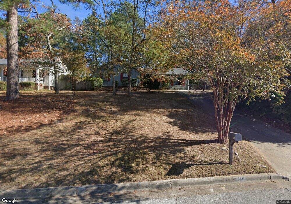
360 Kings Bridge Rd Augusta, GA 30907
Estimated Value: $203,000 - $240,000
3
Beds
2
Baths
1,557
Sq Ft
$145/Sq Ft
Est. Value
About This Home
This home is located at 360 Kings Bridge Rd, Augusta, GA 30907 and is currently estimated at $225,046, approximately $144 per square foot. 360 Kings Bridge Rd is a home located in Columbia County with nearby schools including Brookwood Elementary School, Evans Middle School, and Evans High School.
Ownership History
Date
Name
Owned For
Owner Type
Purchase Details
Closed on
Jul 15, 2024
Sold by
Bohrer Sean R
Bought by
Bohrer Joint Revocable Trust Dated July
Current Estimated Value
Purchase Details
Closed on
Nov 9, 2007
Sold by
Morelock Jeff L
Bought by
Bohrer Sean R
Home Financials for this Owner
Home Financials are based on the most recent Mortgage that was taken out on this home.
Original Mortgage
$106,242
Interest Rate
6.32%
Mortgage Type
New Conventional
Create a Home Valuation Report for This Property
The Home Valuation Report is an in-depth analysis detailing your home's value as well as a comparison with similar homes in the area
Home Values in the Area
Average Home Value in this Area
Purchase History
| Date | Buyer | Sale Price | Title Company |
|---|---|---|---|
| Bohrer Joint Revocable Trust Dated July | -- | -- | |
| Bohrer Sean R | $94,900 | -- |
Source: Public Records
Mortgage History
| Date | Status | Borrower | Loan Amount |
|---|---|---|---|
| Previous Owner | Bohrer Sean R | $106,242 |
Source: Public Records
Tax History
| Year | Tax Paid | Tax Assessment Tax Assessment Total Assessment is a certain percentage of the fair market value that is determined by local assessors to be the total taxable value of land and additions on the property. | Land | Improvement |
|---|---|---|---|---|
| 2025 | $1,938 | $78,787 | $16,404 | $62,383 |
| 2024 | $1,913 | $74,190 | $17,304 | $56,886 |
| 2023 | $1,913 | $71,822 | $17,104 | $54,718 |
| 2022 | $1,667 | $61,902 | $14,404 | $47,498 |
| 2021 | $1,571 | $55,599 | $12,504 | $43,095 |
| 2020 | $1,397 | $48,187 | $11,604 | $36,583 |
| 2019 | $1,377 | $47,449 | $10,604 | $36,845 |
| 2018 | $1,416 | $48,692 | $10,704 | $37,988 |
| 2017 | $1,357 | $46,409 | $10,604 | $35,805 |
| 2016 | $1,266 | $44,775 | $9,880 | $34,895 |
| 2015 | $1,222 | $43,075 | $9,980 | $33,095 |
| 2014 | $1,236 | $43,019 | $9,180 | $33,839 |
Source: Public Records
Map
Nearby Homes
- 4367 Quail Creek Rd
- 4357 Quail Creek Rd
- 4350 Quail Creek Rd
- 351 Pellet Ct
- 233 Kestwick Dr W
- 186 Kestwick Dr W
- 654 Clinton Way W
- 4130 Knollcrest Cir N
- 524 Casey Ct
- 213 S Belair Rd
- 4507 Colonial Rd
- 4127 Meriden Dr
- 4379 Ridge Valley Dr
- 606 Todd Rd
- 511 Merrymont Dr
- 4518 Colonial Rd
- 4121 Englewood Dr
- 1447 Collins Dr
- 4524 Oakley Pirkle Rd
- 302 Summer Place
- 362 Kings Bridge Rd
- 358 Kings Bridge Rd
- 356 Kings Bridge Rd
- 364 Kings Bridge Rd
- 353 Ashley Mill Rd
- 354 Kings Bridge Rd
- 372 Ashley Mill Rd
- 357 Kings Bridge Rd
- 374 Ashley Mill Rd
- 355 Kings Bridge Rd
- 359 Kings Bridge Rd
- 351 Ashley Mill Rd
- 353 Kings Bridge Rd
- 361 Kings Bridge Rd
- 363 Kings Bridge Rd
- 370 Ashley Mill Rd
- 351 Kings Bridge Rd
- 368 Ashley Mill Rd
- 376 Ashley Mill Rd
- 349 Ashley Mill Rd
Your Personal Tour Guide
Ask me questions while you tour the home.