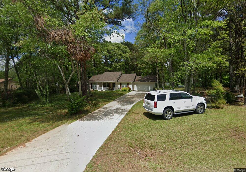
360 New Morn Dr McDonough, GA 30253
Estimated Value: $274,206 - $301,000
3
Beds
2
Baths
1,408
Sq Ft
$204/Sq Ft
Est. Value
About This Home
This home is located at 360 New Morn Dr, McDonough, GA 30253 and is currently estimated at $287,302, approximately $204 per square foot. 360 New Morn Dr is a home located in Henry County with nearby schools including Mount Carmel Elementary School, Hampton Middle School, and Hampton High School.
Ownership History
Date
Name
Owned For
Owner Type
Purchase Details
Closed on
Nov 21, 2001
Sold by
Seabolt Gerald R
Bought by
Seabolt Gerald R and Seabolt Tracy D
Current Estimated Value
Home Financials for this Owner
Home Financials are based on the most recent Mortgage that was taken out on this home.
Original Mortgage
$98,000
Outstanding Balance
$37,964
Interest Rate
6.6%
Mortgage Type
New Conventional
Estimated Equity
$249,338
Purchase Details
Closed on
Jun 24, 1999
Sold by
Seabolt Gerald R
Bought by
Seabolt Gerald R and Seabolt Tracy D
Home Financials for this Owner
Home Financials are based on the most recent Mortgage that was taken out on this home.
Original Mortgage
$94,050
Interest Rate
7.13%
Mortgage Type
New Conventional
Create a Home Valuation Report for This Property
The Home Valuation Report is an in-depth analysis detailing your home's value as well as a comparison with similar homes in the area
Home Values in the Area
Average Home Value in this Area
Purchase History
| Date | Buyer | Sale Price | Title Company |
|---|---|---|---|
| Seabolt Gerald R | -- | -- | |
| Seabolt Gerald R | -- | -- | |
| Seabolt Gerald R | $97,000 | -- |
Source: Public Records
Mortgage History
| Date | Status | Borrower | Loan Amount |
|---|---|---|---|
| Open | Seabolt Gerald R | $98,000 | |
| Previous Owner | Seabolt Gerald R | $94,050 |
Source: Public Records
Tax History Compared to Growth
Tax History
| Year | Tax Paid | Tax Assessment Tax Assessment Total Assessment is a certain percentage of the fair market value that is determined by local assessors to be the total taxable value of land and additions on the property. | Land | Improvement |
|---|---|---|---|---|
| 2025 | $2,933 | $109,760 | $15,600 | $94,160 |
| 2024 | $2,933 | $109,960 | $14,280 | $95,680 |
| 2023 | $2,308 | $100,160 | $13,760 | $86,400 |
| 2022 | $2,234 | $75,640 | $12,680 | $62,960 |
| 2021 | $1,936 | $63,040 | $10,880 | $52,160 |
| 2020 | $1,877 | $60,520 | $10,240 | $50,280 |
| 2019 | $1,773 | $56,120 | $9,720 | $46,400 |
| 2018 | $1,670 | $51,800 | $9,000 | $42,800 |
| 2016 | $1,248 | $38,560 | $6,680 | $31,880 |
| 2015 | $1,098 | $34,040 | $6,960 | $27,080 |
| 2014 | $979 | $30,840 | $6,960 | $23,880 |
Source: Public Records
Map
Nearby Homes
- 1719 Highway 81 W
- 1726 Highway 81 W
- 650 New Morn Dr
- 272 Stone Rd
- 490 Dorsey Rd
- 308 N Dorsey Rd
- 125 Bridget Dr
- 505 Stone Rd
- 276 Oakland Rd
- 112 Bridget Dr
- 151 Courts of Hampton
- 11532 Kimberly Way Unit LOT 35
- 11542 Kimberly Way Unit 40
- 11534 Kimberly Way Unit LOT 36
- 11538 Kimberly Way Unit LOT 38
- 1248 Burlington Ct
- 1580 Blair Rd
- 319 S Mount Carmel Rd
- 374 Williamsburg Cir
- 344 Williamsburg Cir Unit 1
- 350 New Morn Dr
- 370 New Morn Dr
- 340 New Morn Dr
- 415 New Morn Dr
- 400 New Morn Dr
- 419 New Morn Dr
- 1831 Highway 81 W
- 1861 Highway 81 W
- 1791 Highway 81 W
- 315 New Morn Dr
- 330 New Morn Dr
- 100 N Cleveland Church Rd
- 104 Andrea Ln
- 100 Andrea Ln
- 108 Andrea Ln
- 1930 Highway 81 W
- 52 N Cleveland Church Rd
- 112 Andrea Ln
- 1749 Highway 81 W
- 1729 Highway 81 W
