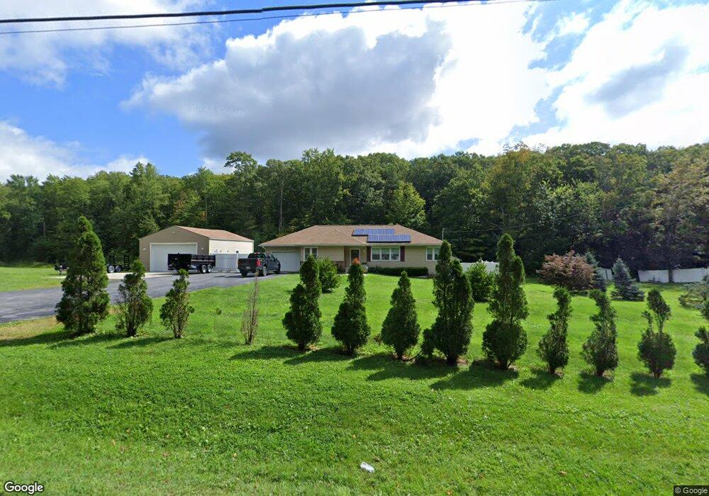
360 Route 32 Newburgh, NY 12550
Estimated Value: $316,000 - $402,000
2
Beds
1
Bath
1,084
Sq Ft
$331/Sq Ft
Est. Value
About This Home
This home is located at 360 Route 32, Newburgh, NY 12550 and is currently estimated at $359,218, approximately $331 per square foot. 360 Route 32 is a home located in Orange County with nearby schools including Newburgh Free Academy Main Campus and Bishop Dunn Memorial.
Ownership History
Date
Name
Owned For
Owner Type
Purchase Details
Closed on
Sep 20, 2005
Sold by
Callas Properties Inc
Bought by
Mcgrane Deborah
Current Estimated Value
Purchase Details
Closed on
Dec 1, 2004
Sold by
Callas David
Bought by
Callas Properties Inc
Purchase Details
Closed on
Jun 5, 2002
Sold by
Monti Joseph V
Bought by
Callas Properties Inc
Home Financials for this Owner
Home Financials are based on the most recent Mortgage that was taken out on this home.
Original Mortgage
$81,000
Interest Rate
6%
Mortgage Type
Seller Take Back
Create a Home Valuation Report for This Property
The Home Valuation Report is an in-depth analysis detailing your home's value as well as a comparison with similar homes in the area
Home Values in the Area
Average Home Value in this Area
Purchase History
| Date | Buyer | Sale Price | Title Company |
|---|---|---|---|
| Mcgrane Deborah | $252,500 | John J Fallon | |
| Callas Properties Inc | -- | Joseph Saffioti | |
| Callas Properties Inc | $85,000 | -- |
Source: Public Records
Mortgage History
| Date | Status | Borrower | Loan Amount |
|---|---|---|---|
| Previous Owner | Callas Properties Inc | $81,000 |
Source: Public Records
Tax History Compared to Growth
Tax History
| Year | Tax Paid | Tax Assessment Tax Assessment Total Assessment is a certain percentage of the fair market value that is determined by local assessors to be the total taxable value of land and additions on the property. | Land | Improvement |
|---|---|---|---|---|
| 2024 | $5,961 | $57,490 | $7,400 | $50,090 |
| 2023 | $5,961 | $57,490 | $7,400 | $50,090 |
| 2022 | $6,141 | $57,490 | $7,400 | $50,090 |
| 2021 | $6,173 | $57,490 | $7,400 | $50,090 |
| 2020 | $5,163 | $57,490 | $7,400 | $50,090 |
| 2019 | $1,598 | $52,100 | $7,400 | $44,700 |
| 2018 | $1,598 | $52,100 | $7,400 | $44,700 |
| 2017 | $4,765 | $52,100 | $7,400 | $44,700 |
| 2016 | $4,674 | $52,100 | $7,400 | $44,700 |
| 2015 | -- | $52,100 | $7,400 | $44,700 |
| 2014 | -- | $52,100 | $7,400 | $44,700 |
Source: Public Records
Map
Nearby Homes
- 16 Sarvis Ln
- 0 Route 32 Unit KEYH6299279
- 126 Foxwood Dr S
- 2 Gerri Ct
- 12 Hinchcliffe Dr
- 421 Fostertown Rd
- 548 Fostertown Rd
- 19 Eagle Height Place
- 0 Canterbury Dr Unit KEY872516
- 12 Chapel Rd
- 1 Sky View Ct
- 9 Sky View Ct
- 9 Chapel Rd
- 1297 Union Ave
- 224 Hickory Hill Ln
- 531 Park Ave
- 20 Chadsford Ln
- 505 Circle Ln
- 43 Brandywine Crossing
- 501 Circle Ln
