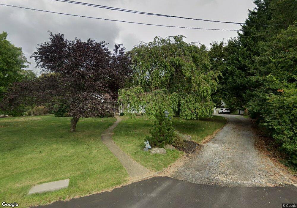
360 Rutledge Dr Red Bank, NJ 07701
New Monmouth NeighborhoodEstimated Value: $800,109 - $905,000
3
Beds
3
Baths
1,952
Sq Ft
$434/Sq Ft
Est. Value
About This Home
This home is located at 360 Rutledge Dr, Red Bank, NJ 07701 and is currently estimated at $847,277, approximately $434 per square foot. 360 Rutledge Dr is a home located in Monmouth County with nearby schools including Middletown Village Elementary School, Thompson Middle School, and Middletown High School North.
Ownership History
Date
Name
Owned For
Owner Type
Purchase Details
Closed on
Aug 15, 2013
Sold by
Duryea Ane Marie Kis and Kis Bradley John
Bought by
Bisgrove Dean W
Current Estimated Value
Home Financials for this Owner
Home Financials are based on the most recent Mortgage that was taken out on this home.
Original Mortgage
$240,000
Outstanding Balance
$178,551
Interest Rate
4.4%
Mortgage Type
New Conventional
Estimated Equity
$668,726
Create a Home Valuation Report for This Property
The Home Valuation Report is an in-depth analysis detailing your home's value as well as a comparison with similar homes in the area
Home Values in the Area
Average Home Value in this Area
Purchase History
| Date | Buyer | Sale Price | Title Company |
|---|---|---|---|
| Bisgrove Dean W | $440,000 | None Available |
Source: Public Records
Mortgage History
| Date | Status | Borrower | Loan Amount |
|---|---|---|---|
| Open | Bisgrove Dean W | $240,000 |
Source: Public Records
Tax History Compared to Growth
Tax History
| Year | Tax Paid | Tax Assessment Tax Assessment Total Assessment is a certain percentage of the fair market value that is determined by local assessors to be the total taxable value of land and additions on the property. | Land | Improvement |
|---|---|---|---|---|
| 2025 | $10,962 | $718,400 | $489,800 | $228,600 |
| 2024 | $10,049 | $666,400 | $402,600 | $263,800 |
| 2023 | $10,049 | $578,200 | $371,600 | $206,600 |
| 2022 | $10,242 | $551,500 | $351,800 | $199,700 |
| 2021 | $10,242 | $492,400 | $314,800 | $177,600 |
| 2020 | $10,130 | $473,800 | $314,800 | $159,000 |
| 2019 | $10,195 | $482,700 | $314,800 | $167,900 |
| 2018 | $9,457 | $436,400 | $295,500 | $140,900 |
| 2017 | $9,178 | $432,100 | $295,500 | $136,600 |
| 2016 | $9,242 | $433,700 | $286,500 | $147,200 |
| 2015 | $9,251 | $433,100 | $286,500 | $146,600 |
| 2014 | $8,220 | $375,500 | $241,500 | $134,000 |
Source: Public Records
Map
Nearby Homes
- 0 Hamiltonian Dr Unit 22514980
- 202 Hamiltonian Dr
- 20 Devon Rd
- 8 Heights Terrace
- 3504 James Ct Unit 159
- 238 Martin Place
- 93 Twin Brooks Ave
- 68 Iler Dr
- 508 Abby Rd Unit 508
- 164 Heights Terrace
- 26 Crest Rd
- 78 Crestview Dr
- 1 Waller Dr
- 31 Southall Ln
- 35 Fairview Dr
- 11 Mayflower Dr
- 10 Waller Dr
- 7 Meehan Ct
- 6 Waller Dr
- 64 Augustus Dr
- 352 Rutledge Dr
- 370 Rutledge Dr
- 344 Rutledge Dr
- 79 Apple Farm Rd
- 87 Apple Farm Rd
- 71 Apple Farm Rd
- 831 Monmouth Ct
- 823 Monmouth Ct
- 28 Corn Ln
- 336 Rutledge Dr
- 815 Monmouth Ct
- 29 Corn Ln
- 328 Rutledge Dr
- 18 Ataboy Ct
- 26 Ataboy Ct
- 12 Ataboy Ct
- 329 Rutledge Dr
- 80 Apple Farm Rd
- 88 Apple Farm Rd
- 72 Apple Farm Rd