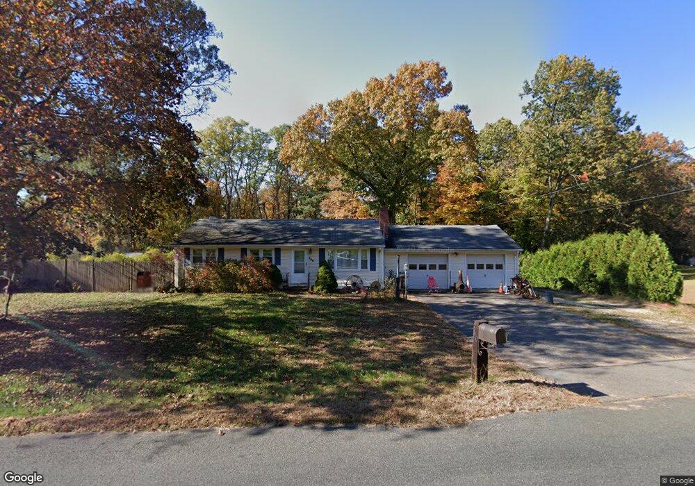
360 Rye St Broad Brook, CT 06016
Estimated Value: $289,000 - $368,201
3
Beds
1
Bath
960
Sq Ft
$336/Sq Ft
Est. Value
About This Home
This home is located at 360 Rye St, Broad Brook, CT 06016 and is currently estimated at $322,550, approximately $335 per square foot. 360 Rye St is a home located in Hartford County with nearby schools including Broad Brook Elementary School, East Windsor Middle School, and East Windsor High School.
Ownership History
Date
Name
Owned For
Owner Type
Purchase Details
Closed on
Jun 17, 2009
Sold by
Est Paleski Lois and Yost Peggy
Bought by
Moonen Timothy
Current Estimated Value
Home Financials for this Owner
Home Financials are based on the most recent Mortgage that was taken out on this home.
Original Mortgage
$170,848
Outstanding Balance
$108,757
Interest Rate
4.91%
Estimated Equity
$213,793
Purchase Details
Closed on
Nov 23, 1993
Sold by
Kuktis Anna and Gledrich Dorothy
Bought by
Paleski Lois
Home Financials for this Owner
Home Financials are based on the most recent Mortgage that was taken out on this home.
Original Mortgage
$27,500
Interest Rate
6.77%
Mortgage Type
Unknown
Create a Home Valuation Report for This Property
The Home Valuation Report is an in-depth analysis detailing your home's value as well as a comparison with similar homes in the area
Home Values in the Area
Average Home Value in this Area
Purchase History
| Date | Buyer | Sale Price | Title Company |
|---|---|---|---|
| Moonen Timothy | $174,000 | -- | |
| Paleski Lois | $105,000 | -- |
Source: Public Records
Mortgage History
| Date | Status | Borrower | Loan Amount |
|---|---|---|---|
| Open | Paleski Lois | $170,848 | |
| Previous Owner | Paleski Lois | $27,500 |
Source: Public Records
Map
Nearby Homes
- 534 Rye St
- 192 Scantic Meadow Rd
- 43 W River Rd
- 23 Cathy (Lot 21) Ln
- 21 Ln
- 19 Cathy (Lot 19) Ln
- 29 W River Rd
- 26 Cathy (Lot 13) Ln
- 22 Cathy (Lot 15) Ln
- 17 Cathy (Lot 18) Ln
- 24 Cathy (Lot 14) Ln
- 555 Graham Rd
- 20 Cathy (Lot 16) Ln
- 18 Cathy (Lot 17) Ln
- 814 Graham Rd
- 27 W River Rd
- 34 W River Rd
- 668 Sullivan Ave
- 79 Steep Rd
- 0 Ellsworth Rd
Your Personal Tour Guide
Ask me questions while you tour the home.