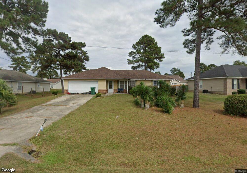
360 Slash Cir Midway, FL 32343
Estimated Value: $220,000 - $264,000
3
Beds
2
Baths
1,206
Sq Ft
$197/Sq Ft
Est. Value
About This Home
This home is located at 360 Slash Cir, Midway, FL 32343 and is currently estimated at $237,276, approximately $196 per square foot. 360 Slash Cir is a home located in Gadsden County.
Ownership History
Date
Name
Owned For
Owner Type
Purchase Details
Closed on
Feb 29, 2012
Sold by
Reed Amos A and Reed Ruby G
Bought by
Reed Amos A
Current Estimated Value
Purchase Details
Closed on
Sep 29, 2006
Sold by
Keystone Homes & Designs Inc
Bought by
Reed Amos and Reed Ruby
Home Financials for this Owner
Home Financials are based on the most recent Mortgage that was taken out on this home.
Original Mortgage
$129,400
Interest Rate
7.7%
Mortgage Type
Stand Alone First
Create a Home Valuation Report for This Property
The Home Valuation Report is an in-depth analysis detailing your home's value as well as a comparison with similar homes in the area
Home Values in the Area
Average Home Value in this Area
Purchase History
| Date | Buyer | Sale Price | Title Company |
|---|---|---|---|
| Reed Amos A | -- | None Available | |
| Reed Amos | $161,800 | North State Title |
Source: Public Records
Mortgage History
| Date | Status | Borrower | Loan Amount |
|---|---|---|---|
| Previous Owner | Reed Amos | $129,400 |
Source: Public Records
Tax History Compared to Growth
Tax History
| Year | Tax Paid | Tax Assessment Tax Assessment Total Assessment is a certain percentage of the fair market value that is determined by local assessors to be the total taxable value of land and additions on the property. | Land | Improvement |
|---|---|---|---|---|
| 2025 | $1,307 | $112,575 | -- | -- |
| 2024 | $1,258 | $109,403 | -- | -- |
| 2023 | $1,214 | $106,217 | $0 | $0 |
| 2022 | $1,159 | $103,124 | $0 | $0 |
| 2021 | $1,129 | $100,121 | $0 | $0 |
| 2020 | $1,101 | $98,739 | $0 | $0 |
| 2019 | $1,080 | $96,519 | $0 | $0 |
| 2018 | $1,074 | $94,719 | $0 | $0 |
| 2017 | $1,039 | $92,771 | $0 | $0 |
| 2016 | $1,016 | $90,863 | $0 | $0 |
| 2015 | $1,006 | $90,231 | $0 | $0 |
| 2014 | $979 | $89,515 | $0 | $0 |
Source: Public Records
Map
Nearby Homes
- 6 Slash Ln
- 65 Deloris Madison Dr
- 62 Frank Run
- 420 N Charles Willis Dr
- 50 Frank Run
- 7 Mae Cato Dr
- 49 Francis Harrell Way
- 17 Pine Bark Ln
- 25 Pine Bark Ln
- 315 Mae Cato Dr
- 407 Mae Cato Dr
- 668 M l King Blvd
- 137 Monroe Creek Dr
- 0 Central Rd Unit 381525
- 81 Knight Rd
- 8873 High Bridge Rd
- 8877 High Bridge Rd
- 274 Forest Cir S
- 69 Buckskin Cir
- 327 Hayward Dupont St