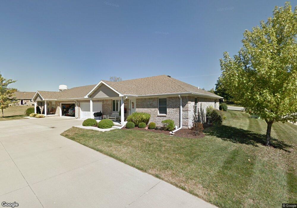
360 Southfork Dr Crawfordsville, IN 47933
Estimated Value: $196,844 - $212,000
2
Beds
2
Baths
1,288
Sq Ft
$159/Sq Ft
Est. Value
About This Home
This home is located at 360 Southfork Dr, Crawfordsville, IN 47933 and is currently estimated at $204,211, approximately $158 per square foot. 360 Southfork Dr is a home located in Montgomery County with nearby schools including Mollie B. Hoover Elementary School, Laura Hose Elementary School, and Meredith Nicholson Elementary School.
Ownership History
Date
Name
Owned For
Owner Type
Purchase Details
Closed on
Jul 13, 2022
Sold by
Black David W
Bought by
Bdl Asset Protection Trust and Black
Current Estimated Value
Purchase Details
Closed on
Jun 11, 2008
Sold by
Cox Martha
Bought by
Black David W
Purchase Details
Closed on
Dec 17, 2007
Sold by
White Katherine L
Bought by
Cox Martha
Create a Home Valuation Report for This Property
The Home Valuation Report is an in-depth analysis detailing your home's value as well as a comparison with similar homes in the area
Home Values in the Area
Average Home Value in this Area
Purchase History
| Date | Buyer | Sale Price | Title Company |
|---|---|---|---|
| Bdl Asset Protection Trust | -- | Moore Doris G Brauman | |
| Black David W | -- | None Available | |
| Cox Martha | -- | None Available |
Source: Public Records
Tax History Compared to Growth
Tax History
| Year | Tax Paid | Tax Assessment Tax Assessment Total Assessment is a certain percentage of the fair market value that is determined by local assessors to be the total taxable value of land and additions on the property. | Land | Improvement |
|---|---|---|---|---|
| 2024 | $2,148 | $176,600 | $19,800 | $156,800 |
| 2023 | $2,112 | $180,300 | $19,800 | $160,500 |
| 2022 | $2,017 | $164,100 | $19,800 | $144,300 |
| 2021 | $1,772 | $141,300 | $19,800 | $121,500 |
| 2020 | $1,709 | $136,300 | $19,800 | $116,500 |
| 2019 | $1,733 | $136,800 | $19,800 | $117,000 |
| 2018 | $1,367 | $127,000 | $16,200 | $110,800 |
| 2017 | $1,419 | $125,900 | $16,200 | $109,700 |
| 2016 | $680 | $121,400 | $16,200 | $105,200 |
| 2014 | $515 | $118,700 | $16,200 | $102,500 |
| 2013 | $515 | $115,700 | $16,200 | $99,500 |
Source: Public Records
Map
Nearby Homes
- 3 Sterling Ln
- 1 Sterling Ln
- 00 N Nucor Rd
- 00 E Co Rd 350 Rd S
- 00 E State Road 32
- 1603 John St
- 408 Hughes St
- 1503 Payton St
- 411 Vandalia Ct
- 917 S State Road 47
- 1404 Payton St
- 1121 Mill St
- 1107 Danville Ave
- 0 S Us 231 Unit MBR22024646
- Ironwood Plan at Hawkview
- Chestnut Plan at Hawkview
- Ashton Plan at Hawkview
- Cooper Plan at Hawkview
- Juniper Plan at Hawkview
- Norway Plan at Hawkview
- 360 S Fork Dr Unit 10
- 360 S Fork Dr
- 362 Southfork Dr
- 358 Southfork Dr
- 358 S Fork Dr
- 364 Southfork Dr
- 364 S Fork Dr Unit 364
- 366 Southfork Dr
- 366 Southfork Dr Unit 11
- 1415 Trophy Ct
- 1415 Trophy Ct
- 1480 Redwood Dr
- 1411 Redwood Dr
- 356 S Fork Dr
- 356 Southfork Dr
- 361 S Fork Dr
- 357 S Fork Dr
- 361 Southfork Dr
- 359 Southfork Dr
- 359 S Fork Dr