Estimated Value: $153,000 - $241,000
2
Beds
1
Bath
912
Sq Ft
$207/Sq Ft
Est. Value
About This Home
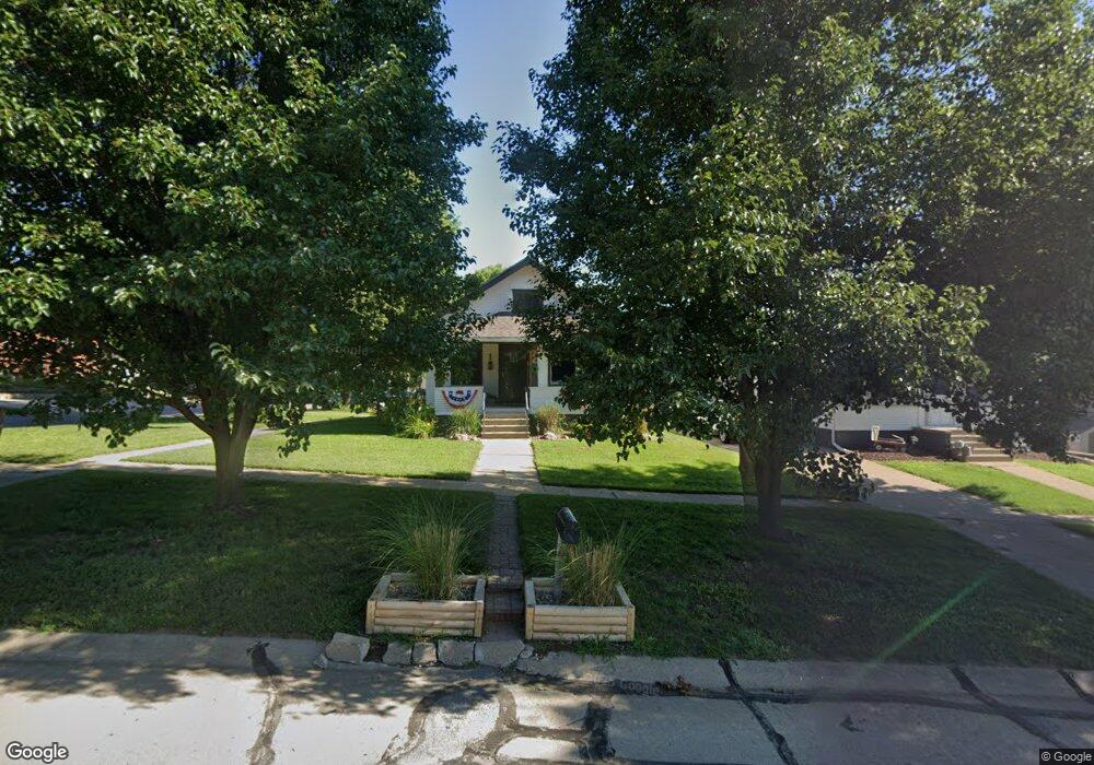
This home is located at 360 W 6th St, Wahoo, NE 68066 and is currently estimated at $188,349, approximately $206 per square foot. 360 W 6th St is a home located in Saunders County with nearby schools including Wahoo Elementary School, Wahoo Middle School, and Wahoo High School.
Ownership History
Date
Name
Owned For
Owner Type
Purchase Details
Closed on
Oct 21, 2018
Sold by
Malina Robert J and Malina Heather
Bought by
Aken Donald R
Current Estimated Value
Home Financials for this Owner
Home Financials are based on the most recent Mortgage that was taken out on this home.
Original Mortgage
$146,111
Outstanding Balance
$127,957
Interest Rate
4.7%
Mortgage Type
New Conventional
Estimated Equity
$60,392
Purchase Details
Closed on
Aug 13, 2007
Sold by
Malina Robert J and Malina Heather
Bought by
Malina Robert J and Malina Heather
Create a Home Valuation Report for This Property
The Home Valuation Report is an in-depth analysis detailing your home's value as well as a comparison with similar homes in the area
Home Values in the Area
Average Home Value in this Area
Purchase History
| Date | Buyer | Sale Price | Title Company |
|---|---|---|---|
| Aken Donald R | $145,000 | Nebraska Land Title & Abstra | |
| Malina Robert J | -- | -- |
Source: Public Records
Mortgage History
| Date | Status | Borrower | Loan Amount |
|---|---|---|---|
| Open | Aken Donald R | $146,111 |
Source: Public Records
Tax History Compared to Growth
Tax History
| Year | Tax Paid | Tax Assessment Tax Assessment Total Assessment is a certain percentage of the fair market value that is determined by local assessors to be the total taxable value of land and additions on the property. | Land | Improvement |
|---|---|---|---|---|
| 2024 | $1,603 | $118,098 | $16,186 | $101,912 |
| 2023 | $1,970 | $112,550 | $16,186 | $96,364 |
| 2022 | $1,906 | $101,629 | $16,186 | $85,443 |
| 2021 | $1,907 | $98,891 | $16,186 | $82,705 |
| 2020 | $1,867 | $96,198 | $16,186 | $80,012 |
| 2019 | $1,992 | $100,362 | $16,186 | $84,176 |
| 2018 | $1,558 | $75,180 | $16,190 | $58,990 |
| 2017 | $1,553 | $75,180 | $16,190 | $58,990 |
| 2016 | $1,603 | $75,490 | $16,190 | $59,300 |
| 2015 | $1,595 | $75,490 | $16,190 | $59,300 |
| 2014 | $1,623 | $75,490 | $16,190 | $59,300 |
| 2012 | $1,717 | $75,490 | $16,190 | $59,300 |
Source: Public Records
Map
Nearby Homes
- 453 W 7th St
- 453 W 4th St
- 565 W 10th St
- 878 W 8th St
- 1039 N Laurel St
- 720 W 10th St
- 649 W 2nd St
- 758 W Park Cir
- 122 E 10th St
- 327 E 7th St
- 1365 N Chestnut St
- 243 S Linden St
- 820 W 15th St
- 651 W 16th St
- 1530 Highway 77 Unit 4.55 Ac.
- 1561 N Linden St
- 428 E 14th St
- 1273 Spruce St
- 1672 N Linden St
- 1283 Spruce St
- 350 W 6th St
- 338 W 6th St
- 611 N Walnut St
- 361 W 7th St
- 343 W 7th St
- 560 N Walnut St
- 323 W 7th St
- 430 W 6th St
- 659 N Walnut St
- 327 W 7th St
- 659 N Walnut St
- 0 W 7th Unit 10132684
- 0 W 7th Unit 21617412
- 536 N Walnut St
- 323 W 6th St
- 440 W 6th St
- 435 W 7th St Unit 437
- 657 N Chestnut St
- 460 W 6th St
- 445 W 6th St