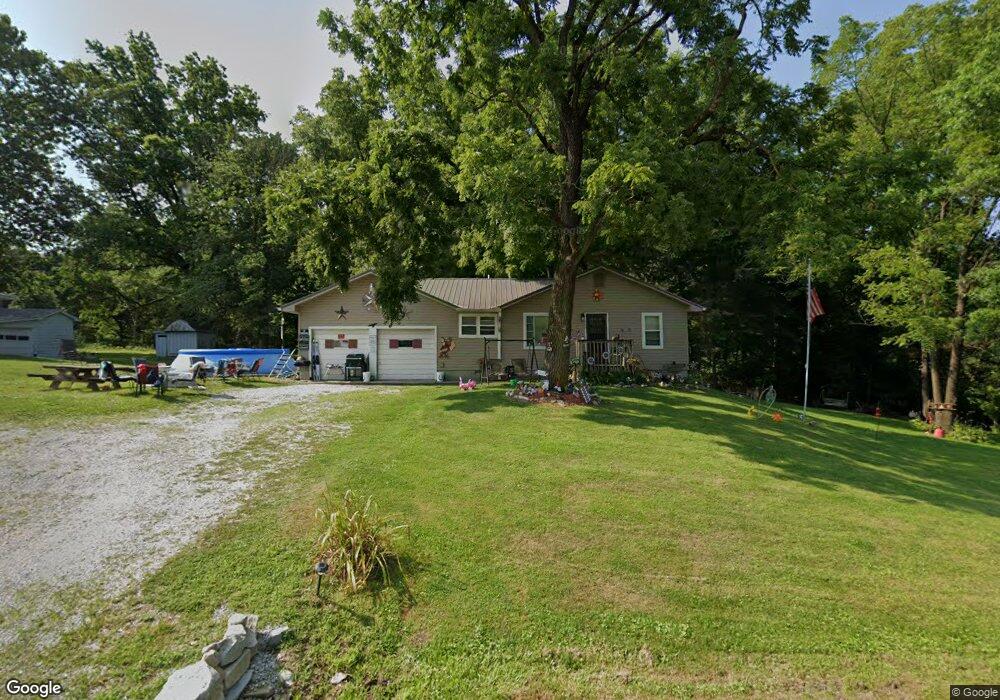
360 W Robert Weist Ave Cloverdale, IN 46120
Estimated Value: $142,865 - $181,000
3
Beds
1
Bath
864
Sq Ft
$190/Sq Ft
Est. Value
About This Home
This home is located at 360 W Robert Weist Ave, Cloverdale, IN 46120 and is currently estimated at $164,466, approximately $190 per square foot. 360 W Robert Weist Ave is a home located in Putnam County with nearby schools including Cloverdale Elementary School, Cloverdale Middle School, and Cloverdale High School.
Ownership History
Date
Name
Owned For
Owner Type
Purchase Details
Closed on
Nov 22, 2017
Sold by
Gottula Ii Norvin L and Gottula Brenda G
Bought by
Gottula Heather Clark
Current Estimated Value
Purchase Details
Closed on
Nov 30, 2005
Sold by
Skirvin Nathan D
Bought by
Gottula Ii Norvin L and Gottula Brenda G
Home Financials for this Owner
Home Financials are based on the most recent Mortgage that was taken out on this home.
Original Mortgage
$55,500
Interest Rate
6.17%
Mortgage Type
New Conventional
Create a Home Valuation Report for This Property
The Home Valuation Report is an in-depth analysis detailing your home's value as well as a comparison with similar homes in the area
Home Values in the Area
Average Home Value in this Area
Purchase History
| Date | Buyer | Sale Price | Title Company |
|---|---|---|---|
| Gottula Heather Clark | -- | -- | |
| Gottula Heather Clark | -- | -- | |
| Gottula Ii Norvin L | -- | None Available |
Source: Public Records
Mortgage History
| Date | Status | Borrower | Loan Amount |
|---|---|---|---|
| Previous Owner | Gottula Ii Norvin L | $55,500 |
Source: Public Records
Tax History Compared to Growth
Tax History
| Year | Tax Paid | Tax Assessment Tax Assessment Total Assessment is a certain percentage of the fair market value that is determined by local assessors to be the total taxable value of land and additions on the property. | Land | Improvement |
|---|---|---|---|---|
| 2024 | $1,514 | $78,000 | $30,700 | $47,300 |
| 2023 | $1,240 | $62,000 | $30,700 | $31,300 |
| 2022 | $1,226 | $61,300 | $30,700 | $30,600 |
| 2021 | $1,168 | $58,400 | $30,700 | $27,700 |
| 2020 | $1,168 | $58,400 | $30,700 | $27,700 |
| 2019 | $1,694 | $83,800 | $56,100 | $27,700 |
| 2018 | $1,727 | $85,400 | $56,100 | $29,300 |
| 2017 | $1,710 | $85,500 | $56,100 | $29,400 |
| 2016 | $1,710 | $85,500 | $56,100 | $29,400 |
| 2014 | $1,686 | $84,300 | $56,100 | $28,200 |
| 2013 | $1,686 | $85,900 | $56,100 | $29,800 |
Source: Public Records
Map
Nearby Homes
- 0 Us 231 Unit MBR21894331
- 0 Us 231 Unit 5677705
- 56 Lewis Dr
- 0 Lewis Dr
- 252 Hurst Ave
- 204 S Lafayette St
- 2442 E Co Rs 1050
- 10 Doe Creek Cir
- 3 U Dr
- 579 Love Ct
- 0 Stardust Way
- 425 Dream Way
- 384 Cooling Eveing Ct
- 396 Cool Evening Ct
- 90 Small Fry Ave
- 84 Stardust Way
- 1841 E County Road 1000 S
- 94 Small Fry Ave
- 334 Small Fry Ave
- 61 Bubble Loo Rd
- 358 W Robert Weist Ave
- 0 E County Road 1000 S
- 356 W Robert Weist Ave
- 208 N West St
- 354 W Robert Weist Ave
- 2652 E County Road 1000 S
- 210 N West St
- 212 N West St
- 2610 E County Road 1000 S
- 206 N West St
- 204 N West St
- 202 N West St
- 300 Sewer Plant Rd
- 404 Lincoln Ave
- 152 W Robert Weist Ave
- 0 Lincoln Ave Unit 81609
- 0 Lincoln Ave Unit 21112888
- 0 Lincoln Ave Unit 21162655
- 0 Lincoln Ave Unit 21232320
- 0 Lincoln Ave Unit 21268793