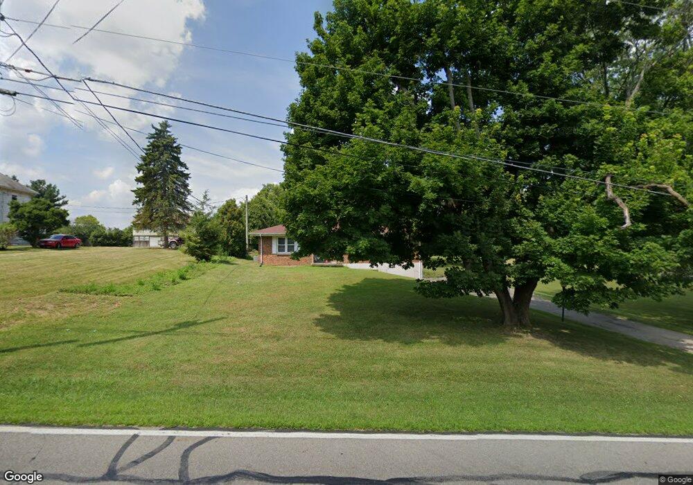
3601 Bosart Rd Springfield, OH 45503
Estimated Value: $239,000 - $262,000
3
Beds
2
Baths
1,338
Sq Ft
$185/Sq Ft
Est. Value
About This Home
This home is located at 3601 Bosart Rd, Springfield, OH 45503 and is currently estimated at $246,928, approximately $184 per square foot. 3601 Bosart Rd is a home located in Clark County with nearby schools including Rolling Hills Elementary School, Northridge Middle School, and Kenton Ridge Middle & High School.
Ownership History
Date
Name
Owned For
Owner Type
Purchase Details
Closed on
Sep 23, 2008
Sold by
Reflogle Elizabeth M and Reflogle Edward
Bought by
Dixon William B
Current Estimated Value
Home Financials for this Owner
Home Financials are based on the most recent Mortgage that was taken out on this home.
Original Mortgage
$99,200
Outstanding Balance
$65,982
Interest Rate
6.52%
Mortgage Type
Purchase Money Mortgage
Estimated Equity
$180,946
Purchase Details
Closed on
Sep 9, 2008
Sold by
Lightle Barbara A and Lightle James A
Bought by
Dixon William B
Home Financials for this Owner
Home Financials are based on the most recent Mortgage that was taken out on this home.
Original Mortgage
$99,200
Outstanding Balance
$65,982
Interest Rate
6.52%
Mortgage Type
Purchase Money Mortgage
Estimated Equity
$180,946
Create a Home Valuation Report for This Property
The Home Valuation Report is an in-depth analysis detailing your home's value as well as a comparison with similar homes in the area
Home Values in the Area
Average Home Value in this Area
Purchase History
| Date | Buyer | Sale Price | Title Company |
|---|---|---|---|
| Dixon William B | $62,000 | Ohio Real Estate Title | |
| Dixon William B | $62,000 | Ohio Real Estate Title |
Source: Public Records
Mortgage History
| Date | Status | Borrower | Loan Amount |
|---|---|---|---|
| Open | Dixon William B | $99,200 |
Source: Public Records
Tax History Compared to Growth
Tax History
| Year | Tax Paid | Tax Assessment Tax Assessment Total Assessment is a certain percentage of the fair market value that is determined by local assessors to be the total taxable value of land and additions on the property. | Land | Improvement |
|---|---|---|---|---|
| 2024 | $2,364 | $54,660 | $14,040 | $40,620 |
| 2023 | $2,364 | $54,660 | $14,040 | $40,620 |
| 2022 | $2,372 | $54,660 | $14,040 | $40,620 |
| 2021 | $2,295 | $44,800 | $11,510 | $33,290 |
| 2020 | $2,297 | $44,800 | $11,510 | $33,290 |
| 2019 | $2,341 | $44,800 | $11,510 | $33,290 |
| 2018 | $2,102 | $38,590 | $10,660 | $27,930 |
| 2017 | $1,809 | $38,592 | $10,658 | $27,934 |
| 2016 | $1,797 | $38,592 | $10,658 | $27,934 |
| 2015 | $1,742 | $36,030 | $10,658 | $25,372 |
| 2014 | $1,741 | $36,030 | $10,658 | $25,372 |
| 2013 | $1,702 | $36,030 | $10,658 | $25,372 |
Source: Public Records
Map
Nearby Homes
- 3452 Bosart Rd
- 3963 Covington Dr Unit 3963
- 3500 Oakmont Ct
- 3112 Country Side Ct Unit 3112
- 2939 Mechanicsburg Rd
- 1781 Pinehurst Dr
- 1922 Wedgewood Cir
- 1920 Wedgewood Cir
- 1507 Kingsgate Rd
- 1505 Kingsgate Rd
- 4249 Reno Rd
- 1503 Kingsgate Rd
- 1501 Kingsgate Rd
- 3316 Sudbury St
- 4050 Tacoma St
- 1509 Kingsgate Rd
- 3541 Bosart Rd
- 3619 Bosart Rd
- 3542 Bosart Rd
- 3610 Bosart Rd
- 3627 Bosart Rd
- 3624 Bosart Rd
- 3522 Bosart Rd
- 3637 Bosart Rd
- 3634 Bosart Rd
- 3509 Bosart Rd
- 3701 Bosart Rd
- 3510 Bosart Rd
- 3700 Bosart Rd
- 3523 Mechanicsburg Rd
- 3545 Mechanicsburg Rd
- 3501 Mechanicsburg Rd
- 3725 Bosart Rd
- 3740 Bosart Rd
- 3449 Bosart Rd
- 3440 Bosart Rd