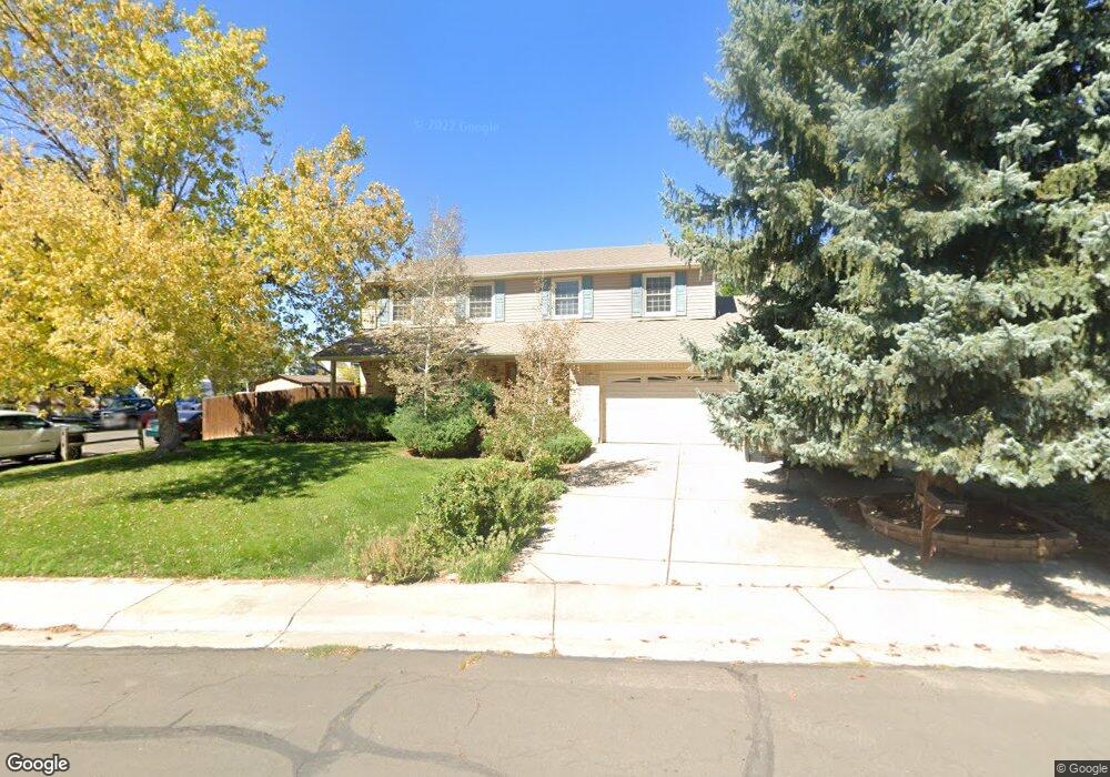
3601 E 133rd Cir Thornton, CO 80241
Estimated Value: $521,007 - $618,000
4
Beds
3
Baths
2,206
Sq Ft
$250/Sq Ft
Est. Value
About This Home
This home is located at 3601 E 133rd Cir, Thornton, CO 80241 and is currently estimated at $551,752, approximately $250 per square foot. 3601 E 133rd Cir is a home located in Adams County with nearby schools including Tarver Elementary School, Century Middle School, and Horizon High School.
Ownership History
Date
Name
Owned For
Owner Type
Purchase Details
Closed on
Jun 9, 1995
Sold by
Richen Ellen and Richen Michael J
Bought by
Johnson David W and Johnson Kerrie A
Current Estimated Value
Home Financials for this Owner
Home Financials are based on the most recent Mortgage that was taken out on this home.
Original Mortgage
$121,200
Interest Rate
8.17%
Purchase Details
Closed on
Jan 13, 1995
Sold by
Sbs Development Ltd Liability Company
Bought by
Meridian Homes Ltd Liability Company
Home Financials for this Owner
Home Financials are based on the most recent Mortgage that was taken out on this home.
Original Mortgage
$141,088
Interest Rate
9.2%
Create a Home Valuation Report for This Property
The Home Valuation Report is an in-depth analysis detailing your home's value as well as a comparison with similar homes in the area
Purchase History
| Date | Buyer | Sale Price | Title Company |
|---|---|---|---|
| Johnson David W | $151,550 | -- | |
| Meridian Homes Ltd Liability Company | $14,426 | Land Title |
Source: Public Records
Mortgage History
| Date | Status | Borrower | Loan Amount |
|---|---|---|---|
| Closed | Johnson David W | $121,200 | |
| Previous Owner | Meridian Homes Ltd Liability Company | $141,088 |
Source: Public Records
Tax History
| Year | Tax Paid | Tax Assessment Tax Assessment Total Assessment is a certain percentage of the fair market value that is determined by local assessors to be the total taxable value of land and additions on the property. | Land | Improvement |
|---|---|---|---|---|
| 2025 | $2,772 | $34,820 | $7,480 | $27,340 |
| 2024 | $2,772 | $32,010 | $6,880 | $25,130 |
| 2023 | $2,745 | $37,270 | $6,900 | $30,370 |
| 2022 | $2,934 | $26,630 | $7,090 | $19,540 |
| 2021 | $3,032 | $26,630 | $7,090 | $19,540 |
| 2020 | $2,900 | $25,990 | $7,290 | $18,700 |
| 2019 | $2,905 | $25,990 | $7,290 | $18,700 |
| 2018 | $2,734 | $23,760 | $7,200 | $16,560 |
| 2017 | $2,486 | $23,760 | $7,200 | $16,560 |
| 2016 | $2,130 | $19,820 | $4,140 | $15,680 |
| 2015 | $2,127 | $19,820 | $4,140 | $15,680 |
| 2014 | $1,914 | $17,340 | $3,340 | $14,000 |
Source: Public Records
Map
Nearby Homes
- 3867 E 133rd Ct
- 13064 Garfield Dr
- 13068 Harrison Dr
- 13064 Harrison Dr
- 2973 E 133rd Ln
- 13055 Harrison Dr
- 13488 Monroe St
- 4087 E 133rd Cir
- 13406 Clayton St
- 13004 Harrison Dr
- 2615 Signal Creek Dr
- 3670 E 128th Place
- 2746 E 132nd Place
- 13604 Garfield St Unit E
- 13222 Clermont Cir
- 13212 Clermont Cir
- 12804 Harrison St
- 12829 Cook Dr
- 13608 Garfield St Unit D
- 0 Colorado Blvd
- 3611 E 133rd Cir
- 13322 Monroe Way
- 13305 Monroe Way
- 3620 E 133rd Cir
- 3612 E 133rd Ct
- 3621 E 133rd Cir
- 13295 Monroe Way
- 3602 E 133rd Ct
- 3622 E 133rd Ct
- 13327 Monroe Way
- 13323 Monroe Way
- 3630 E 133rd Cir
- 13287 Monroe Way
- 3632 E 133rd Ct
- 13345 Monroe Way
- 3631 E 133rd Cir
- 13355 Monroe Way
- 13283 Monroe Way
- 13315 Monroe Way
- 13220 Garfield Dr
Your Personal Tour Guide
Ask me questions while you tour the home.