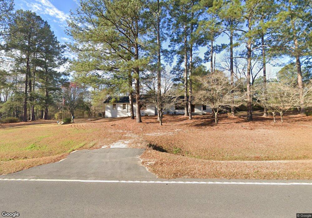
3601 Ga Highway 15 S Wrightsville, GA 31096
Estimated Value: $108,120 - $165,000
--
Bed
--
Bath
1,674
Sq Ft
$81/Sq Ft
Est. Value
About This Home
This home is located at 3601 Ga Highway 15 S, Wrightsville, GA 31096 and is currently estimated at $135,530, approximately $80 per square foot. 3601 Ga Highway 15 S is a home with nearby schools including Johnson County Elementary School, Johnson County Middle School, and Johnson County High School.
Ownership History
Date
Name
Owned For
Owner Type
Purchase Details
Closed on
Jul 24, 2019
Sold by
Parmer Betty Ann C
Bought by
Bullington Trina P
Current Estimated Value
Purchase Details
Closed on
Mar 20, 2017
Sold by
Carroll Myrell F
Bought by
Parmer Ann C
Purchase Details
Closed on
Dec 13, 2015
Sold by
Carroll Myrell F
Bought by
Daniels Robert Edwin and Daniels Carolyn C
Purchase Details
Closed on
Sep 26, 2005
Sold by
Foskey Gladys C
Bought by
Carroll Myrrell F
Purchase Details
Closed on
Sep 25, 1978
Sold by
Carroll B F Estate
Bought by
Carroll Myrell F
Create a Home Valuation Report for This Property
The Home Valuation Report is an in-depth analysis detailing your home's value as well as a comparison with similar homes in the area
Home Values in the Area
Average Home Value in this Area
Purchase History
| Date | Buyer | Sale Price | Title Company |
|---|---|---|---|
| Bullington Trina P | -- | -- | |
| Parmer Betty Ann C | -- | -- | |
| Parmer Ann C | -- | -- | |
| Daniels Robert Edwin | -- | -- | |
| Daniels Robert Edwin | -- | -- | |
| Palmer Ann C | -- | -- | |
| Carroll Myrrell F | -- | -- | |
| Carroll Myrell F | -- | -- |
Source: Public Records
Tax History Compared to Growth
Tax History
| Year | Tax Paid | Tax Assessment Tax Assessment Total Assessment is a certain percentage of the fair market value that is determined by local assessors to be the total taxable value of land and additions on the property. | Land | Improvement |
|---|---|---|---|---|
| 2024 | $1,005 | $34,222 | $1,462 | $32,760 |
| 2023 | $924 | $34,222 | $1,462 | $32,760 |
| 2022 | $881 | $32,702 | $1,462 | $31,240 |
| 2021 | $784 | $26,722 | $1,462 | $25,260 |
| 2020 | $818 | $26,722 | $1,462 | $25,260 |
| 2019 | $619 | $26,622 | $1,462 | $25,160 |
| 2018 | $795 | $27,094 | $1,462 | $25,632 |
| 2017 | $126 | $10,447 | $2,183 | $8,264 |
| 2016 | $303 | $10,323 | $2,183 | $8,140 |
| 2015 | -- | $79,031 | $41,952 | $37,079 |
| 2014 | -- | $76,721 | $41,952 | $34,770 |
| 2013 | -- | $76,721 | $41,951 | $34,769 |
Source: Public Records
Map
Nearby Homes
- 84 J D Garnto Rd
- 0 Red Hill Cemetery Rd Unit 30103
- 0 Red Hill Cemetery Rd Unit 10564131
- 92 Paul Lord Rd
- 250 Archers Pond Smith Rd
- 0 Sardis Church Rd Unit 10601519
- 0 Walden Way Unit 10601502
- 154 Bobby Fortner Rd
- 499 Smith Chapel Rd
- 0 Trinity Church Rd
- 117 Lovett Scott Rd
- 2373 U S 80
- 467 Alton Stewart Rd
- 0 Alton Stewart Rd Unit 10628094
- Pendleton Rreek Rd
- 0 Pendleton Creek Rd Unit SA340356
- 00 Poplar Springs Church Rd
- 210 W College St
- 0 Poplar Springs Church Rd Unit 10557967
- 600 Alton Lawson Rd