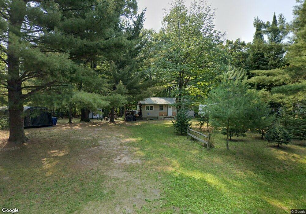
3601 Lansing Rd Roscommon, MI 48653
Estimated Value: $97,488 - $201,000
--
Bed
--
Bath
864
Sq Ft
$172/Sq Ft
Est. Value
About This Home
This home is located at 3601 Lansing Rd, Roscommon, MI 48653 and is currently estimated at $148,872, approximately $172 per square foot. 3601 Lansing Rd is a home with nearby schools including Collins Upper Elementary School, Collins Elementary School, and Houghton Lake High School.
Ownership History
Date
Name
Owned For
Owner Type
Purchase Details
Closed on
Jul 2, 2024
Sold by
Aul Diane L
Bought by
Aul Family Trust and Aul
Current Estimated Value
Purchase Details
Closed on
Dec 6, 2023
Sold by
Aul Diane L
Bought by
Aul Family Trust and Aul
Purchase Details
Closed on
Jun 10, 2008
Sold by
Densmore Sandra K and Estate Of Gerhardt L Oswald
Bought by
Brady Robert and Aul Diane
Home Financials for this Owner
Home Financials are based on the most recent Mortgage that was taken out on this home.
Original Mortgage
$44,000
Interest Rate
6.09%
Mortgage Type
New Conventional
Create a Home Valuation Report for This Property
The Home Valuation Report is an in-depth analysis detailing your home's value as well as a comparison with similar homes in the area
Home Values in the Area
Average Home Value in this Area
Purchase History
| Date | Buyer | Sale Price | Title Company |
|---|---|---|---|
| Aul Family Trust | -- | None Listed On Document | |
| Aul Family Trust | -- | None Listed On Document | |
| Brady Robert | $55,000 | None Available |
Source: Public Records
Mortgage History
| Date | Status | Borrower | Loan Amount |
|---|---|---|---|
| Previous Owner | Brady Robert | $44,000 |
Source: Public Records
Tax History Compared to Growth
Tax History
| Year | Tax Paid | Tax Assessment Tax Assessment Total Assessment is a certain percentage of the fair market value that is determined by local assessors to be the total taxable value of land and additions on the property. | Land | Improvement |
|---|---|---|---|---|
| 2025 | $1,186 | $45,100 | $0 | $0 |
| 2024 | $667 | $31,400 | $0 | $0 |
| 2023 | $636 | $31,400 | $0 | $0 |
| 2022 | $1,073 | $28,600 | $0 | $0 |
| 2021 | $1,007 | $25,900 | $0 | $0 |
| 2020 | $1,008 | $24,100 | $0 | $0 |
| 2019 | $989 | $21,600 | $0 | $0 |
| 2018 | $914 | $20,600 | $0 | $0 |
| 2016 | $858 | $18,000 | $0 | $0 |
| 2015 | -- | $18,300 | $0 | $0 |
| 2014 | -- | $17,700 | $0 | $0 |
| 2013 | -- | $25,600 | $0 | $0 |
Source: Public Records
Map
Nearby Homes
- 0 N Markey Rd
- 4075 N Markey Rd
- .57 Acres N Markey Rd
- 3396 W Lansing Rd
- 3396 Lansing Rd
- N1/2 Lot 1 N Markey Rd
- 302 Sheffield Dr
- 6789 E Houghton Lake Dr
- 6899 E Houghton Lake Dr
- 6783 E Houghton Lake Dr
- 6656 E Houghton Lake Dr
- 106 Kirkwood Dr
- 804 Ridgedale Dr
- Lot 10 Burgundy Way
- 7571 E Houghton Lake Dr
- 408 Kirkshire Ave
- 212 Glenhurst Dr
- 121 Caduca Dr
- Lots 55-56 E Houghton Lake Dr
- V/L N
- XXX Burning Oak Ct
- 3602 Lansing
- 3623 W Lansing Rd
- 100 Burning Oak Ct
- 3640 W Lansing Rd
- 3622 W Lansing Rd
- 000 Burning Oak
- 3622 Lansing Rd
- 3640 Lansing Rd
- 3665 Lansing Rd
- 3660 Lansing Rd
- 3602 W Lansing Rd
- 305 Great Oak Dr
- 3683 Lansing Rd
- 103 Burning Oak Ct
- 104 Crooked Oak Ct
- 3564 W Lansing Rd
- 108 Crooked Oak Ct
- 3564 Lansing Rd
- 3700 Lansing Rd