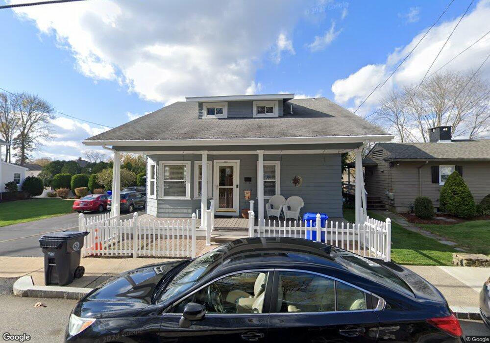
3601 Pawtucket Ave Riverside, RI 02915
Riverside NeighborhoodEstimated Value: $461,176 - $525,000
4
Beds
2
Baths
1,778
Sq Ft
$276/Sq Ft
Est. Value
About This Home
This home is located at 3601 Pawtucket Ave, Riverside, RI 02915 and is currently estimated at $491,044, approximately $276 per square foot. 3601 Pawtucket Ave is a home located in Providence County with nearby schools including East Providence High School, St Mary Academy-Bay View, and The Gordon School.
Ownership History
Date
Name
Owned For
Owner Type
Purchase Details
Closed on
Feb 16, 2022
Sold by
Motroni Frances A
Bought by
Frances A Motroni Ret and Motroni
Current Estimated Value
Purchase Details
Closed on
Nov 12, 1997
Sold by
Church Charles L and Church Dorothy
Bought by
Motroni Robert J and Motroni Frances
Create a Home Valuation Report for This Property
The Home Valuation Report is an in-depth analysis detailing your home's value as well as a comparison with similar homes in the area
Home Values in the Area
Average Home Value in this Area
Purchase History
| Date | Buyer | Sale Price | Title Company |
|---|---|---|---|
| Frances A Motroni Ret | -- | None Available | |
| Frances A Motroni Ret | -- | None Available | |
| Motroni Robert J | $108,000 | -- | |
| Motroni Robert J | $108,000 | -- |
Source: Public Records
Mortgage History
| Date | Status | Borrower | Loan Amount |
|---|---|---|---|
| Previous Owner | Motroni Robert J | $35,000 | |
| Previous Owner | Motroni Robert J | $158,000 |
Source: Public Records
Tax History Compared to Growth
Tax History
| Year | Tax Paid | Tax Assessment Tax Assessment Total Assessment is a certain percentage of the fair market value that is determined by local assessors to be the total taxable value of land and additions on the property. | Land | Improvement |
|---|---|---|---|---|
| 2025 | $5,353 | $409,600 | $90,600 | $319,000 |
| 2024 | $4,932 | $321,700 | $75,500 | $246,200 |
| 2023 | $4,748 | $321,700 | $75,500 | $246,200 |
| 2022 | $5,010 | $229,200 | $46,900 | $182,300 |
| 2021 | $4,928 | $229,200 | $45,500 | $183,700 |
| 2020 | $4,719 | $229,200 | $45,500 | $183,700 |
| 2019 | $4,589 | $229,200 | $45,500 | $183,700 |
| 2018 | $4,549 | $198,800 | $48,700 | $150,100 |
| 2017 | $4,447 | $198,800 | $48,700 | $150,100 |
| 2016 | $4,425 | $198,800 | $48,700 | $150,100 |
| 2015 | $4,321 | $188,300 | $47,600 | $140,700 |
| 2014 | $4,321 | $188,300 | $47,600 | $140,700 |
Source: Public Records
Map
Nearby Homes
- 1 Fales St
- 43 Bullocks Point Ave Unit 4C
- 25 Bullocks Point Ave Unit 5C
- 31 Bullocks Point Ave Unit 2A
- 151 Willett Ave Unit 2
- 151 Willett Ave Unit 5
- 6 Fuller Ave
- 81 Sprague Ave
- 25 Arnold St
- 3421 Pawtucket Ave
- 88 Lincoln Ave
- 57 Harris St
- 17 Oak Ave
- 33 Pine St Unit 35
- 1 Holly St
- 129 Cedar Ave
- 25 Read St
- 93 Narragansett Ave
- 87 Bluff St
- 536 Willett Ave
- 3605 Pawtucket Ave
- 3595 Pawtucket Ave
- 58 Bullocks Point Ave
- 3580 Pawtucket Ave
- 62 Bullocks Point Ave
- 3591 Pawtucket Ave
- 54 Bullocks Point Ave
- 3568 Pawtucket Ave
- 3609 Pawtucket Ave
- 3600 Pawtucket Ave
- 68 Bullocks Point Ave Unit 70
- 66 Bullocks Point Ave
- 50 Bullocks Point Ave
- 3615 Pawtucket Ave
- 37 Willett Ave
- 10 Burton Ave
- 74 Bullocks Point Ave
- 3553 3553 Pawtucket Ave
- 3553 Pawtucket Ave
- 3608 Pawtucket Ave