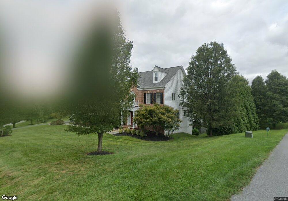
3603 Clear Drive Ct Glenwood, MD 21738
Estimated Value: $1,362,000 - $2,624,558
--
Bed
6
Baths
6,832
Sq Ft
$292/Sq Ft
Est. Value
About This Home
This home is located at 3603 Clear Drive Ct, Glenwood, MD 21738 and is currently estimated at $1,993,279, approximately $291 per square foot. 3603 Clear Drive Ct is a home located in Howard County with nearby schools including Bushy Park Elementary School, Glenwood Middle School, and Glenelg High School.
Ownership History
Date
Name
Owned For
Owner Type
Purchase Details
Closed on
Jan 3, 2017
Sold by
Van Vanjohn R and Van Gayle A
Bought by
State Hwy
Current Estimated Value
Purchase Details
Closed on
Sep 22, 2006
Sold by
Vanhorn John R
Bought by
Van Horn John R Trustee and Van Horn Gayle A Trustee
Purchase Details
Closed on
Aug 11, 2006
Sold by
Vanhorn John R
Bought by
Van Horn John R Trustee and Van Horn Gayle A Trustee
Purchase Details
Closed on
Mar 8, 2000
Sold by
Security Development Corporation
Bought by
Vanhorn John R and Vanhorn Van Horn
Purchase Details
Closed on
Dec 7, 1981
Sold by
Graddick Charles P and Graddick Wf
Bought by
Security Development Corporation
Home Financials for this Owner
Home Financials are based on the most recent Mortgage that was taken out on this home.
Original Mortgage
$300,000
Interest Rate
16.9%
Create a Home Valuation Report for This Property
The Home Valuation Report is an in-depth analysis detailing your home's value as well as a comparison with similar homes in the area
Home Values in the Area
Average Home Value in this Area
Purchase History
| Date | Buyer | Sale Price | Title Company |
|---|---|---|---|
| State Hwy | $6,000 | None Available | |
| Van Horn John R Trustee | -- | -- | |
| Van Horn John R Trustee | -- | -- | |
| Vanhorn John R | $372,500 | -- | |
| Security Development Corporation | $435,300 | -- |
Source: Public Records
Mortgage History
| Date | Status | Borrower | Loan Amount |
|---|---|---|---|
| Previous Owner | Security Development Corporation | $300,000 |
Source: Public Records
Tax History Compared to Growth
Tax History
| Year | Tax Paid | Tax Assessment Tax Assessment Total Assessment is a certain percentage of the fair market value that is determined by local assessors to be the total taxable value of land and additions on the property. | Land | Improvement |
|---|---|---|---|---|
| 2025 | $20,837 | $1,768,300 | $305,500 | $1,462,800 |
| 2024 | $20,837 | $1,626,733 | $0 | $0 |
| 2023 | $19,712 | $1,485,167 | $0 | $0 |
| 2022 | $18,692 | $1,343,600 | $190,300 | $1,153,300 |
| 2021 | $18,692 | $1,343,600 | $190,300 | $1,153,300 |
| 2020 | $18,692 | $1,343,600 | $190,300 | $1,153,300 |
| 2019 | $24,186 | $1,748,500 | $209,300 | $1,539,200 |
| 2018 | $22,915 | $1,732,367 | $0 | $0 |
| 2017 | $21,996 | $1,748,500 | $0 | $0 |
| 2016 | -- | $1,700,100 | $0 | $0 |
| 2015 | -- | $1,589,167 | $0 | $0 |
| 2014 | -- | $1,478,233 | $0 | $0 |
Source: Public Records
Map
Nearby Homes
- 2938 Maryland 97
- 2926 Maryland 97
- 15207 Callaway Ct
- 3595 Willow Birch Dr
- 15300 Doe Hill Ct
- 2934 Route 97
- 15309 Leondina Dr
- 3734 Sofia Ct
- 2935 Route 97
- 2925 Route 97
- 15474 Roxbury Rd
- 15740 Union Chapel Rd
- 16005 Fields End Ct
- 3574 Sharp Rd
- 3302 Sang Rd
- 15948 Union Chapel Rd
- 16020 Fields End Ct
- 14414 Dorsey Mill Rd
- 2638 Hobbs Rd
- Dorchester IV Plan at Cattail Chase Overlook
- 3516 Winding Path Ct
- 3520 Winding Path Ct
- 2925 Hunt Valley Dr
- 2921 Hunt Valley Dr
- 3521 Winding Path Ct
- 3508 Winding Path Ct
- 3517 Winding Path Ct
- 3504 Winding Path Ct
- 2933 Hunt Valley Dr
- 3605 Clear Drive Ct
- 3513 Winding Path Ct
- 3500 Winding Path Ct
- 2928 Hunt Valley Dr
- 2928 Hunt Valley Dr
- 3609 Clear Drive Ct
- 2916 Hunt Valley Dr
- 3613 Clear Drive Ct
- 3601 Clear Drive Ct
- 3509 Winding Path Ct
- 2937 Hunt Valley Dr