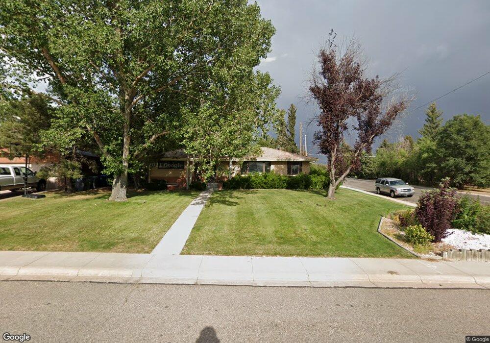
3603 Essex Rd Cheyenne, WY 82001
Estimated Value: $357,000 - $460,000
--
Bed
1
Bath
2,145
Sq Ft
$201/Sq Ft
Est. Value
About This Home
This home is located at 3603 Essex Rd, Cheyenne, WY 82001 and is currently estimated at $430,240, approximately $200 per square foot. 3603 Essex Rd is a home located in Laramie County with nearby schools including Henderson Elementary School, Carey Junior High School, and East High School.
Ownership History
Date
Name
Owned For
Owner Type
Purchase Details
Closed on
Jan 12, 2011
Sold by
Bacon Sue K and Bacon Philip C
Bought by
Korthals Thomas E and Korthals Tamera R
Current Estimated Value
Purchase Details
Closed on
Jan 4, 2011
Sold by
Korthals Thomas Eugene and Bacon Sue K
Bought by
Bacon Sue K and Korthals Thomas Eugene
Purchase Details
Closed on
Nov 29, 2006
Sold by
Korthals Wilbur Eugene
Bought by
Korthals Wilbur Eugene and Wilbur Eugene Korthals Revocable Trust
Create a Home Valuation Report for This Property
The Home Valuation Report is an in-depth analysis detailing your home's value as well as a comparison with similar homes in the area
Home Values in the Area
Average Home Value in this Area
Purchase History
| Date | Buyer | Sale Price | Title Company |
|---|---|---|---|
| Korthals Thomas E | -- | None Available | |
| Bacon Sue K | -- | None Available | |
| Korthals Wilbur Eugene | -- | None Available |
Source: Public Records
Tax History Compared to Growth
Tax History
| Year | Tax Paid | Tax Assessment Tax Assessment Total Assessment is a certain percentage of the fair market value that is determined by local assessors to be the total taxable value of land and additions on the property. | Land | Improvement |
|---|---|---|---|---|
| 2025 | $3,025 | $23,382 | $2,690 | $20,692 |
| 2024 | $3,025 | $45,784 | $5,379 | $40,405 |
| 2023 | $2,916 | $44,240 | $5,379 | $38,861 |
| 2022 | $2,791 | $41,671 | $5,379 | $36,292 |
| 2021 | $2,361 | $35,643 | $5,379 | $30,264 |
| 2020 | $2,487 | $37,476 | $5,379 | $32,097 |
| 2019 | $2,323 | $35,172 | $5,379 | $29,793 |
| 2018 | $2,055 | $31,727 | $4,936 | $26,791 |
| 2017 | $2,020 | $30,996 | $4,936 | $26,060 |
| 2016 | $1,889 | $29,166 | $4,649 | $24,517 |
| 2015 | $1,727 | $26,914 | $4,649 | $22,265 |
| 2014 | $1,622 | $25,317 | $4,649 | $20,668 |
Source: Public Records
Map
Nearby Homes
- 3444 Dover Rd
- 1958 Newton Dr
- 3700 Essex Rd
- 1801 Milton Dr
- 1813 Andover Dr
- 1813 Newton Dr
- 1751 E Pershing Blvd
- 1808 E 21st St
- 1731 E Pershing Blvd
- 1718 Newton Dr
- 1702 Newton Dr
- 3529 Concord Rd
- 1837 Crook Ave
- TBD E Lincolnway
- TBD Charles St
- Tract 1 E Pershing Blvd
- Lot 1 E Phipps Ave
- 3561 Boston Rd
- 1869 Cherry Ct
- 1610 E 20th St