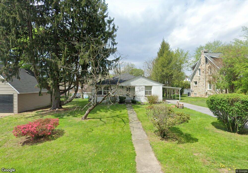
3604 Rusty Rock Rd Randallstown, MD 21133
Estimated Value: $239,000 - $324,503
3
Beds
2
Baths
2,178
Sq Ft
$127/Sq Ft
Est. Value
About This Home
This home is located at 3604 Rusty Rock Rd, Randallstown, MD 21133 and is currently estimated at $277,126, approximately $127 per square foot. 3604 Rusty Rock Rd is a home located in Baltimore County with nearby schools including Randallstown Elementary School, Deer Park Middle Magnet School, and Randallstown High School.
Ownership History
Date
Name
Owned For
Owner Type
Purchase Details
Closed on
Nov 25, 1997
Sold by
New Coast Properties Inc
Bought by
St Rose Selwyn
Current Estimated Value
Purchase Details
Closed on
Apr 29, 1997
Sold by
Hardy Edward F
Bought by
New Coast Properties Inc
Create a Home Valuation Report for This Property
The Home Valuation Report is an in-depth analysis detailing your home's value as well as a comparison with similar homes in the area
Home Values in the Area
Average Home Value in this Area
Purchase History
| Date | Buyer | Sale Price | Title Company |
|---|---|---|---|
| St Rose Selwyn | $89,900 | -- | |
| New Coast Properties Inc | $51,000 | -- |
Source: Public Records
Tax History Compared to Growth
Tax History
| Year | Tax Paid | Tax Assessment Tax Assessment Total Assessment is a certain percentage of the fair market value that is determined by local assessors to be the total taxable value of land and additions on the property. | Land | Improvement |
|---|---|---|---|---|
| 2025 | $3,520 | $217,600 | -- | -- |
| 2024 | $3,520 | $203,400 | $74,200 | $129,200 |
| 2023 | $1,673 | $195,633 | $0 | $0 |
| 2022 | $3,202 | $187,867 | $0 | $0 |
| 2021 | $3,104 | $180,100 | $56,200 | $123,900 |
| 2020 | $3,104 | $179,633 | $0 | $0 |
| 2019 | $2,944 | $179,167 | $0 | $0 |
| 2018 | $3,217 | $178,700 | $56,200 | $122,500 |
| 2017 | $3,088 | $166,400 | $0 | $0 |
| 2016 | $2,177 | $154,100 | $0 | $0 |
| 2015 | $2,177 | $141,800 | $0 | $0 |
| 2014 | $2,177 | $141,800 | $0 | $0 |
Source: Public Records
Map
Nearby Homes
- 8948 Harkate Way
- 3705 Allenswood Ct
- 3506 Bayer Ave
- 9012 Allenswood Rd
- 3418 Carroll Ave
- 8908 Meadow Heights Rd
- 3402 Offutt Rd
- 3332 Offutt Rd
- 3821 Brownhill Rd
- 5713 Old Court Rd
- 9044 Allenswood Rd
- 8513 Charlton Rd
- 8541 Lucerne Rd
- 3312 Lauri Rd
- 3320 Offutt Rd
- 3907 Roxanne Rd
- 8504 Fieldway Dr
- 0 Old Court Rd Parcel 631
- 9202 Samoset Rd
- 3805 Terka Cir
- 3606 Rusty Rock Rd
- 8814 Liberty Rd
- 8816 Liberty Rd
- 3608 Rusty Rock Rd
- 3603 Briarstone Rd
- 3605 Briarstone Rd
- 3607 Rusty Rock Rd
- 3601 Briarstone Rd
- 3610 Rusty Rock Rd
- 3607 Briarstone Rd
- 3609 Rusty Rock Rd
- 3601 Rusty Rock Rd
- 3612 Rusty Rock Rd
- 3609 Briarstone Rd
- 3604 Blair Ave
- 3602 Blair Ave
- 3606 Blair Ave
- 3614 Rusty Rock Rd
- 3613 Rusty Rock Rd
- 3600 Blair Ave