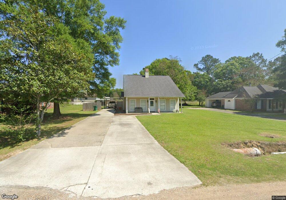
36064 Cheray Dr Denham Springs, LA 70706
Estimated Value: $198,000 - $273,000
4
Beds
2
Baths
1,777
Sq Ft
$136/Sq Ft
Est. Value
About This Home
This home is located at 36064 Cheray Dr, Denham Springs, LA 70706 and is currently estimated at $241,231, approximately $135 per square foot. 36064 Cheray Dr is a home located in Livingston Parish with nearby schools including Live Oak Elementary School, Live Oak Middle School, and Live Oak High School.
Ownership History
Date
Name
Owned For
Owner Type
Purchase Details
Closed on
Nov 19, 2007
Sold by
Desoto Keith P and Vandesoto Shontel Van
Bought by
Borne Jonathan P and Borne Mickey Young
Current Estimated Value
Home Financials for this Owner
Home Financials are based on the most recent Mortgage that was taken out on this home.
Original Mortgage
$160,900
Outstanding Balance
$102,065
Interest Rate
6.43%
Mortgage Type
New Conventional
Estimated Equity
$139,166
Create a Home Valuation Report for This Property
The Home Valuation Report is an in-depth analysis detailing your home's value as well as a comparison with similar homes in the area
Home Values in the Area
Average Home Value in this Area
Purchase History
| Date | Buyer | Sale Price | Title Company |
|---|---|---|---|
| Borne Jonathan P | $178,800 | Professional Title Of La Inc |
Source: Public Records
Mortgage History
| Date | Status | Borrower | Loan Amount |
|---|---|---|---|
| Open | Borne Jonathan P | $160,900 |
Source: Public Records
Tax History Compared to Growth
Tax History
| Year | Tax Paid | Tax Assessment Tax Assessment Total Assessment is a certain percentage of the fair market value that is determined by local assessors to be the total taxable value of land and additions on the property. | Land | Improvement |
|---|---|---|---|---|
| 2024 | $2,249 | $19,847 | $1,930 | $17,917 |
| 2023 | $1,895 | $14,540 | $1,930 | $12,610 |
| 2022 | $1,907 | $14,540 | $1,930 | $12,610 |
| 2021 | $1,694 | $14,540 | $1,930 | $12,610 |
| 2020 | $1,686 | $14,540 | $1,930 | $12,610 |
| 2019 | $1,509 | $12,580 | $1,930 | $10,650 |
| 2018 | $1,528 | $12,580 | $1,930 | $10,650 |
| 2017 | $1,495 | $12,050 | $1,930 | $10,120 |
| 2015 | $567 | $11,860 | $1,930 | $9,930 |
| 2014 | $575 | $11,860 | $1,930 | $9,930 |
Source: Public Records
Map
Nearby Homes
- 10345 Springfield Rd
- 11230 Springfield Rd
- 36491 Caraway Rd
- 36219 Fore Rd
- 10118 Saray Dr
- CC-2-A & B Herman Ernest Rd
- 14079 Oakwilde Dr
- 36991 Oak Haven Dr
- 9293 Springfield Rd
- 9788 Hunter Brook Ln
- 36035 Raleigh Dr
- 35983 Raleigh Dr
- 11858 Springfield Rd
- 36043 Portsmouth Dr
- 36108 Norfolk Ave
- TBD Uti Moore Rd
- 35336 Perkins Rd
- 34940 Clinton Allen Rd
- 7270 Riverbank Dr
- 36135 Reinninger Rd
- 36066 Cheray
- 36050 Cheray Dr
- 10716 Cheryll Dr
- 36034 Cheray Dr
- Lot 50C Springfield Rd
- 36120 Cheray Dr
- 10734 Cheryll Dr
- 36020 Cheray Dr
- 36053 Cheray Dr
- 36059 Cheray Dr
- 36045 Cheray Dr
- 36067 Cheray Dr
- 36037 Cheray Dr
- 10794 Cheryll Dr
- 36136 Cheray Dr
- 10748 Cheryll Dr
- 10748 Cheryll Dr
- 10715 Cheryll Dr
- 36073 Cheray Dr
- D4 Cheray Dr