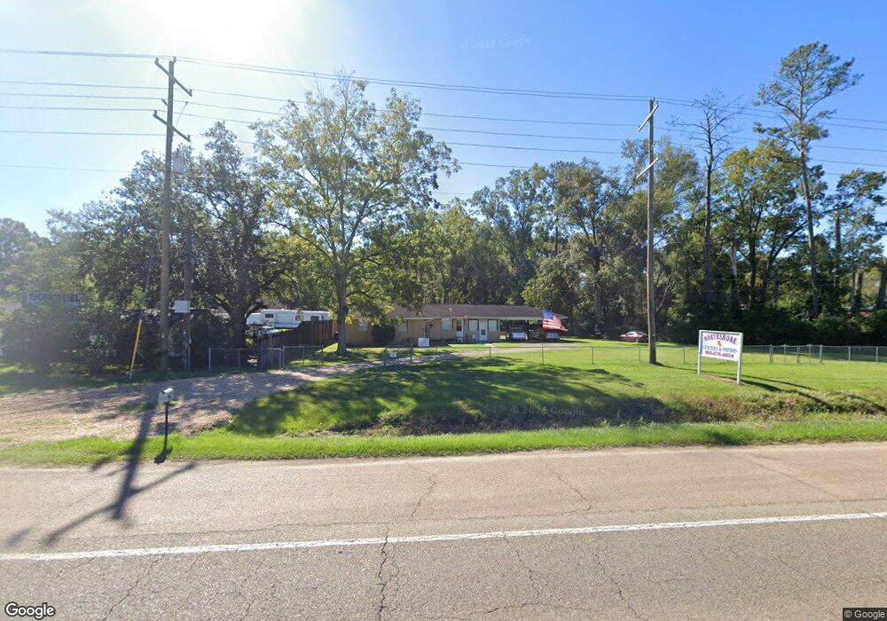
3607 W Hwy 190 None Hammond, LA 70403
Estimated Value: $154,390 - $287,000
--
Bed
--
Bath
2,314
Sq Ft
$88/Sq Ft
Est. Value
About This Home
This home is located at 3607 W Hwy 190 None, Hammond, LA 70403 and is currently estimated at $203,848, approximately $88 per square foot. 3607 W Hwy 190 None is a home located in Tangipahoa Parish with nearby schools including Woodland Park Magnet, Greenville Park Leadership Academy, and Uxbridge Middle School.
Ownership History
Date
Name
Owned For
Owner Type
Purchase Details
Closed on
Jan 23, 2019
Sold by
Nicolosi Phillip P
Bought by
Nicolosi Salvador A
Current Estimated Value
Home Financials for this Owner
Home Financials are based on the most recent Mortgage that was taken out on this home.
Original Mortgage
$86,500
Outstanding Balance
$76,051
Interest Rate
4.6%
Mortgage Type
New Conventional
Estimated Equity
$127,797
Create a Home Valuation Report for This Property
The Home Valuation Report is an in-depth analysis detailing your home's value as well as a comparison with similar homes in the area
Home Values in the Area
Average Home Value in this Area
Purchase History
| Date | Buyer | Sale Price | Title Company |
|---|---|---|---|
| Nicolosi Salvador A | $80,000 | -- |
Source: Public Records
Mortgage History
| Date | Status | Borrower | Loan Amount |
|---|---|---|---|
| Open | Nicolosi Salvador A | $86,500 |
Source: Public Records
Tax History Compared to Growth
Tax History
| Year | Tax Paid | Tax Assessment Tax Assessment Total Assessment is a certain percentage of the fair market value that is determined by local assessors to be the total taxable value of land and additions on the property. | Land | Improvement |
|---|---|---|---|---|
| 2024 | $730 | $8,819 | $1,296 | $7,523 |
| 2023 | $729 | $8,722 | $1,200 | $7,522 |
| 2022 | $729 | $8,722 | $1,200 | $7,522 |
| 2021 | $292 | $8,722 | $1,200 | $7,522 |
| 2020 | $912 | $8,722 | $1,200 | $7,522 |
| 2019 | $910 | $8,722 | $1,200 | $7,522 |
| 2018 | $395 | $3,776 | $1,200 | $2,576 |
| 2017 | $395 | $3,776 | $1,200 | $2,576 |
| 2016 | $395 | $3,776 | $1,200 | $2,576 |
| 2015 | $317 | $3,776 | $1,200 | $2,576 |
| 2014 | $301 | $3,776 | $1,200 | $2,576 |
Source: Public Records
Map
Nearby Homes
- 9.88 acres U S Highway 190
- 17458 Highway 190
- 2025 Highway 190
- 312 N Oak St
- 19419 Chelwood Ct
- 401 S Cypress St
- 1004 S Magnolia St
- 305 S Holly St
- 1103 S Pine St
- 500 E Church St
- 501 S Holly St
- 604 S Cherry St
- 412 E Michigan St
- 407 E Michigan St
- 600 E Hanson Ave
- 404 E Colorado St
- 703 Edwin Neill Way
- 301 S General Pershing St
- 44476 E Thomas St
- 1301 N Holly St
- 12673 U S Hwy 19 Hwy
- 500 Simpson Other
- 311 Second St
- 309 Second St
- 42090 Gardens St Unit A
- 109 W Minnesota Pkwy Unit 4-A
- 77 Ronald Reagan Hwy
- 4 U S Highway 190
- 101 W Thomas St
- 101 W Thomas St Unit A
- 108 N Cate St Unit 7
- 108 N Cate St Unit 3
- 107 W Thomas St Unit A
- 107 W Thomas St Unit B
- 107 W Thomas St Unit C
- 111 E Thomas St
- 111 W Thomas St
- 113 W Thomas St
- 111 W Charles St
- 116 W Thomas St