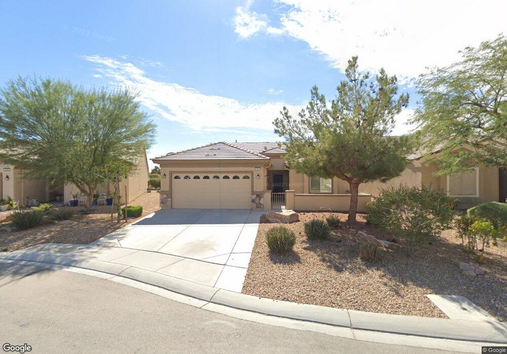
3609 Hammerkop Dr Unit 2 North Las Vegas, NV 89084
Aliante NeighborhoodEstimated Value: $387,772 - $425,000
2
Beds
2
Baths
1,570
Sq Ft
$260/Sq Ft
Est. Value
About This Home
This home is located at 3609 Hammerkop Dr Unit 2, North Las Vegas, NV 89084 and is currently estimated at $407,443, approximately $259 per square foot. 3609 Hammerkop Dr Unit 2 is a home located in Clark County with nearby schools including Vincent L. Triggs Elementary School, Anthony Saville Middle School, and Shadow Ridge High School.
Ownership History
Date
Name
Owned For
Owner Type
Purchase Details
Closed on
Feb 5, 2014
Sold by
Kovacs Charles J and Kovacs Ann L
Bought by
Kovacs Charles and Kovacs Revocabl L R
Current Estimated Value
Purchase Details
Closed on
Mar 21, 2003
Sold by
Pn Ii Inc
Bought by
Kovacs Charles J and Kovacs Ann L
Home Financials for this Owner
Home Financials are based on the most recent Mortgage that was taken out on this home.
Original Mortgage
$151,632
Outstanding Balance
$63,852
Interest Rate
5.6%
Estimated Equity
$343,591
Create a Home Valuation Report for This Property
The Home Valuation Report is an in-depth analysis detailing your home's value as well as a comparison with similar homes in the area
Home Values in the Area
Average Home Value in this Area
Purchase History
| Date | Buyer | Sale Price | Title Company |
|---|---|---|---|
| Kovacs Charles | -- | None Available | |
| Kovacs Charles J | $195,333 | Lawyers Title Of Nevada |
Source: Public Records
Mortgage History
| Date | Status | Borrower | Loan Amount |
|---|---|---|---|
| Open | Kovacs Charles J | $151,632 |
Source: Public Records
Tax History Compared to Growth
Tax History
| Year | Tax Paid | Tax Assessment Tax Assessment Total Assessment is a certain percentage of the fair market value that is determined by local assessors to be the total taxable value of land and additions on the property. | Land | Improvement |
|---|---|---|---|---|
| 2025 | $2,611 | $97,439 | $28,000 | $69,439 |
| 2024 | $2,419 | $97,439 | $28,000 | $69,439 |
| 2023 | $1,607 | $95,787 | $30,100 | $65,687 |
| 2022 | $2,240 | $85,838 | $25,900 | $59,938 |
| 2021 | $1,584 | $80,008 | $23,100 | $56,908 |
| 2020 | $1,919 | $78,604 | $22,400 | $56,204 |
| 2019 | $1,799 | $75,676 | $20,300 | $55,376 |
| 2018 | $1,716 | $69,394 | $16,100 | $53,294 |
| 2017 | $2,278 | $67,066 | $14,000 | $53,066 |
| 2016 | $1,607 | $65,445 | $12,250 | $53,195 |
| 2015 | $1,604 | $52,814 | $9,800 | $43,014 |
| 2014 | $1,553 | $44,116 | $7,000 | $37,116 |
Source: Public Records
Map
Nearby Homes
- 7839 Lyrebird Dr
- 7713 Lily Trotter St
- 7910 Kiskadee St
- 3807 Andorian Ave
- 3312 Lapwing Dr
- 3405 Kingbird Dr
- 3824 Lambent Ave
- 7927 Crested Starling Ct
- 3832 Andorian Ave
- 7633 Lily Trotter St
- 3516 Herring Gull Ln Unit 3
- 7616 Quail Dust St
- 3220 Flinthead Dr
- 7741 Fruit Dove St Unit 4
- 3705 Nesting Wren Dr
- 7908 Stone Forest St
- 3821 Nesting Wren Dr
- 3765 Helens Pouroff Ave
- 3124 Kookaburra Way
- 7921 Fantail Dr
- 3613 Hammerkop Dr
- 3605 Hammerkop Dr
- 3608 Harrier Ct
- 3608 Harrier Ct
- 7814 Lyrebird Dr
- 3604 Harrier Ct
- 3612 Harrier Ct Unit 2
- 3608 Hammerkop Dr
- 3608 Hammerkop Dr Unit n/a
- 3612 Hammerkop Dr Unit 2
- 7818 Lyrebird Dr Unit 2
- 3616 Hammerkop Dr Unit 2
- 7822 Lyrebird Dr
- 7809 Lily Trotter St
- 7805 Lily Trotter St
- 7813 Lily Trotter St
- 7835 Lyrebird Dr
- 7753 Lily Trotter St
- 7817 Lily Trotter St
- 7834 Lily Trotter St