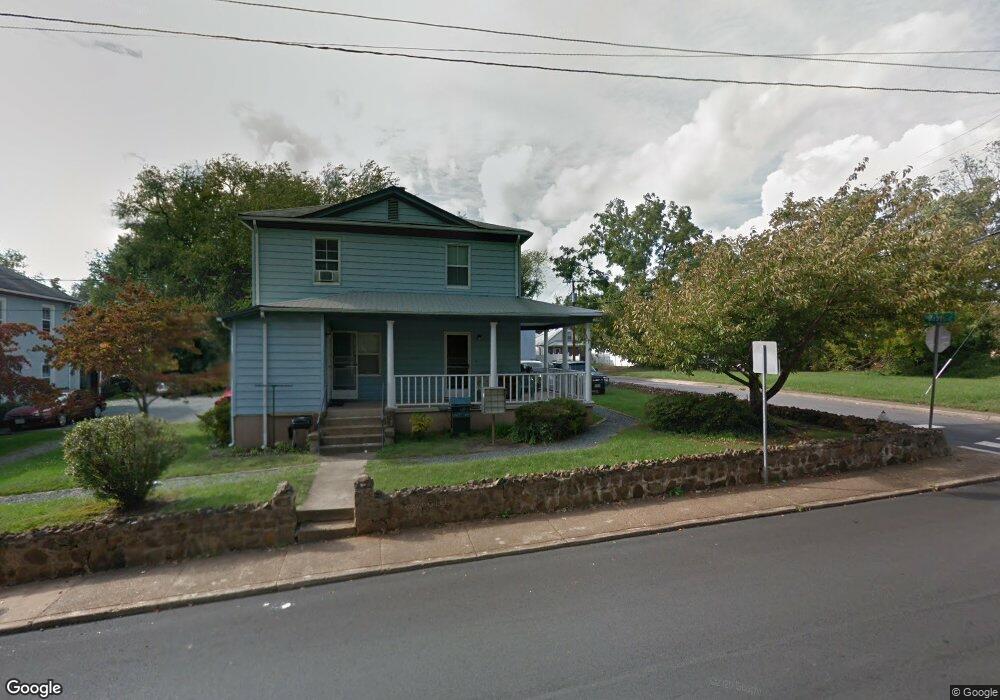
361 10th St NW Charlottesville, VA 22903
10th and Page NeighborhoodEstimated Value: $362,698 - $649,000
4
Beds
2
Baths
1,944
Sq Ft
$270/Sq Ft
Est. Value
About This Home
This home is located at 361 10th St NW, Charlottesville, VA 22903 and is currently estimated at $524,675, approximately $269 per square foot. 361 10th St NW is a home located in Charlottesville City with nearby schools including Trailblazer Elementary School, Buford Middle School, and Charlottesville High School.
Ownership History
Date
Name
Owned For
Owner Type
Purchase Details
Closed on
May 29, 2025
Sold by
Charlottesville Redevelopment And Housin
Bought by
City Of Charlottesville Virginia and Charlottesville Redevelopment And Housin
Current Estimated Value
Purchase Details
Closed on
Jun 29, 2023
Sold by
Dogwood Properties Of Charlottesville Ll
Bought by
Charlottesville Redevelopment And Housin
Home Financials for this Owner
Home Financials are based on the most recent Mortgage that was taken out on this home.
Original Mortgage
$5,000,000
Interest Rate
6.79%
Mortgage Type
Purchase Money Mortgage
Purchase Details
Closed on
Nov 1, 2007
Bought by
Dogwood Properties Of C'Ville Llc
Create a Home Valuation Report for This Property
The Home Valuation Report is an in-depth analysis detailing your home's value as well as a comparison with similar homes in the area
Home Values in the Area
Average Home Value in this Area
Purchase History
| Date | Buyer | Sale Price | Title Company |
|---|---|---|---|
| City Of Charlottesville Virginia | -- | Chicago Title Insurance Co | |
| Charlottesville Redevelopment And Housin | -- | Chicago Title Insurance Compan | |
| Dogwood Properties Of C'Ville Llc | $4,900,000 | -- |
Source: Public Records
Mortgage History
| Date | Status | Borrower | Loan Amount |
|---|---|---|---|
| Previous Owner | Charlottesville Redevelopment And Housin | $5,000,000 |
Source: Public Records
Tax History Compared to Growth
Tax History
| Year | Tax Paid | Tax Assessment Tax Assessment Total Assessment is a certain percentage of the fair market value that is determined by local assessors to be the total taxable value of land and additions on the property. | Land | Improvement |
|---|---|---|---|---|
| 2025 | $115 | $268,900 | $128,800 | $140,100 |
| 2024 | $115 | $230,400 | $103,000 | $127,400 |
| 2023 | $2,237 | $221,000 | $93,600 | $127,400 |
| 2022 | $1,988 | $195,100 | $74,900 | $120,200 |
| 2021 | $1,746 | $171,700 | $62,400 | $109,300 |
| 2020 | $1,652 | $161,800 | $62,400 | $99,400 |
| 2019 | $1,580 | $154,200 | $54,800 | $99,400 |
| 2018 | $687 | $132,600 | $49,800 | $82,800 |
| 2017 | $1,194 | $113,600 | $38,300 | $75,300 |
| 2016 | $2,153 | $107,900 | $34,800 | $73,100 |
| 2015 | $2,022 | $107,900 | $34,800 | $73,100 |
| 2014 | $2,022 | $107,900 | $34,800 | $73,100 |
Source: Public Records
Map
Nearby Homes
- 430 11th St NW
- 423 10 1 2 St NW
- 611 Booker St
- 800 Anderson St
- 611 & 604 Booker St
- 324 8th St NW
- 708 West St
- 903 Charlton Ave
- 211 Cream St Unit 202
- 821 Cabell Ave Unit A&B
- 765 Walker Square Unit 4B
- 105 Kelsey Ct
- 208 SE 7th St
- 301 7th St SW
- 1515 Amherst St
- 918 King St
- 921 Cherry Ave
- 1514 Westwood Rd
- 1514 Westwood Rd Unit A and B
- 301 2nd St NW Unit C
- 1004 West St
- 401 10th St NW
- 353 10th St NW
- 351 10th St NW
- 351 10 1/2 St NW
- 348 10th St NW
- 349 10th St NW
- 349 10th St NW
- 347 10 1/2 St NW
- 346 10th St NW
- 354 10 1/2 St NW
- 356 10 1/2 St NW
- 352 10 1/2 St NW
- 923 West St
- 403 10th St NW
- 348 10 1/2 St NW
- 344 10th St NW
- 345 10th St NW
- 352 10 1 2 St NW
- 402 10 1/2 St NW