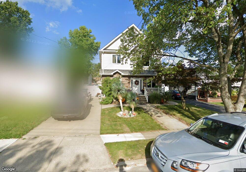
361 Armstrong Ave Staten Island, NY 10308
Great Kills NeighborhoodEstimated Value: $957,789 - $1,231,000
5
Beds
2
Baths
3,451
Sq Ft
$304/Sq Ft
Est. Value
About This Home
This home is located at 361 Armstrong Ave, Staten Island, NY 10308 and is currently estimated at $1,050,197, approximately $304 per square foot. 361 Armstrong Ave is a home located in Richmond County with nearby schools including P.S. 8 Shirlee Solomon, Myra S. Barnes Intermediate School 24, and New Dorp High School.
Ownership History
Date
Name
Owned For
Owner Type
Purchase Details
Closed on
Jun 24, 2013
Sold by
Lotito George Denise
Bought by
George Denise and Denise George Revocable Living
Current Estimated Value
Purchase Details
Closed on
Feb 28, 2013
Sold by
Lotito Denise and Lotito Edward A
Bought by
Lotito George Denise
Home Financials for this Owner
Home Financials are based on the most recent Mortgage that was taken out on this home.
Original Mortgage
$7,006
Outstanding Balance
$4,944
Interest Rate
3.54%
Mortgage Type
New Conventional
Estimated Equity
$1,045,253
Purchase Details
Closed on
Jan 6, 2006
Sold by
Lotito Edward A and Lotito Bridgett T
Bought by
Lotito Denise
Purchase Details
Closed on
Aug 6, 2004
Sold by
Lotito Edward A and Lotito Bridgett T
Bought by
Lotito Denise
Create a Home Valuation Report for This Property
The Home Valuation Report is an in-depth analysis detailing your home's value as well as a comparison with similar homes in the area
Home Values in the Area
Average Home Value in this Area
Purchase History
| Date | Buyer | Sale Price | Title Company |
|---|---|---|---|
| George Denise | -- | Old Republic National Title | |
| Lotito George Denise | -- | York Title Agency | |
| Lotito Denise | -- | None Available | |
| Lotito Denise | -- | Newell & Talarico |
Source: Public Records
Mortgage History
| Date | Status | Borrower | Loan Amount |
|---|---|---|---|
| Open | Lotito George Denise | $7,006 |
Source: Public Records
Tax History Compared to Growth
Tax History
| Year | Tax Paid | Tax Assessment Tax Assessment Total Assessment is a certain percentage of the fair market value that is determined by local assessors to be the total taxable value of land and additions on the property. | Land | Improvement |
|---|---|---|---|---|
| 2025 | $8,302 | $70,860 | $7,077 | $63,783 |
| 2024 | $8,314 | $64,140 | $7,396 | $56,744 |
| 2023 | $7,903 | $40,316 | $7,488 | $32,828 |
| 2022 | $7,306 | $59,280 | $11,100 | $48,180 |
| 2021 | $7,701 | $49,080 | $11,100 | $37,980 |
| 2020 | $7,673 | $54,240 | $11,100 | $43,140 |
| 2019 | $7,157 | $47,160 | $11,100 | $36,060 |
| 2018 | $6,551 | $33,597 | $8,051 | $25,546 |
| 2017 | $6,162 | $31,696 | $7,913 | $23,783 |
| 2016 | $6,026 | $31,696 | $7,404 | $24,292 |
| 2015 | $5,390 | $31,374 | $7,657 | $23,717 |
| 2014 | $5,390 | $29,677 | $8,689 | $20,988 |
Source: Public Records
Map
Nearby Homes
- 107 Elmwood Ave
- 247 Hillcrest St
- 190 Oakdale St
- 92 Ramblewood Ave
- 127 Cloverdale Ave
- 232 Robinson Ave
- 445 Beach Rd
- 331 Winchester Ave
- 323 Winchester Ave
- 0 Oakdale St
- 474 Armstrong Ave
- 485 Armstrong Ave Unit D - 3
- 485 Armstrong Ave Unit D2
- 485 Armstrong Ave Unit E1
- 333 Pacific Ave
- 107 Oakdale St
- 111 David St
- 103 Acacia Ave
- 249 Ridgecrest Ave
- 475 Armstrong Ave Unit 1f
- 357 Armstrong Ave
- 371 Armstrong Ave
- 48 Elmwood Ave
- 353 Armstrong Ave
- 44 Elmwood Ave
- 54 Elmwood Ave
- 52 Elmwood Ave
- 40 Elmwood Ave
- 56 Elmwood Ave
- 375 Armstrong Ave
- 58 Elmwood Ave
- 349 Armstrong Ave
- 36 Elmwood Ave
- 360 Armstrong Ave
- 364 Armstrong Ave
- 60 Elmwood Ave
- 356 Armstrong Ave
- 368 Armstrong Ave
- 352 Armstrong Ave
- 345 Armstrong Ave