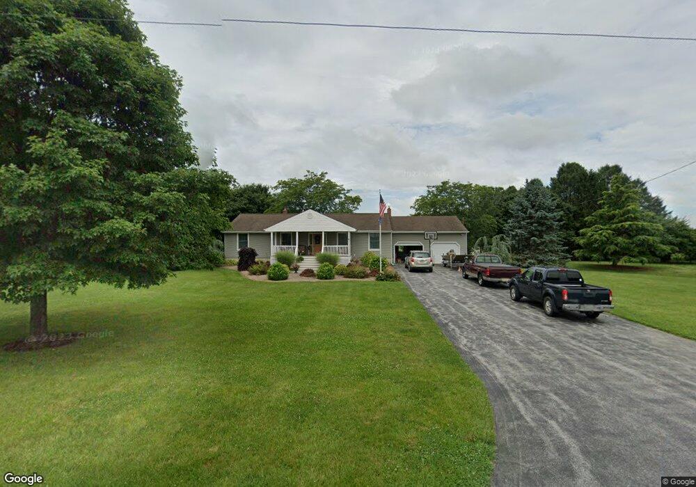
361 Avis Mill Rd Pilesgrove, NJ 08098
Estimated Value: $476,691 - $563,000
Studio
--
Bath
2,551
Sq Ft
$205/Sq Ft
Est. Value
About This Home
This home is located at 361 Avis Mill Rd, Pilesgrove, NJ 08098 and is currently estimated at $523,673, approximately $205 per square foot. 361 Avis Mill Rd is a home located in Salem County with nearby schools including Mary S. Shoemaker School, Woodstown Middle School, and Woodstown High School.
Ownership History
Date
Name
Owned For
Owner Type
Purchase Details
Closed on
Dec 5, 2005
Sold by
Swoyer Mary E
Bought by
Matulewicz Michael P and Matulewicz Sheryl A
Current Estimated Value
Home Financials for this Owner
Home Financials are based on the most recent Mortgage that was taken out on this home.
Original Mortgage
$169,000
Outstanding Balance
$94,501
Interest Rate
6.28%
Mortgage Type
Stand Alone First
Estimated Equity
$429,172
Purchase Details
Closed on
Jul 11, 2003
Sold by
Swoyer Paul F and Swoyer Mary M
Bought by
Swoyer Mary M
Home Financials for this Owner
Home Financials are based on the most recent Mortgage that was taken out on this home.
Original Mortgage
$145,000
Interest Rate
5.56%
Mortgage Type
Purchase Money Mortgage
Create a Home Valuation Report for This Property
The Home Valuation Report is an in-depth analysis detailing your home's value as well as a comparison with similar homes in the area
Purchase History
| Date | Buyer | Sale Price | Title Company |
|---|---|---|---|
| Matulewicz Michael P | $289,900 | None Available | |
| Swoyer Mary M | -- | -- |
Source: Public Records
Mortgage History
| Date | Status | Borrower | Loan Amount |
|---|---|---|---|
| Open | Matulewicz Michael P | $169,000 | |
| Previous Owner | Swoyer Mary M | $145,000 |
Source: Public Records
Tax History
| Year | Tax Paid | Tax Assessment Tax Assessment Total Assessment is a certain percentage of the fair market value that is determined by local assessors to be the total taxable value of land and additions on the property. | Land | Improvement |
|---|---|---|---|---|
| 2025 | $10,548 | $288,500 | $83,900 | $204,600 |
| 2024 | $10,700 | $288,500 | $83,900 | $204,600 |
| 2023 | $10,700 | $288,500 | $83,900 | $204,600 |
| 2022 | $10,080 | $288,500 | $83,900 | $204,600 |
| 2021 | $9,708 | $288,500 | $83,900 | $204,600 |
| 2020 | $9,373 | $288,500 | $83,900 | $204,600 |
| 2019 | $9,099 | $288,500 | $83,900 | $204,600 |
| 2018 | $8,736 | $288,500 | $83,900 | $204,600 |
| 2017 | $8,450 | $288,500 | $83,900 | $204,600 |
| 2016 | $8,107 | $288,500 | $83,900 | $204,600 |
| 2015 | $7,501 | $288,500 | $83,900 | $204,600 |
| 2014 | $7,224 | $288,500 | $83,900 | $204,600 |
Source: Public Records
Map
Nearby Homes
- 22 Lincoln Mill Rd
- 232 Commissioners Rd
- 236 E Lake Rd
- 75 Ferrell Rd
- 276 Woodstown Daretown Rd
- 29 Kingsberry Ln
- 340 Woodstown Daretown Rd
- 104 Willowbrook Ct
- 178 E Millbrooke Ave
- 365 N Main St
- 50 Colson Ct
- 44 Church St
- 440 Bailey St
- 16 Bowen Ave
- 444 S Main St
- 438 Bailey St
- 15 Cedar Grove Rd
- L13 Highway 40 W
- 212 S Main St
- 19 Maple Ave
- 369 Avis Mill Rd
- 353 Avis Mill Rd
- 363 Whig Lane Rd
- 10 Wick Dr
- 6 Wick Dr
- 0 Whig Lane Rd Unit 5793887
- 0 Whig Lane Rd Unit 5793892
- 0 Whig Lane Rd Unit 5998316
- 0 Whig Lane Rd Unit 1009434650
- 8 Wick Dr
- 371 Whig Lane Rd
- 4 Wick Dr
- 2 Wick Dr
- 356 Whig Lane Rd
- 372 Whig Lane Rd
- 1 Arthurs Ct
- 9 Wick Dr
- 11 Wick Dr
- 3 Wick Dr
- 1 Wick Dr
Your Personal Tour Guide
Ask me questions while you tour the home.