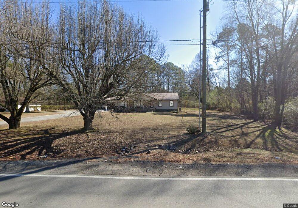
361 Carbondale Rd SW Dalton, GA 30721
Estimated Value: $245,415 - $307,000
--
Bed
2
Baths
1,819
Sq Ft
$153/Sq Ft
Est. Value
About This Home
This home is located at 361 Carbondale Rd SW, Dalton, GA 30721 and is currently estimated at $279,104, approximately $153 per square foot. 361 Carbondale Rd SW is a home located in Whitfield County with nearby schools including Valley Point Elementary School, Valley Point Middle School, and Southeast Whitfield County High School.
Ownership History
Date
Name
Owned For
Owner Type
Purchase Details
Closed on
May 31, 2018
Sold by
Shiver Edgar E
Bought by
Shiver Edgar Dewayne and Shiver Daniel Rory
Current Estimated Value
Purchase Details
Closed on
Apr 9, 2007
Sold by
Shiver Edgar E
Bought by
Shiver Edgar E
Purchase Details
Closed on
Apr 5, 2007
Sold by
Hanes Geneva
Bought by
Shiver Edgar E
Purchase Details
Closed on
Oct 3, 2006
Sold by
Parker Hugh Dennis
Bought by
Hanes Geneva
Create a Home Valuation Report for This Property
The Home Valuation Report is an in-depth analysis detailing your home's value as well as a comparison with similar homes in the area
Home Values in the Area
Average Home Value in this Area
Purchase History
| Date | Buyer | Sale Price | Title Company |
|---|---|---|---|
| Shiver Edgar Dewayne | -- | -- | |
| Shiver Edgar E | -- | -- | |
| Shiver Edgar E | $155,000 | -- | |
| Hanes Geneva | $97,751 | -- |
Source: Public Records
Tax History Compared to Growth
Tax History
| Year | Tax Paid | Tax Assessment Tax Assessment Total Assessment is a certain percentage of the fair market value that is determined by local assessors to be the total taxable value of land and additions on the property. | Land | Improvement |
|---|---|---|---|---|
| 2024 | $414 | $88,208 | $5,956 | $82,252 |
| 2023 | $414 | $58,549 | $5,195 | $53,354 |
| 2022 | $259 | $44,129 | $3,723 | $40,406 |
| 2021 | $259 | $44,129 | $3,723 | $40,406 |
| 2020 | $284 | $44,129 | $3,723 | $40,406 |
| 2019 | $296 | $44,129 | $3,723 | $40,406 |
| 2018 | $314 | $44,606 | $4,200 | $40,406 |
| 2017 | $314 | $44,606 | $4,200 | $40,406 |
| 2016 | $245 | $41,203 | $4,200 | $37,003 |
| 2014 | $171 | $41,203 | $4,200 | $37,003 |
| 2013 | -- | $41,202 | $4,200 | $37,002 |
Source: Public Records
Map
Nearby Homes
- 0 Carbondale Rd SW Unit 129966
- 0 Carbondale Rd SW Unit 7574085
- 0 Carbondale Rd SW Unit 130445
- 0 Carbondale Rd SW Unit 1522370
- 0 Carbondale Rd SW Unit 10515867
- 0 Carbondale Rd SW Unit 129726
- 323 Tubman Way
- 3737 S Dixie Rd
- 213 Gwendolyn Lee Ln
- 4381 S Dixie Hwy
- 116 Robin Hood Dr
- 112 Robin Hood Dr
- 122 Robin Hood Dr
- 674 Eber Rd SE
- 4888 Cline Rd
- 402 W Nance Springs Rd
- 73 Acres S Dixie Hwy
- 282 Collington Cir
- 4280 Old Dixie Hwy SE
- 586 Collington Cir
- 357 Carbondale Rd SW
- 358 Carbondale Rd SW
- 375 Carbondale Rd SW
- 387 Carbondale Rd SW
- 350 Carbondale Rd SW
- 0 Dug Gap Rd Unit 1101747
- 0 Dug Gap Rd Unit 1128198
- 0 Dug Gap Rd Unit 1141521
- 0 Dug Gap Rd Unit 1141523
- 0 Dug Gap Rd Unit 10141119
- 0 Dug Gap Rd Unit 107381
- 0 Dug Gap Rd Unit 121154
- 409 Carbondale Rd SW
- 401 Carbondale Rd SW
- 404 Carbondale Rd SW
- 413 Carbondale Rd SW
- 321 Carbondale Rd SW
- 417 Carbondale Rd SW
- 503 Redwine Cove Rd SW
- 505 Redwine Cove Rd SW