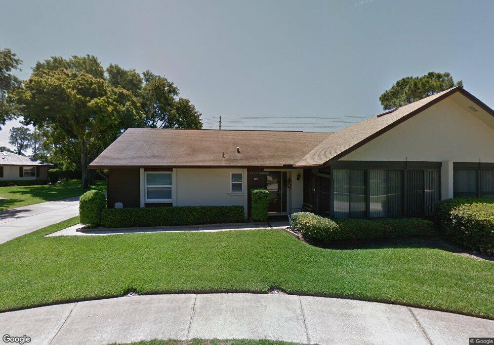
361 Dunbar Ct Unit 1552 Dunedin, FL 34698
Estimated Value: $262,000 - $326,000
2
Beds
2
Baths
1,110
Sq Ft
$273/Sq Ft
Est. Value
About This Home
This home is located at 361 Dunbar Ct Unit 1552, Dunedin, FL 34698 and is currently estimated at $303,513, approximately $273 per square foot. 361 Dunbar Ct Unit 1552 is a home located in Pinellas County with nearby schools including Dunedin Elementary School, Dunedin Highland Middle School, and Dunedin High School.
Ownership History
Date
Name
Owned For
Owner Type
Purchase Details
Closed on
Sep 4, 2014
Sold by
Svensson Carmella
Bought by
Czerniak Linda J
Current Estimated Value
Purchase Details
Closed on
Sep 16, 2002
Sold by
Keely Joan
Bought by
Svensson Thor H and Svensson Carmella
Purchase Details
Closed on
Apr 17, 2002
Sold by
Croft Frank L
Bought by
Keely Joan
Home Financials for this Owner
Home Financials are based on the most recent Mortgage that was taken out on this home.
Original Mortgage
$79,200
Interest Rate
6.89%
Mortgage Type
New Conventional
Create a Home Valuation Report for This Property
The Home Valuation Report is an in-depth analysis detailing your home's value as well as a comparison with similar homes in the area
Home Values in the Area
Average Home Value in this Area
Purchase History
| Date | Buyer | Sale Price | Title Company |
|---|---|---|---|
| Czerniak Linda J | $127,500 | Security Title Company | |
| Svensson Thor H | $90,000 | -- | |
| Keely Joan | $88,000 | -- |
Source: Public Records
Mortgage History
| Date | Status | Borrower | Loan Amount |
|---|---|---|---|
| Previous Owner | Keely Joan | $79,200 |
Source: Public Records
Tax History Compared to Growth
Tax History
| Year | Tax Paid | Tax Assessment Tax Assessment Total Assessment is a certain percentage of the fair market value that is determined by local assessors to be the total taxable value of land and additions on the property. | Land | Improvement |
|---|---|---|---|---|
| 2025 | $1,424 | $127,941 | -- | -- |
| 2024 | $1,388 | $124,335 | -- | -- |
| 2023 | $1,388 | $120,714 | $0 | $0 |
| 2022 | $1,335 | $117,198 | $0 | $0 |
| 2021 | $1,338 | $113,784 | $0 | $0 |
| 2020 | $1,328 | $112,213 | $0 | $0 |
| 2019 | $1,295 | $109,690 | $0 | $0 |
| 2018 | $1,269 | $107,645 | $0 | $0 |
| 2017 | $1,250 | $105,431 | $0 | $0 |
| 2016 | $1,232 | $103,262 | $0 | $0 |
| 2015 | $1,253 | $102,544 | $0 | $0 |
| 2014 | $545 | $77,154 | $0 | $0 |
Source: Public Records
Map
Nearby Homes
- 330 Promenade Dr Unit 103
- 330 Promenade Dr Unit 206
- 1342 Stonehaven Ln Unit 1392
- 2280 Springwood Cir W
- 240 Promenade Dr Unit 102
- 470 Kirkland Cir
- 506 Belmist Ct
- 2233 Springwood Cir W
- 630 Kirkland Cir
- 1888 Springbush Ln
- 1155 Montrose Place Unit 1666
- 1120 Bluffs Cir
- 458 Exmoor Terrace Unit 1672
- 1438 Millstream Ln Unit 201
- 1473 Aberdeen Oaks Dr
- 1114 Castlemay Cir
- 1390 Oak Hill Dr Unit 206
- 223 Somerset Cir N
- 1454 Aberdeen Oaks Dr
- 642 Weathersfield Dr
- 362 Dunbar Ct
- 360 Dunbar Ct Unit 1553
- 361 Dunbar Ct
- 365 Dunbar Ct
- 361 Berwick Ct
- 357 Berwick Ct
- 364 Dunbar Ct
- 368 Dunbar Ct
- 381 Berwick Ct
- 375 Berwick Ct
- 374 Dunbar Ct Unit 1612
- 380 Dunbar Ct
- 381 Berwick Ct Unit 1614
- 1432 Summer Isle Ct Unit 1564
- 1428 Summer Isle Ct Unit 1563
- 1440 Summer Isle Ct
- 1436 Summer Isle Ct
- 378 Dunbar Ct
- 373 Dunbar Ct
- 1424 Summer Isle Ct