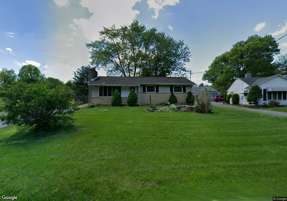
361 Lowland Rd Hamburg, PA 19526
Estimated Value: $192,000 - $285,421
3
Beds
1
Bath
1,248
Sq Ft
$191/Sq Ft
Est. Value
About This Home
This home is located at 361 Lowland Rd, Hamburg, PA 19526 and is currently estimated at $237,855, approximately $190 per square foot. 361 Lowland Rd is a home located in Berks County with nearby schools including Hamburg Area High School, Blue Mountain Seventh-day Adventist Elementary School, and Blue Mountain Academy.
Ownership History
Date
Name
Owned For
Owner Type
Purchase Details
Closed on
May 30, 2025
Sold by
Henry Jason A and Henry Kimberly G
Bought by
Daigneault Donald D and Daigneault Deborah J
Current Estimated Value
Purchase Details
Closed on
Dec 14, 2011
Sold by
Henry Jason Alan
Bought by
Henry Jason A and Henry Kimberly G
Home Financials for this Owner
Home Financials are based on the most recent Mortgage that was taken out on this home.
Original Mortgage
$109,300
Interest Rate
3.99%
Mortgage Type
New Conventional
Purchase Details
Closed on
Feb 27, 2004
Sold by
Dickison Judith Ann
Bought by
Henry Jason Alan
Home Financials for this Owner
Home Financials are based on the most recent Mortgage that was taken out on this home.
Original Mortgage
$120,000
Interest Rate
5.62%
Mortgage Type
Purchase Money Mortgage
Create a Home Valuation Report for This Property
The Home Valuation Report is an in-depth analysis detailing your home's value as well as a comparison with similar homes in the area
Home Values in the Area
Average Home Value in this Area
Purchase History
| Date | Buyer | Sale Price | Title Company |
|---|---|---|---|
| Daigneault Donald D | $190,000 | Evergreen Settlement | |
| Henry Jason A | -- | None Available | |
| Henry Jason Alan | $120,000 | -- |
Source: Public Records
Mortgage History
| Date | Status | Borrower | Loan Amount |
|---|---|---|---|
| Previous Owner | Henry Jason A | $109,300 | |
| Previous Owner | Henry Jason Alan | $120,000 |
Source: Public Records
Tax History Compared to Growth
Tax History
| Year | Tax Paid | Tax Assessment Tax Assessment Total Assessment is a certain percentage of the fair market value that is determined by local assessors to be the total taxable value of land and additions on the property. | Land | Improvement |
|---|---|---|---|---|
| 2025 | $1,083 | $95,300 | $27,700 | $67,600 |
| 2024 | $3,589 | $95,300 | $27,700 | $67,600 |
| 2023 | $3,509 | $95,300 | $27,700 | $67,600 |
| 2022 | $3,499 | $95,300 | $27,700 | $67,600 |
| 2021 | $3,499 | $95,300 | $27,700 | $67,600 |
| 2020 | $3,499 | $95,300 | $27,700 | $67,600 |
| 2019 | $3,509 | $95,300 | $27,700 | $67,600 |
| 2018 | $3,437 | $95,300 | $27,700 | $67,600 |
| 2017 | $3,386 | $95,300 | $27,700 | $67,600 |
| 2016 | $824 | $95,300 | $27,700 | $67,600 |
| 2015 | $824 | $95,300 | $27,700 | $67,600 |
| 2014 | $824 | $95,300 | $27,700 | $67,600 |
Source: Public Records
Map
Nearby Homes
- 363 Lowland Rd
- 351 Lowland Rd
- 371 Lowland Rd
- 377 Lowland Rd
- 0 Lowland Rd
- 379 Lowland Rd
- 337 Lowland Rd
- 385 Lowland Rd
- 333 Lowland Rd
- 323 Lowland Rd
- 311 Lowland Rd
- 722 Port Clinton Ave
- 920 Port Clinton Ave
- 720 Port Clinton Ave
- 915 Port Clinton Ave
- 1010 Port Clinton Ave
- 721 Port Clinton Ave
- 40 Industrial Dr
- 711 Port Clinton Ave
- 463 Lowland Rd