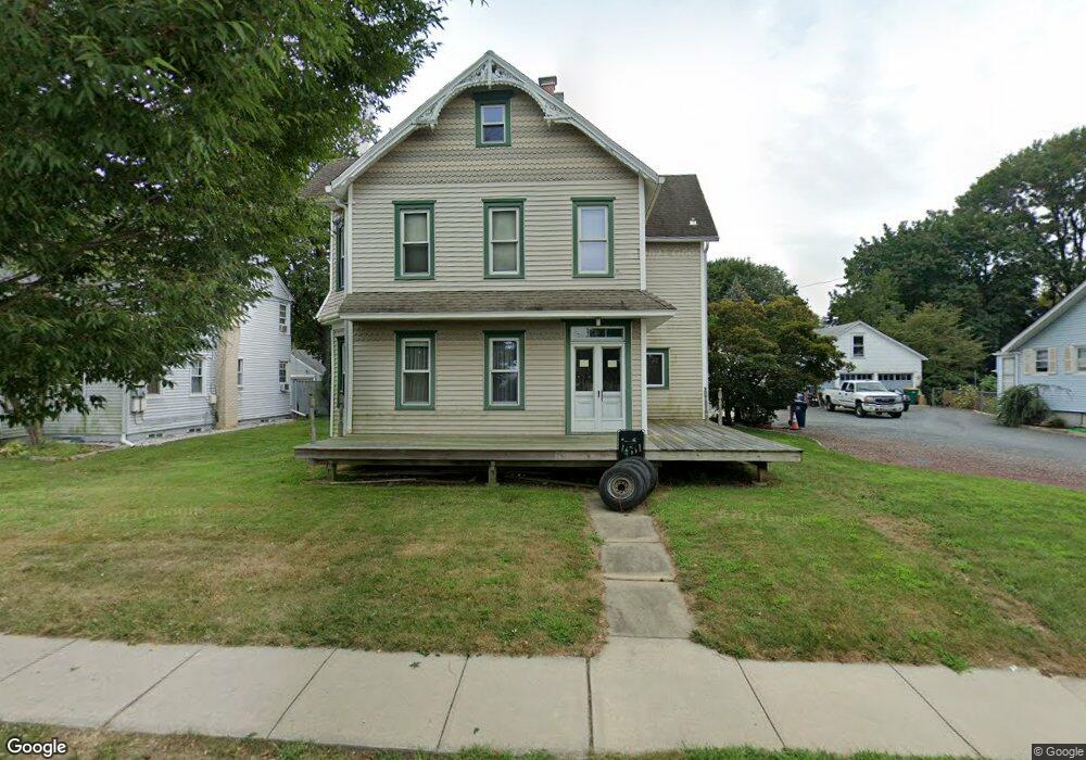
361 Morrison Ave Hightstown, NJ 08520
Estimated Value: $466,643 - $613,000
--
Bed
--
Bath
1,930
Sq Ft
$278/Sq Ft
Est. Value
About This Home
This home is located at 361 Morrison Ave, Hightstown, NJ 08520 and is currently estimated at $536,911, approximately $278 per square foot. 361 Morrison Ave is a home located in Mercer County with nearby schools including Melvin H. Kreps Middle School, Hightstown High School, and SciCore Academy.
Ownership History
Date
Name
Owned For
Owner Type
Purchase Details
Closed on
Nov 30, 2021
Sold by
Zullo Joseph C
Bought by
Zullo Joseph C and Zullo Katherine M
Current Estimated Value
Purchase Details
Closed on
Nov 23, 2021
Sold by
Zullo Elaine C
Bought by
Zullo Joseph C
Purchase Details
Closed on
Nov 30, 1987
Bought by
Zullo Joseph C and Zullo Elaine C
Create a Home Valuation Report for This Property
The Home Valuation Report is an in-depth analysis detailing your home's value as well as a comparison with similar homes in the area
Home Values in the Area
Average Home Value in this Area
Purchase History
| Date | Buyer | Sale Price | Title Company |
|---|---|---|---|
| Zullo Joseph C | -- | E Title Solutions | |
| Zullo Joseph C | -- | E Title Solutions | |
| Zullo Joseph C | $131,000 | -- |
Source: Public Records
Tax History Compared to Growth
Tax History
| Year | Tax Paid | Tax Assessment Tax Assessment Total Assessment is a certain percentage of the fair market value that is determined by local assessors to be the total taxable value of land and additions on the property. | Land | Improvement |
|---|---|---|---|---|
| 2025 | $11,870 | $256,000 | $78,500 | $177,500 |
| 2024 | $11,749 | $242,100 | $78,500 | $163,600 |
| 2023 | $11,749 | $242,100 | $78,500 | $163,600 |
| 2022 | $11,342 | $242,100 | $78,500 | $163,600 |
| 2021 | $10,933 | $242,100 | $78,500 | $163,600 |
| 2020 | $10,684 | $236,300 | $78,500 | $157,800 |
| 2019 | $10,137 | $236,300 | $78,500 | $157,800 |
| 2018 | $9,842 | $236,300 | $78,500 | $157,800 |
| 2017 | $9,740 | $236,300 | $78,500 | $157,800 |
| 2016 | $9,655 | $236,300 | $78,500 | $157,800 |
| 2015 | $9,594 | $236,300 | $78,500 | $157,800 |
| 2014 | $9,655 | $236,300 | $78,500 | $157,800 |
Source: Public Records
Map
Nearby Homes
- 107 Hausser Ave
- 365 Stockton St
- 201 Morrison Ave
- 400 Stockton St
- 17 Winchester Dr
- 58 Teal Ct
- 102 Teal Ct
- 104 1st Ave
- 145 Lincoln Ave
- 203 Hutchinson St
- 28 Columbia Ave
- 309 Lincoln Ave
- 302 S Main St
- 569 Route 130
- 0 Route 130
- 104 One Mile Rd
- 108 Orchard Ave
- 288 Dutch Neck Rd
- 1 Sterling Ct
- 15 Brownstone Rd
- 363 Morrison Ave
- 357 Morrison Ave
- 100 Bennett Place
- 367 Morrison Ave
- 369 Morrison Ave
- 118 Bennett Place
- 333 Morrison Ave
- 140 Harron Ave
- 377 Morrison Ave
- 331 Morrison Ave
- 136 Harron Ave
- 101 Bennett Place
- 103 Hausser Ave
- 121 Bennett Place
- 126 Bennett Place
- 380 Morrison Ave
- 329 Morrison Ave
- 123 Bennett Place
- 132 Harron Ave
- 385 Morrison Ave