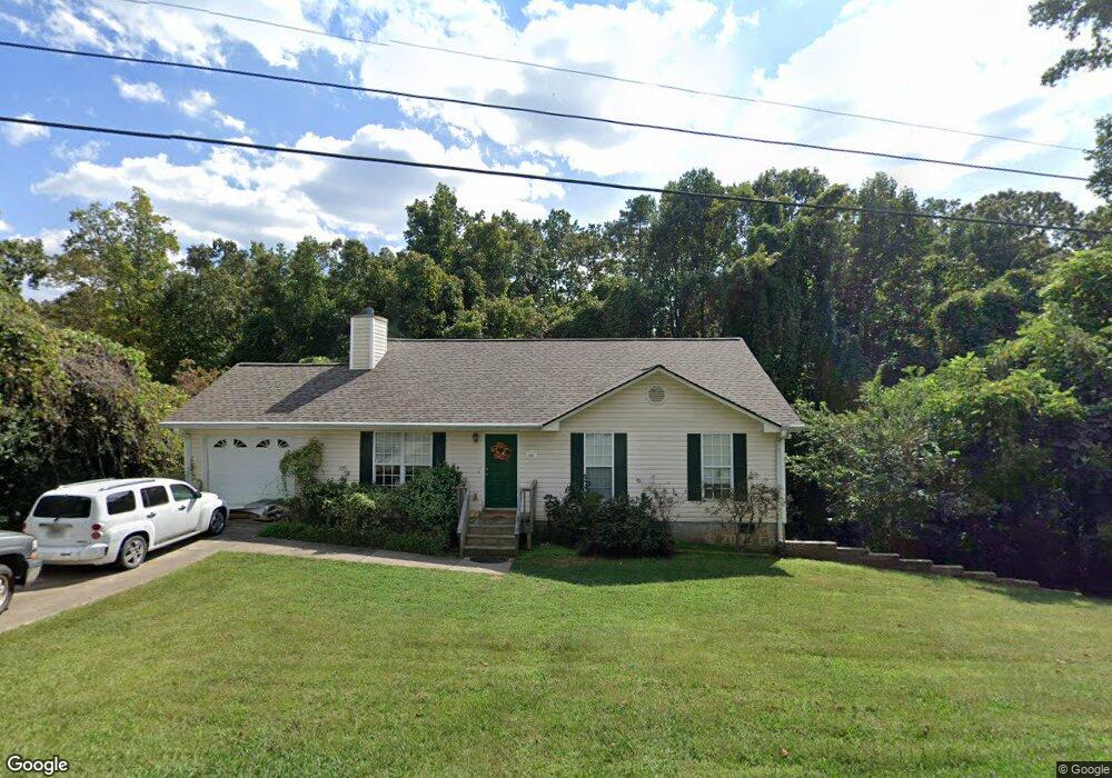
361 N Hall Rd Dahlonega, GA 30533
Estimated Value: $268,591 - $344,000
--
Bed
2
Baths
1,320
Sq Ft
$227/Sq Ft
Est. Value
About This Home
This home is located at 361 N Hall Rd, Dahlonega, GA 30533 and is currently estimated at $299,148, approximately $226 per square foot. 361 N Hall Rd is a home located in Lumpkin County with nearby schools including Clay County Middle School and Lumpkin County High School.
Ownership History
Date
Name
Owned For
Owner Type
Purchase Details
Closed on
May 25, 1999
Sold by
Ellerson Florence M
Bought by
Thames Jody L
Current Estimated Value
Purchase Details
Closed on
May 23, 1996
Sold by
Gooch Ruby
Bought by
Ellerson Florence M
Purchase Details
Closed on
Jul 1, 1987
Sold by
Housley Carol S
Bought by
Gooch Ruby
Purchase Details
Closed on
Mar 1, 1976
Sold by
B B Jr Trustees
Bought by
Housley Carol S
Create a Home Valuation Report for This Property
The Home Valuation Report is an in-depth analysis detailing your home's value as well as a comparison with similar homes in the area
Home Values in the Area
Average Home Value in this Area
Purchase History
| Date | Buyer | Sale Price | Title Company |
|---|---|---|---|
| Thames Jody L | $110,700 | -- | |
| Ellerson Florence M | $11,000 | -- | |
| Gooch Ruby | -- | -- | |
| Housley Carol S | -- | -- |
Source: Public Records
Tax History Compared to Growth
Tax History
| Year | Tax Paid | Tax Assessment Tax Assessment Total Assessment is a certain percentage of the fair market value that is determined by local assessors to be the total taxable value of land and additions on the property. | Land | Improvement |
|---|---|---|---|---|
| 2024 | $38 | $76,428 | $17,520 | $58,908 |
| 2023 | $102 | $72,138 | $17,520 | $54,618 |
| 2022 | $25 | $65,484 | $17,520 | $47,964 |
| 2021 | $2,057 | $56,505 | $17,520 | $38,985 |
| 2020 | $2,012 | $55,284 | $17,520 | $37,764 |
| 2019 | $2,012 | $55,284 | $17,520 | $37,764 |
| 2018 | $1,842 | $50,620 | $17,520 | $33,100 |
| 2017 | $1,782 | $49,801 | $17,520 | $32,281 |
| 2016 | $1,700 | $46,581 | $17,520 | $29,061 |
| 2015 | $1,465 | $46,582 | $17,520 | $29,061 |
| 2014 | $1,465 | $46,980 | $17,520 | $29,459 |
| 2013 | -- | $47,775 | $17,520 | $30,255 |
Source: Public Records
Map
Nearby Homes
- 490 N Hall Rd
- 399 N Chestatee St
- 253 Blair Ridge Rd
- 94 Mountain View Dr
- 0 Dawsonville Hwy Unit 10631159
- 00 Dawsonville Hwy
- 95 Jones St
- 315 Church St
- 120 Blair Ridge Rd
- 121 Blair Ridge Rd
- 168 W Main St
- 22 Honeysuckle Ln
- 0 S Chestatee St Unit 10619536
- 0 Highway 19 N Unit 10594984
- 549 Ivy Terrace
- 97 Beaumont Dr
- 132 J Mountain Dr
- 502 Wimpy Mill Rd
- 1392 S Chestatee St
- 1202 Oak Grove Rd
- N N Hall Rd
- 13 Housley Dr
- 351 N Hall Rd
- 47 Housley Dr
- 390 N Hall Rd
- 358 N Hall Rd
- 0 Trahlyta Trail Unit 7270528
- 0 Trahlyta Trail Unit 7198009
- 0 Trahlyta Trail
- 8 Trahlyta Trail
- 0 Housley Dr
- 0 Housley Dr Unit 7550393
- 0 Housley Dr Unit 7253432
- 451 N Hall Rd
- 460 N Hall Rd
- 91 Housley Dr
- 38 Trahlyta Trail
- 0 N Hall Rd Unit 10029607
- 0 N Hall Rd Unit 7017705
- 0 N Hall Rd Unit 8744821