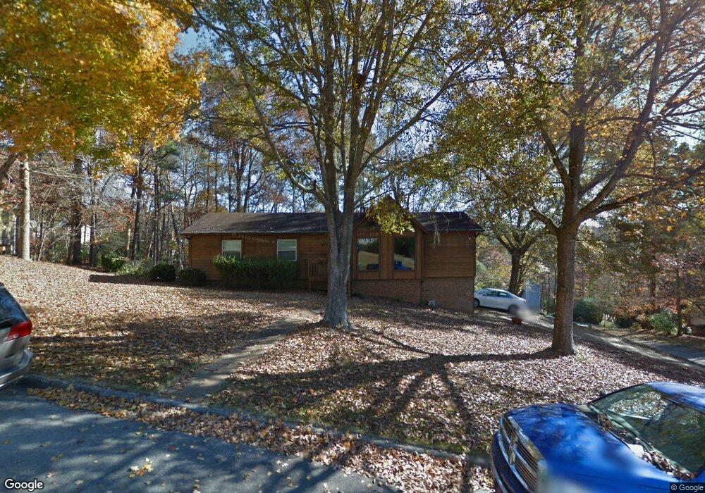
361 Stonebridge Rd Irondale, AL 35210
Cahaba Heights NeighborhoodEstimated Value: $290,000 - $380,000
3
Beds
3
Baths
1,599
Sq Ft
$203/Sq Ft
Est. Value
About This Home
This home is located at 361 Stonebridge Rd, Irondale, AL 35210 and is currently estimated at $324,497, approximately $202 per square foot. 361 Stonebridge Rd is a home located in Jefferson County with nearby schools including Grantswood Community Elementary School, Shades Valley High School, and Highlands School.
Ownership History
Date
Name
Owned For
Owner Type
Purchase Details
Closed on
Apr 25, 2000
Sold by
Keith Jerry W and Keith Susan W
Bought by
Crawford Kenneth L and Crawford Andrea P
Current Estimated Value
Home Financials for this Owner
Home Financials are based on the most recent Mortgage that was taken out on this home.
Original Mortgage
$122,850
Outstanding Balance
$42,869
Interest Rate
8.28%
Estimated Equity
$281,628
Create a Home Valuation Report for This Property
The Home Valuation Report is an in-depth analysis detailing your home's value as well as a comparison with similar homes in the area
Home Values in the Area
Average Home Value in this Area
Purchase History
| Date | Buyer | Sale Price | Title Company |
|---|---|---|---|
| Crawford Kenneth L | $136,500 | -- |
Source: Public Records
Mortgage History
| Date | Status | Borrower | Loan Amount |
|---|---|---|---|
| Open | Crawford Kenneth L | $122,850 |
Source: Public Records
Tax History Compared to Growth
Tax History
| Year | Tax Paid | Tax Assessment Tax Assessment Total Assessment is a certain percentage of the fair market value that is determined by local assessors to be the total taxable value of land and additions on the property. | Land | Improvement |
|---|---|---|---|---|
| 2024 | $1,530 | $25,280 | -- | -- |
| 2022 | $1,348 | $24,750 | $6,800 | $17,950 |
| 2021 | $1,087 | $20,130 | $6,800 | $13,330 |
| 2020 | $1,087 | $20,130 | $6,800 | $13,330 |
| 2019 | $1,087 | $20,140 | $0 | $0 |
| 2018 | $933 | $17,420 | $0 | $0 |
| 2017 | $979 | $18,240 | $0 | $0 |
| 2016 | $933 | $17,420 | $0 | $0 |
| 2015 | $933 | $17,420 | $0 | $0 |
| 2014 | $923 | $17,160 | $0 | $0 |
| 2013 | $923 | $17,160 | $0 | $0 |
Source: Public Records
Map
Nearby Homes
- 5531 Overton Rd
- 123 Trillium Dr
- 5620 Alexandria Dr Unit 1
- 5720 Overton Rd
- 7410 Kings Mountain Ct Unit 102
- 7105 Valderrama Cir
- 7385 Ridgecrest Court Rd
- 5161 Clubridge Dr E
- The Richardson Plan at Clubridge at Liberty Park - Club Ridge at Liberty Park
- The Kayden Plan at Clubridge at Liberty Park - Club Ridge at Liberty Park
- The Jefferson Plan at Clubridge at Liberty Park - Club Ridge at Liberty Park
- 4251 Cedar St Unit 1
- 7512 Kings Mountain Ridge
- 4362 Kings Mountain Ridge
- 5125 Club Ridge Dr W
- 3520 Ridgeview Dr
- 4338 Kings Mountain Ridge
- 4326 Kings Mountain Ridge
- 455 Ravine Rd
- 3833 Moss Creek Cir
- 355 Stonebridge Rd
- 381 Stonebridge Rd
- 348 Stonebridge Rd
- 352 Stonebridge Rd
- 337 Stonebridge Rd
- 401 Stonebridge Rd
- 349 Stonebridge Rd
- 341 Stonebridge Rd
- 340 Stonebridge Rd
- 372 Stonebridge Rd
- 407 Stonebridge Rd
- 4633 Stonebridge Cir
- 382 Stonebridge Rd
- 343 Stonebridge Rd
- 330 Stonebridge Rd
- 390 Stonebridge Rd
- 307 Stonebridge Rd
- 4623 Stonebridge Cir
- 283 Stonebridge Rd
- 415 Stonebridge Rd