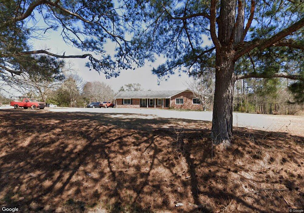
361 Wehunt Rd Unit 15 Covington, GA 30016
Estimated Value: $311,292 - $332,000
3
Beds
2
Baths
1,742
Sq Ft
$185/Sq Ft
Est. Value
About This Home
This home is located at 361 Wehunt Rd Unit 15, Covington, GA 30016 and is currently estimated at $321,823, approximately $184 per square foot. 361 Wehunt Rd Unit 15 is a home located in Newton County with nearby schools including Oak Hill Elementary School, Veterans Memorial Middle School, and Alcovy High School.
Ownership History
Date
Name
Owned For
Owner Type
Purchase Details
Closed on
Mar 15, 2017
Sold by
Dasilva Debra Lee
Bought by
Harris Eric and Harris Charlene Bell
Current Estimated Value
Home Financials for this Owner
Home Financials are based on the most recent Mortgage that was taken out on this home.
Original Mortgage
$152,093
Outstanding Balance
$125,032
Interest Rate
4.12%
Mortgage Type
FHA
Estimated Equity
$196,791
Purchase Details
Closed on
Mar 18, 2014
Sold by
Sorrell Terina
Bought by
Dasilva Debra Lee
Create a Home Valuation Report for This Property
The Home Valuation Report is an in-depth analysis detailing your home's value as well as a comparison with similar homes in the area
Home Values in the Area
Average Home Value in this Area
Purchase History
| Date | Buyer | Sale Price | Title Company |
|---|---|---|---|
| Harris Eric | $154,900 | -- | |
| Dasilva Debra Lee | $122,500 | -- |
Source: Public Records
Mortgage History
| Date | Status | Borrower | Loan Amount |
|---|---|---|---|
| Open | Harris Eric | $152,093 |
Source: Public Records
Tax History Compared to Growth
Tax History
| Year | Tax Paid | Tax Assessment Tax Assessment Total Assessment is a certain percentage of the fair market value that is determined by local assessors to be the total taxable value of land and additions on the property. | Land | Improvement |
|---|---|---|---|---|
| 2025 | $3,328 | $133,724 | $26,880 | $106,844 |
| 2024 | $3,064 | $120,964 | $17,760 | $103,204 |
| 2023 | $2,886 | $106,364 | $17,760 | $88,604 |
| 2022 | $2,422 | $89,244 | $17,760 | $71,484 |
| 2021 | $2,315 | $76,324 | $17,760 | $58,564 |
| 2020 | $2,065 | $61,468 | $12,600 | $48,868 |
| 2019 | $2,025 | $59,360 | $12,600 | $46,760 |
| 2018 | $1,998 | $58,200 | $12,600 | $45,600 |
| 2017 | $1,610 | $50,800 | $9,440 | $41,360 |
| 2016 | $1,400 | $44,680 | $9,440 | $35,240 |
| 2015 | $1,378 | $44,040 | $9,440 | $34,600 |
| 2014 | $1,403 | $41,000 | $0 | $0 |
Source: Public Records
Map
Nearby Homes
- 5618 Highway 212
- 115 Arthurs Ln
- 624 Bethany Rd
- 1824 Smith Store Rd
- 230 Laurel Way
- 40 Browning Dr
- 455 Bethany Rd
- 20 Clarion Ct
- 195 Sampson Ct
- 55 the Falls Blvd
- 35 Cambridge Way
- 335 Glen Echo Dr
- 30 Laurel Way
- 425 Berkshire Dr
- 190 Oak Hill Cir
- 35 Green Hill Ct
- 45 Saratoga Way
- 10 Edgewater Ct
- 110 Chapel Heights Way
- 0 Highway 81 S Unit 7670352
- 361 Wehunt Rd
- 399 Wehunt Rd
- 398 Wehunt Rd
- 312 Wehunt Rd
- 129 Little Mill Rd
- 60 Little Mill Rd
- 60 Little Mill Rd Unit LOT 8
- 88 Little Mill Rd Unit LOT 9
- 88 Little Mill Rd
- 452 Wehunt Rd
- 87 Little Mill Rd
- 1288 Covered Bridge Rd
- 1609 Covered Bridge Rd
- 1280 Covered Bridge Rd
- 45 Little Mill Rd
- 0000 Hollingsworth Rd
- 0 Hollingsworth Rd
- 00 Hollingsworth Rd
- 0 Hollingsworth Rd Unit 10032818
- 0 Hollingsworth Rd Unit 7022852