Estimated Value: $624,000 - $735,000
4
Beds
4
Baths
2,383
Sq Ft
$280/Sq Ft
Est. Value
About This Home
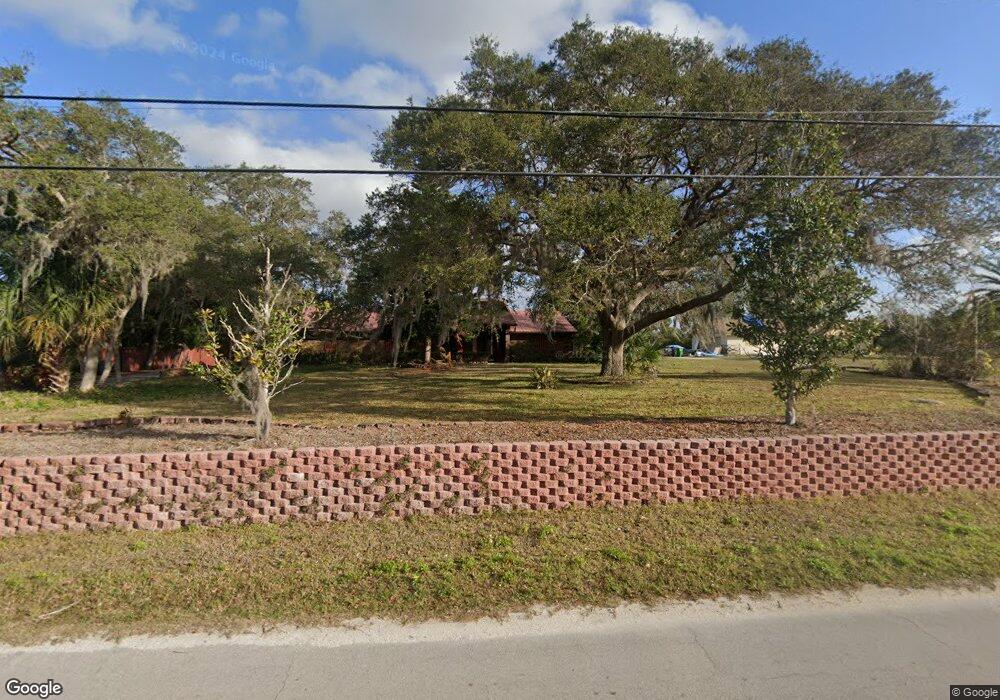
This home is located at 3610 Lionel Rd, Mims, FL 32754 and is currently estimated at $668,079, approximately $280 per square foot. 3610 Lionel Rd is a home located in Brevard County with nearby schools including Pinewood Elementary School, James Madison Middle School, and Astronaut High School.
Ownership History
Date
Name
Owned For
Owner Type
Purchase Details
Closed on
Nov 7, 2014
Sold by
Potts Robert G and Potts Wanda J
Bought by
Penley Meck R and Penley Tanya M
Current Estimated Value
Purchase Details
Closed on
Jul 20, 1998
Sold by
Emmick Paul Allen and Emmick Dorothy Elizabeth
Bought by
Potts Robert G and Potts Wanda J
Home Financials for this Owner
Home Financials are based on the most recent Mortgage that was taken out on this home.
Original Mortgage
$112,000
Interest Rate
7.02%
Create a Home Valuation Report for This Property
The Home Valuation Report is an in-depth analysis detailing your home's value as well as a comparison with similar homes in the area
Home Values in the Area
Average Home Value in this Area
Purchase History
| Date | Buyer | Sale Price | Title Company |
|---|---|---|---|
| Penley Meck R | $369,900 | Fidelity Natl Title Fl Inc | |
| Potts Robert G | $140,000 | -- |
Source: Public Records
Mortgage History
| Date | Status | Borrower | Loan Amount |
|---|---|---|---|
| Previous Owner | Potts Robert G | $112,000 |
Source: Public Records
Tax History
| Year | Tax Paid | Tax Assessment Tax Assessment Total Assessment is a certain percentage of the fair market value that is determined by local assessors to be the total taxable value of land and additions on the property. | Land | Improvement |
|---|---|---|---|---|
| 2025 | $5,031 | $386,200 | -- | -- |
| 2024 | $4,979 | $375,320 | -- | -- |
| 2023 | $4,979 | $364,390 | $0 | $0 |
| 2022 | $4,684 | $353,780 | $0 | $0 |
| 2021 | $4,898 | $343,480 | $0 | $0 |
| 2020 | $4,855 | $338,740 | $0 | $0 |
| 2019 | $4,836 | $331,130 | $0 | $0 |
| 2018 | $4,861 | $324,960 | $0 | $0 |
| 2017 | $4,930 | $318,280 | $0 | $0 |
| 2016 | $5,017 | $311,740 | $48,900 | $262,840 |
| 2015 | $5,516 | $292,480 | $48,900 | $243,580 |
| 2014 | $2,876 | $178,000 | $39,120 | $138,880 |
Source: Public Records
Map
Nearby Homes
- 3931 U S Route 1
- 0000 Joel Ave
- 3527 Old Dixie Hwy
- 3550 US Highway 1 Unit Lot 8
- 3550 US Highway 1 Unit Lot 75
- 3772 E R Smyth Dr
- 4080 Highway 1 Hwy
- 3345 Carter Rd
- 4150 U S Route 1
- 0000 Wood Duck Dr
- 4110 Hampton Ln
- 3500 U S Route 1
- 3600 Burrowing Owl Dr
- 3570 Burrowing Owl Dr
- 3634 Sandhill Crane Cir
- 0 Grantline Rd Unit 1067984
- 3573 Sandhill Crane Cir
- 3724 Sandhill Crane Cir
- 3375 Grantline Rd
- 3509 Burrowing Owl Dr
- 3600 Lionel Rd
- 3620 Lionel Rd
- 3630 Lionel Rd
- 3601 Lionel Rd
- 3550 Lionel Rd
- 3650 Lionel Rd
- 3595 Lionel Rd
- 3640 Lionel Rd
- 3575 Lionel Rd
- 3660 Lionel Rd
- 3611 Dunlap Rd
- 3500 Lionel Rd
- 3555 Lionel Rd
- 3621 Dunlap Rd
- 3550 Gloria Ave
- 3641 Dunlap Rd
- 3525 Lionel Rd
- 3560 Gloria Ave
- 3570 Gloria Ave
- 3530 Gloria Ave
Your Personal Tour Guide
Ask me questions while you tour the home.