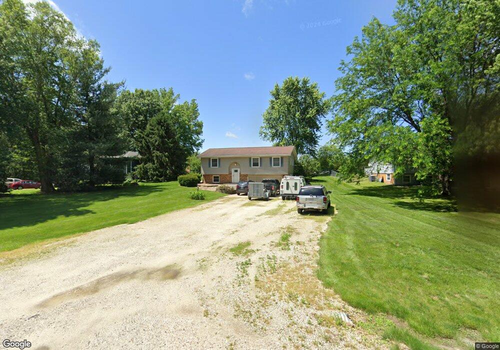
3610 Saint Anthony Rd Quincy, IL 62305
Estimated Value: $191,848 - $242,000
3
Beds
2
Baths
1,075
Sq Ft
$197/Sq Ft
Est. Value
About This Home
This home is located at 3610 Saint Anthony Rd, Quincy, IL 62305 and is currently estimated at $211,462, approximately $196 per square foot. 3610 Saint Anthony Rd is a home located in Adams County with nearby schools including Lincoln-Douglas Elementary School, Quincy Junior High School, and Quincy Senior High School.
Ownership History
Date
Name
Owned For
Owner Type
Purchase Details
Closed on
Aug 17, 2018
Sold by
Walker Clinton
Bought by
Burton Tyler B and Calvo Christina E
Current Estimated Value
Home Financials for this Owner
Home Financials are based on the most recent Mortgage that was taken out on this home.
Original Mortgage
$112,500
Outstanding Balance
$98,231
Interest Rate
4.75%
Mortgage Type
New Conventional
Estimated Equity
$113,231
Create a Home Valuation Report for This Property
The Home Valuation Report is an in-depth analysis detailing your home's value as well as a comparison with similar homes in the area
Home Values in the Area
Average Home Value in this Area
Purchase History
| Date | Buyer | Sale Price | Title Company |
|---|---|---|---|
| Burton Tyler B | $125,000 | Illinois Real Estate Title |
Source: Public Records
Mortgage History
| Date | Status | Borrower | Loan Amount |
|---|---|---|---|
| Open | Burton Tyler B | $112,500 |
Source: Public Records
Tax History Compared to Growth
Tax History
| Year | Tax Paid | Tax Assessment Tax Assessment Total Assessment is a certain percentage of the fair market value that is determined by local assessors to be the total taxable value of land and additions on the property. | Land | Improvement |
|---|---|---|---|---|
| 2024 | $3,087 | $57,170 | $6,860 | $50,310 |
| 2023 | $2,824 | $51,660 | $6,200 | $45,460 |
| 2022 | $2,504 | $45,690 | $5,780 | $39,910 |
| 2021 | $2,400 | $43,730 | $5,530 | $38,200 |
| 2020 | $2,337 | $43,010 | $5,440 | $37,570 |
| 2019 | $2,218 | $41,660 | $5,270 | $36,390 |
| 2018 | $2,329 | $43,060 | $5,230 | $37,830 |
| 2017 | $2,304 | $42,640 | $5,180 | $37,460 |
| 2016 | $2,046 | $37,100 | $4,970 | $32,130 |
| 2015 | $1,926,140 | $37,100 | $4,970 | $32,130 |
| 2012 | $1,880 | $35,590 | $4,770 | $30,820 |
Source: Public Records
Map
Nearby Homes
- 3635 Timberline Dr
- 3510 Overlook Dr
- 3430 Timberline Dr
- 5128 Lookout Ridge
- 4811 Bitter Ct
- 4526 Payson Rd
- 1522 Rim Rd
- 4714 Caleb Ln
- 1707 S 47th St
- 1623 S 47th St
- 1619 S 47th St
- 1120 Rim Rd
- 2124 S 40th St
- 5509 Melrose St S
- 900 Lucinda Ln
- 4219 Devonshire Ct
- 2300 Greenspointe Cir
- 4212 Newbury Ct
- 3330 Greenspointe Pkwy
- 3331 Greenspointe Pkwy
- 3610 St Anthony Rd
- 3616 Saint Anthony Rd
- 3602 Saint Anthony Rd
- 3624 Saint Anthony Rd
- 3532 Saint Anthony Rd
- 3630 Saint Anthony Rd
- 3702 Saint Anthony Rd
- 3710 Saint Anthony Rd
- 3710 St Anthony Rd
- 3520 Saint Anthony Rd
- 3930 Halfpap Ln
- 3716 Saint Anthony Rd
- 3724 Saint Anthony Rd
- 3730 Saint Anthony Rd
- 3615 Saint Anthony Rd
- 3806 Saint Anthony Rd
- 3414 Saint Anthony Rd
- 3822 Halfpap Ln
- 3334 Saint Anthony Rd
- 3335 Saint Anthony Rd