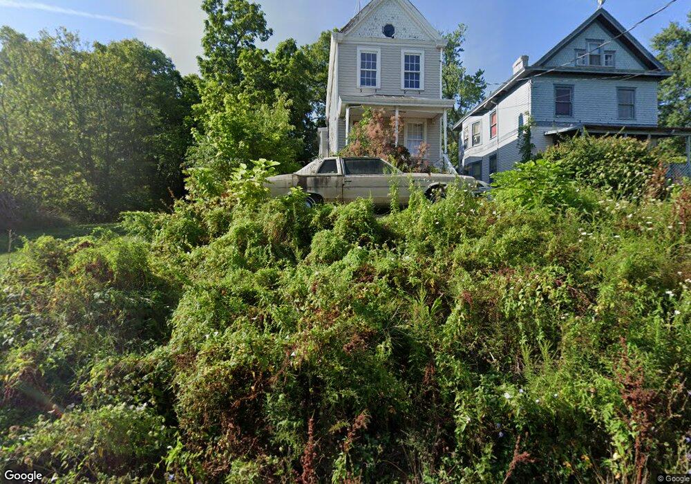
3611 Laclede Ave Cincinnati, OH 45205
East Price Hill NeighborhoodEstimated Value: $53,830 - $117,000
About This Home
This home is located at 3611 Laclede Ave, Cincinnati, OH 45205 and is currently estimated at $82,610, approximately $44 per square foot. 3611 Laclede Ave is a home located in Hamilton County with nearby schools including Gilbert A. Dater High School, Western Hills High School, and Robert A. Taft Information Technology High School.
Ownership History
We collect this data history from publicly available records. To have your information removed, we recommend requesting removal directly through your county’s website.
Purchase Details
Home Financials for this Owner
Home Financials are based on the most recent Mortgage that was taken out on this home.Purchase Details
Home Financials for this Owner
Home Financials are based on the most recent Mortgage that was taken out on this home.Purchase Details
Purchase Details
Purchase Details
Purchase Details
Purchase Details
Purchase Details
Purchase Details
Home Values in the Area
Average Home Value in this Area
Purchase History
We collect this data history from publicly available records. To have your information removed, we recommend requesting removal directly through your county’s website.
| Date | Buyer | Sale Price | Title Company |
|---|---|---|---|
| $40,000 | Tandem Title | ||
| $35,000 | None Listed On Document | ||
| -- | None Listed On Document | ||
| $5,830 | Attorney | ||
| $42,000 | None Available | ||
| $88,000 | None Available | ||
| $39,000 | Resource Title Agency Inc | ||
| $54,000 | None Available | ||
| -- | -- |
Mortgage History
We collect this data history from publicly available records. To have your information removed, we recommend requesting removal directly through your county’s website.
| Date | Status | Borrower | Loan Amount |
|---|---|---|---|
| Previous Owner | $60,000 |
Tax History
We collect this data history from publicly available records. To have your information removed, we recommend requesting removal directly through your county’s website.
| Year | Tax Paid | Tax Assessment Tax Assessment Total Assessment is a certain percentage of the fair market value that is determined by local assessors to be the total taxable value of land and additions on the property. | Land | Improvement |
|---|---|---|---|---|
| 2025 | $1,115 | $17,500 | $1,596 | $15,904 |
| 2024 | $1,703 | $26,824 | $1,596 | $25,228 |
| 2023 | $1,706 | $26,824 | $1,596 | $25,228 |
| 2022 | $655 | $9,191 | $1,414 | $7,777 |
| 2021 | $641 | $9,191 | $1,414 | $7,777 |
| 2020 | $643 | $9,191 | $1,414 | $7,777 |
| 2019 | $642 | $8,355 | $1,285 | $7,070 |
| 2018 | $642 | $8,355 | $1,285 | $7,070 |
| 2017 | $619 | $8,355 | $1,285 | $7,070 |
| 2016 | $154 | $1,982 | $1,187 | $795 |
| 2015 | $138 | $1,982 | $1,187 | $795 |
| 2014 | $139 | $1,982 | $1,187 | $795 |
| 2013 | $145 | $2,041 | $1,222 | $819 |
Map
- 1011 Mcpherson Ave
- 1120 Wells St
- 3719 Laclede Ave
- 963 Wells St
- 962 Wells St
- 3711 Glenway Ave
- 924 Mcpherson Ave
- 825 Wells St
- 3424 Kensington Place
- 3337 Glenway Ave
- 962 Mansion Ave
- 843 Fairbanks Ave
- 824 Mcpherson Ave
- 3321 Glenway Ave
- 3744 Mayfield Ave
- 1015 Purcell Ave
- 3320 Glenway Ave
- 812 Fairbanks Ave
- 808 Kirbert Ave
- 738 Enright Ave
- 3609 Laclede Ave
- 3615 Laclede Ave
- 3605 Laclede Ave
- 3619 Laclede Ave
- 3610 Maria Ave
- 3603 Laclede Ave
- 3614 Maria Ave
- 3608 Maria Ave
- 1029 Mcpherson Ave
- 3604 Maria Ave
- 3623 Laclede Ave
- 3600 Maria Ave
- 1039 Mcpherson Ave
- 3612 Laclede Ave
- 3610 Laclede Ave
- 3614 Laclede Ave
- 3625 Laclede Ave
- 1028 Sturm St
- 3616 Laclede Ave
- 1024 Sturm St
Ask me questions while you tour the home.