Estimated Value: $560,000 - $845,000
4
Beds
2
Baths
3,546
Sq Ft
$182/Sq Ft
Est. Value
About This Home
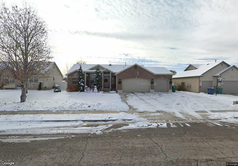
This home is located at 3611 W 5275 S, Roy, UT 84067 and is currently estimated at $645,809, approximately $182 per square foot. 3611 W 5275 S is a home located in Weber County with nearby schools including Freedom School, Roy Junior High School, and Roy High School.
Ownership History
Date
Name
Owned For
Owner Type
Purchase Details
Closed on
Mar 6, 2024
Sold by
Mccall Charles and Mccall Tanya L
Bought by
Mccall Tanya L
Current Estimated Value
Purchase Details
Closed on
Jul 21, 2011
Sold by
Northern Regal Homes Inc
Bought by
Mccall Charles and Mccall Tanya L
Home Financials for this Owner
Home Financials are based on the most recent Mortgage that was taken out on this home.
Original Mortgage
$239,000
Interest Rate
4.45%
Mortgage Type
VA
Create a Home Valuation Report for This Property
The Home Valuation Report is an in-depth analysis detailing your home's value as well as a comparison with similar homes in the area
Home Values in the Area
Average Home Value in this Area
Purchase History
| Date | Buyer | Sale Price | Title Company |
|---|---|---|---|
| Mccall Tanya L | -- | Intermountain Title | |
| Mccall Charles | -- | Executive Title Ogden |
Source: Public Records
Mortgage History
| Date | Status | Borrower | Loan Amount |
|---|---|---|---|
| Previous Owner | Mccall Charles | $239,000 |
Source: Public Records
Tax History
| Year | Tax Paid | Tax Assessment Tax Assessment Total Assessment is a certain percentage of the fair market value that is determined by local assessors to be the total taxable value of land and additions on the property. | Land | Improvement |
|---|---|---|---|---|
| 2025 | $272 | $591,086 | $177,555 | $413,531 |
| 2024 | $265 | $319,549 | $97,655 | $221,894 |
| 2023 | $257 | $312,950 | $94,449 | $218,501 |
| 2022 | $2,373 | $326,700 | $72,332 | $254,368 |
| 2021 | $1,953 | $488,000 | $86,105 | $401,895 |
| 2020 | $1,652 | $418,000 | $86,105 | $331,895 |
| 2019 | $1,815 | $377,000 | $69,948 | $307,052 |
| 2018 | $1,652 | $339,000 | $59,958 | $279,042 |
| 2017 | $1,574 | $315,000 | $57,005 | $257,995 |
| 2016 | $1,389 | $158,254 | $30,259 | $127,995 |
| 2015 | $908 | $126,619 | $24,304 | $102,315 |
| 2014 | $852 | $121,045 | $24,304 | $96,741 |
Source: Public Records
Map
Nearby Homes
- 3443 W 5200 S Unit 2&3
- 3832 W 5625 S
- 3509 W 4835 S Unit 26
- 3517 W 4835 S Unit 27
- 5529 S 3200 W
- 5155 S 3200 W
- 5444 S 4050 W
- 5321 S 3100 W
- 3826 W 5750 S
- 3176 W 5625 S
- 4096 W 5075 S
- 3166 W 5625 S
- 5854 S 3500 W
- 4950 3900 West St
- 4813 S 3850 W
- 5791 S 3260 W
- 4088 W 5050 S
- 4239 W 5325 S
- 4216 W 5250 S
- 5141 S 2975 W
- 3611 W 5275 S Unit 70
- 3621 W 5275 S
- 3599 W 5275 S
- 3633 W 5275 S
- 3633 W 5275 S Unit 72
- 3589 W 5275 S
- 3610 W 5275 S
- 3610 W 5275 S Unit 61
- 5261 S 3575 W
- 3622 W 5275 S
- 3643 W 5275 S
- 3643 W 5275 S Unit 73
- 3634 W 5275 S
- 3626 W 5350 S
- 3596 W 5350 S
- 3577 W 5275 S
- 3610 W 5350 S
- 5245 S 3575 W
- 5245 S 3575 W Unit 63
- 5264 S 3575 W
Your Personal Tour Guide
Ask me questions while you tour the home.