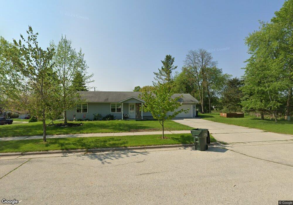
3611 Winter Dr West Bend, WI 53090
Estimated Value: $374,403 - $401,000
5
Beds
3
Baths
1,104
Sq Ft
$349/Sq Ft
Est. Value
About This Home
This home is located at 3611 Winter Dr, West Bend, WI 53090 and is currently estimated at $385,101, approximately $348 per square foot. 3611 Winter Dr is a home located in Washington County with nearby schools including McLane Elementary School, Silverbrook Intermediate School, and East High School.
Ownership History
Date
Name
Owned For
Owner Type
Purchase Details
Closed on
Jun 28, 2018
Sold by
Tri City Properties Llc
Bought by
Mueller Michael and Mueller Christine A
Current Estimated Value
Home Financials for this Owner
Home Financials are based on the most recent Mortgage that was taken out on this home.
Original Mortgage
$180,000
Outstanding Balance
$156,342
Interest Rate
4.6%
Mortgage Type
New Conventional
Estimated Equity
$228,759
Purchase Details
Closed on
Dec 15, 2017
Sold by
Kleinhans Christopher and Kleinhans Ellen
Bought by
Tri City Properties Llc
Home Financials for this Owner
Home Financials are based on the most recent Mortgage that was taken out on this home.
Original Mortgage
$86,165
Interest Rate
3.9%
Mortgage Type
Commercial
Create a Home Valuation Report for This Property
The Home Valuation Report is an in-depth analysis detailing your home's value as well as a comparison with similar homes in the area
Home Values in the Area
Average Home Value in this Area
Purchase History
| Date | Buyer | Sale Price | Title Company |
|---|---|---|---|
| Mueller Michael | $225,000 | Attorneys Title Closing Serv | |
| Tri City Properties Llc | $85,900 | None Available |
Source: Public Records
Mortgage History
| Date | Status | Borrower | Loan Amount |
|---|---|---|---|
| Open | Mueller Michael | $180,000 | |
| Previous Owner | Tri City Properties Llc | $86,165 |
Source: Public Records
Tax History Compared to Growth
Tax History
| Year | Tax Paid | Tax Assessment Tax Assessment Total Assessment is a certain percentage of the fair market value that is determined by local assessors to be the total taxable value of land and additions on the property. | Land | Improvement |
|---|---|---|---|---|
| 2024 | $4,124 | $319,800 | $51,600 | $268,200 |
| 2023 | $3,670 | $193,400 | $44,000 | $149,400 |
| 2022 | $3,341 | $193,400 | $44,000 | $149,400 |
| 2021 | $3,421 | $193,400 | $44,000 | $149,400 |
| 2020 | $3,379 | $193,400 | $44,000 | $149,400 |
| 2019 | $3,265 | $193,400 | $44,000 | $149,400 |
| 2018 | $3,068 | $179,100 | $44,000 | $135,100 |
| 2017 | $3,331 | $163,000 | $44,000 | $119,000 |
| 2016 | $3,409 | $163,000 | $44,000 | $119,000 |
| 2015 | $3,856 | $163,000 | $44,000 | $119,000 |
| 2014 | $3,856 | $163,000 | $44,000 | $119,000 |
| 2013 | $4,289 | $163,000 | $44,000 | $119,000 |
Source: Public Records
Map
Nearby Homes
- 3316 Mediterranean Ave
- 3315 Windsor Place
- 6837 Reuter Ln
- Lt3-5 Schuster Dr
- Lt3 Schuster Dr
- Lt5 Schuster Dr
- Lt4 Schuster Dr
- 4262 N Woodcrest Ridge Dr
- 2820 Valley Ave
- 2606 Park Forest Dr
- 805 Canterberry Ct Unit C
- 2346 W Washington St
- Lt2 Beaver Dam Rd
- 4000 W Washington St
- 2124 Willowbrook Dr
- 2110 Hollow Cir
- 2214 Willowbrook Dr
- 6215 Riesch Rd
- 704 N 18th Ave
- 2106 Chestnut St
- 830 Shepherds Dr
- 910 Shepherds Dr
- 905 Shepherds Dr
- 925 Shepherds Dr
- 915 Shepherds Dr
- 820 Shepherds Dr
- 835 Shepherds Dr
- 810 Shepherds Dr
- 920 Shepherds Dr
- 815 Shepherds Dr
- 955 Shepherds Dr
- 1045 Shepherds Dr
- 1115 Shepherds Dr
- 800 Shepherds Dr
- 3534 Stanford Ln
- 1125 Shepherds Dr
- 1025 Shepherds Dr
- 930 Shepherds Dr
- 1105 Shepherds Dr
- 1135 Shepherds Dr