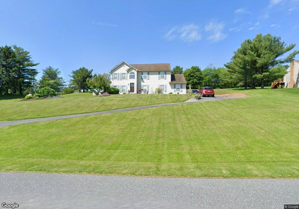
3612 Apple Rd Orefield, PA 18069
North Whitehall Township NeighborhoodEstimated Value: $486,931 - $528,000
3
Beds
3
Baths
2,136
Sq Ft
$235/Sq Ft
Est. Value
About This Home
This home is located at 3612 Apple Rd, Orefield, PA 18069 and is currently estimated at $502,983, approximately $235 per square foot. 3612 Apple Rd is a home located in Lehigh County with nearby schools including Schnecksville School, Orefield Middle School, and Parkland High School.
Ownership History
Date
Name
Owned For
Owner Type
Purchase Details
Closed on
Apr 30, 1999
Sold by
Wayne Snyder and Thomas Kelly
Bought by
Stufflet Michael S and Stufflet Barbara J
Current Estimated Value
Purchase Details
Closed on
Mar 24, 1994
Sold by
A J W Inc
Bought by
Snyder Wayne and Kelly Thomas
Purchase Details
Closed on
Aug 5, 1993
Sold by
Western Lehigh Valley Corp
Bought by
A J W Inc
Purchase Details
Closed on
Oct 25, 1988
Bought by
Western Lehigh Valley Corp
Create a Home Valuation Report for This Property
The Home Valuation Report is an in-depth analysis detailing your home's value as well as a comparison with similar homes in the area
Home Values in the Area
Average Home Value in this Area
Purchase History
| Date | Buyer | Sale Price | Title Company |
|---|---|---|---|
| Stufflet Michael S | $147,000 | -- | |
| Snyder Wayne | $144,300 | -- | |
| A J W Inc | $90,000 | -- | |
| Western Lehigh Valley Corp | $282,400 | -- |
Source: Public Records
Mortgage History
| Date | Status | Borrower | Loan Amount |
|---|---|---|---|
| Open | Stufflet Michael S | $258,597 | |
| Closed | Stufflet Michael S | $94,000 | |
| Closed | Stufflet Michael S | $75,850 | |
| Closed | Stufflet Michael S | $36,000 |
Source: Public Records
Tax History Compared to Growth
Tax History
| Year | Tax Paid | Tax Assessment Tax Assessment Total Assessment is a certain percentage of the fair market value that is determined by local assessors to be the total taxable value of land and additions on the property. | Land | Improvement |
|---|---|---|---|---|
| 2025 | $5,654 | $254,700 | $73,300 | $181,400 |
| 2024 | $5,318 | $254,700 | $73,300 | $181,400 |
| 2023 | $5,165 | $254,700 | $73,300 | $181,400 |
| 2022 | $5,142 | $254,700 | $181,400 | $73,300 |
| 2021 | $5,142 | $254,700 | $73,300 | $181,400 |
| 2020 | $5,142 | $254,700 | $73,300 | $181,400 |
| 2019 | $5,007 | $254,700 | $73,300 | $181,400 |
| 2018 | $4,908 | $254,700 | $73,300 | $181,400 |
| 2017 | $4,837 | $254,700 | $73,300 | $181,400 |
| 2016 | -- | $254,700 | $73,300 | $181,400 |
| 2015 | -- | $254,700 | $73,300 | $181,400 |
| 2014 | -- | $254,700 | $73,300 | $181,400 |
Source: Public Records
Map
Nearby Homes
- 3461 Wolf Pack Dr
- 3413 Cougar Cir
- 3739 Lindy Dr
- 3470 Cougar Cir
- 4403 Wolfs Crossing Rd
- 3360 Woodlea Rd
- 3256 Woodlea Rd
- 2845 Pacific Ave
- 4332 Route 309
- 3054 Jordan Rd
- 4168 Orefield Rd
- 3063 Jordan Rd
- 4473 Valley Green Dr Unit 38
- 4482 Valley Green Dr Unit 37
- 2507 Rachael Ln
- 2695 Apple Valley Estates Dr
- 3065 Quarry St
- 3077 Gayle Ln
- 4450 Maple St
- Maverick Plan at Greenleaf Fields at Parkland
- 3620 Apple Rd
- 4327 Dumpling Dr
- 3472 Wolf Pack Dr Unit 19
- 3628 Apple Rd
- 3485 Lil Wolf Dr
- 4243 Wolf Den Ct
- 4247 Wolf Den Ct
- 3471 Lil Wolf Dr
- 4339 Dumpling Dr
- 3453 Wolf Pack Dr
- 3549 Lumar St
- 3468 Wolf Pack Dr
- 3538 Apple Rd
- 3555 Apple Rd
- 4238 Bobcat Ct
- 4326 Dumpling Dr
- 3442 Wolf Pack Dr
- 3717 Wolfs Hollow Rd
- 3459 Lil Wolf Dr
- 4305 Coyote Ct