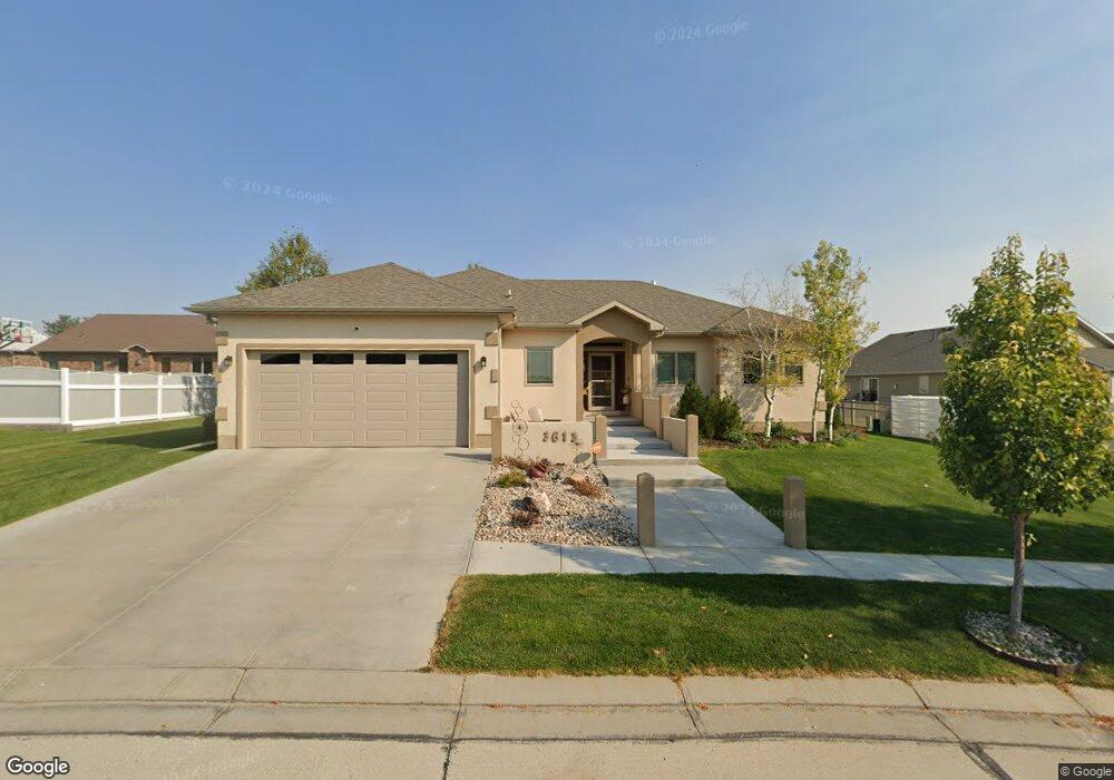
3613 Maple Dr Scottsbluff, NE 69361
Estimated Value: $438,000 - $501,000
3
Beds
3
Baths
1,832
Sq Ft
$251/Sq Ft
Est. Value
About This Home
This home is located at 3613 Maple Dr, Scottsbluff, NE 69361 and is currently estimated at $459,203, approximately $250 per square foot. 3613 Maple Dr is a home with nearby schools including Lincoln Heights Elementary School, Bluffs Middle School, and Scottsbluff Senior High School.
Ownership History
Date
Name
Owned For
Owner Type
Purchase Details
Closed on
Jan 7, 2013
Sold by
C & T Holdings Llc
Bought by
West Jeffrey D and West Laura L
Current Estimated Value
Create a Home Valuation Report for This Property
The Home Valuation Report is an in-depth analysis detailing your home's value as well as a comparison with similar homes in the area
Home Values in the Area
Average Home Value in this Area
Purchase History
| Date | Buyer | Sale Price | Title Company |
|---|---|---|---|
| West Jeffrey D | $25,000 | Ferguson Title Services Llc |
Source: Public Records
Tax History
| Year | Tax Paid | Tax Assessment Tax Assessment Total Assessment is a certain percentage of the fair market value that is determined by local assessors to be the total taxable value of land and additions on the property. | Land | Improvement |
|---|---|---|---|---|
| 2025 | $5,338 | $442,875 | $23,960 | $418,915 |
| 2024 | $5,163 | $418,890 | $19,925 | $398,965 |
| 2023 | $7,429 | $366,850 | $19,923 | $346,927 |
| 2022 | $7,429 | $366,850 | $19,923 | $346,927 |
| 2021 | $6,892 | $335,311 | $19,923 | $315,388 |
| 2020 | $6,683 | $323,181 | $19,923 | $303,258 |
| 2019 | $6,492 | $314,348 | $19,923 | $294,425 |
| 2018 | $7,923 | $381,293 | $19,923 | $361,370 |
| 2017 | $7,660 | $367,394 | $19,923 | $347,471 |
| 2016 | $7,669 | $367,394 | $19,923 | $347,471 |
| 2015 | $7,269 | $350,848 | $19,923 | $330,925 |
| 2014 | $3,991 | $205,958 | $19,923 | $186,035 |
| 2012 | -- | $19,922 | $19,922 | $0 |
Source: Public Records
Map
Nearby Homes
- TBD W 36th St
- 0 W 36th St Unit 20254154
- 597 Sagebrush Dr
- 501 W 38th St
- 410 Sandra Ct
- 3918 Avenue D
- 1012 W 36th St
- 501 W 32nd St
- 2918 Avenue H
- 3415 Ross Ave
- Lot 1 31st St
- 2809 Avenue I
- TBD U S Highway 26
- 1010 W 29th St
- Lot 2 31st St
- 2614 Avenue D
- 1011 W 27th St
- 2417 Avenue F
- 2417 Avenue A
- 250455 Seip Rd
- 3612 Aspen Dr
- 605 W 36th St
- 603 W 36th St
- 3615 Maple Dr
- 3614 Aspen Dr
- 3614 Maple Dr
- 601 W 36th St
- 3612 Maple Dr
- 720 W 36th St Unit 720 West 36th Street
- 926 W 36th St
- 426 W 36th St
- 600 W 36th St
- 926 W 36th St Unit HIGHWAY 26 & 71
- 1014 W 36th St
- 1105 W 36th St
- . W 36th St
- 4 LOTS W 36th St Unit SOLD AS ONE UNIT
- 0 W 36th St Unit C-3 Lot 60,940 sq ft
- TBD W 36th St Unit LOT 6
- 0 W 36th St
Your Personal Tour Guide
Ask me questions while you tour the home.