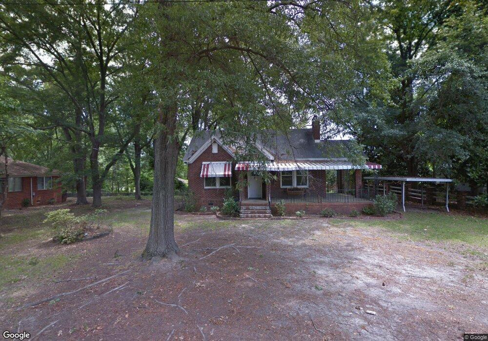
3614 Carrison Rd Columbia, SC 29210
Saint Andrews NeighborhoodEstimated Value: $164,000 - $230,074
2
Beds
1
Bath
1,216
Sq Ft
$153/Sq Ft
Est. Value
About This Home
This home is located at 3614 Carrison Rd, Columbia, SC 29210 and is currently estimated at $185,519, approximately $152 per square foot. 3614 Carrison Rd is a home located in Richland County with nearby schools including Pine Grove Elementary School, St. Andrews Middle School, and Columbia High School.
Ownership History
Date
Name
Owned For
Owner Type
Purchase Details
Closed on
Apr 23, 2012
Sold by
Reyman Dorothy B and Branham Mack C
Bought by
Right Direction Community Development Co
Current Estimated Value
Home Financials for this Owner
Home Financials are based on the most recent Mortgage that was taken out on this home.
Original Mortgage
$88,000
Interest Rate
3.9%
Mortgage Type
New Conventional
Purchase Details
Closed on
Jun 21, 2010
Sold by
Reyman Dorothy B and Reyman Dorothy Branham
Bought by
Reyman Dorothy B and Sturkie Richard
Create a Home Valuation Report for This Property
The Home Valuation Report is an in-depth analysis detailing your home's value as well as a comparison with similar homes in the area
Home Values in the Area
Average Home Value in this Area
Purchase History
| Date | Buyer | Sale Price | Title Company |
|---|---|---|---|
| Right Direction Community Development Co | $110,000 | None Available | |
| Reyman Dorothy B | -- | -- |
Source: Public Records
Mortgage History
| Date | Status | Borrower | Loan Amount |
|---|---|---|---|
| Closed | Right Direction Community Development Co | $88,000 |
Source: Public Records
Tax History Compared to Growth
Tax History
| Year | Tax Paid | Tax Assessment Tax Assessment Total Assessment is a certain percentage of the fair market value that is determined by local assessors to be the total taxable value of land and additions on the property. | Land | Improvement |
|---|---|---|---|---|
| 2023 | $399 | $0 | $0 | $0 |
| 2021 | $324 | $0 | $0 | $0 |
| 2020 | $324 | $0 | $0 | $0 |
| 2019 | $286 | $0 | $0 | $0 |
| 2018 | $249 | $0 | $0 | $0 |
| 2017 | $249 | $0 | $0 | $0 |
| 2016 | $249 | $0 | $0 | $0 |
| 2015 | $249 | $0 | $0 | $0 |
| 2014 | $249 | $0 | $0 | $0 |
| 2013 | -- | $0 | $0 | $0 |
Source: Public Records
Map
Nearby Homes
- 458 Regency Park Dr
- 465 Regency Park Dr
- 2007 Creekside Way Unit 707
- 6001 Village Creek Dr
- 2114 Apple Valley Rd
- 109 Timber Ct
- 205 Timber Ct
- 1015 Mandel Dr
- 225 Timber Ct
- 119 Preston Hills Dr
- 349 Hickory Hill Dr
- 121 Beatty Downs Rd
- 1900 Rolling Hills Rd
- 912 Saint Andrews Rd
- 1026 Tundra Teal Ln Unit 153
- 1117 Piney Woods Rd Unit 3A
- 1618 van Lingle Ave
- 1810 Saint Michaels Rd
- 1825 Woodsboro Dr
- 1605 Kathleen Dr
- 3618 Carrison Rd
- 3606 Carrison Rd
- 3626 Carrison Rd
- 3532 Broad River Rd
- 1403 Saint Andrews Terrace Rd
- 1331 St Andrews Terrace Rd
- 1411 Saint Andrews Terrace Rd
- 1425 Saint Andrews Terrace Rd
- 1433 Saint Andrews Terrace Rd
- 3718 Broad River Rd
- 3440 Broad River Rd
- 3726 Broad River Rd
- 1505 Saint Andrews Terrace Rd
- 3721 Broad River Rd
- 1509 St Andrews Terrace Rd
- 3430 Broad River Rd
- 3715 Broad River Rd
- 1509 Saint Andrews Terrace Rd
- 3533 Broad River Rd
- 1131 Beatty Rd